(Coming Soon: Photos)
Sometimes I have a love/hate relationship with a hut. This qualifies as one of those.
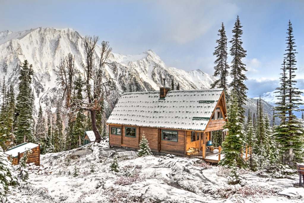
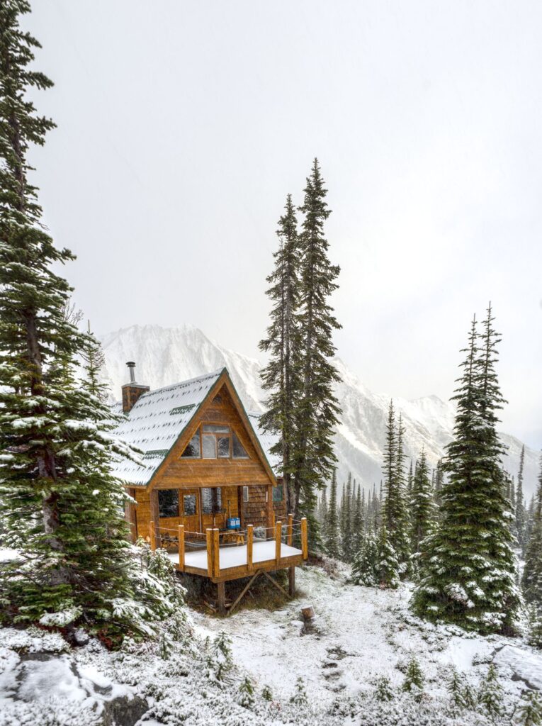
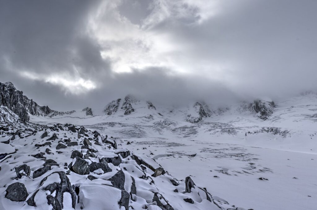
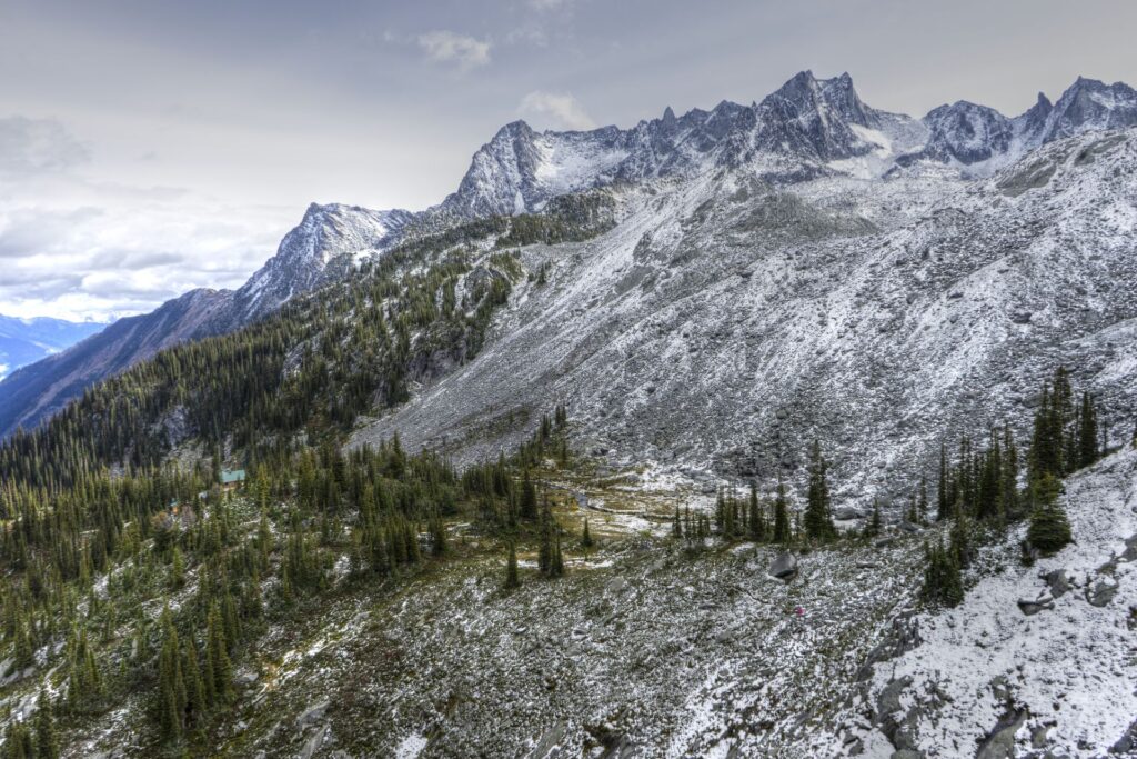
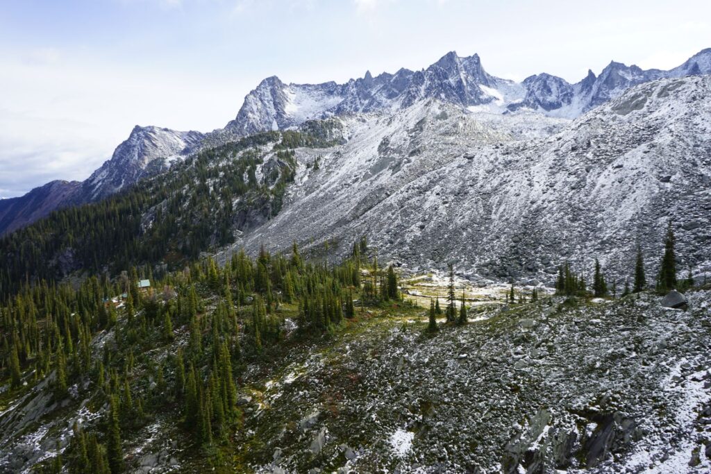
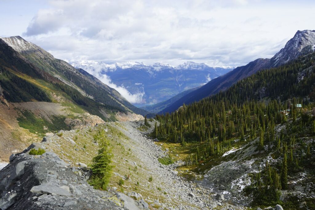
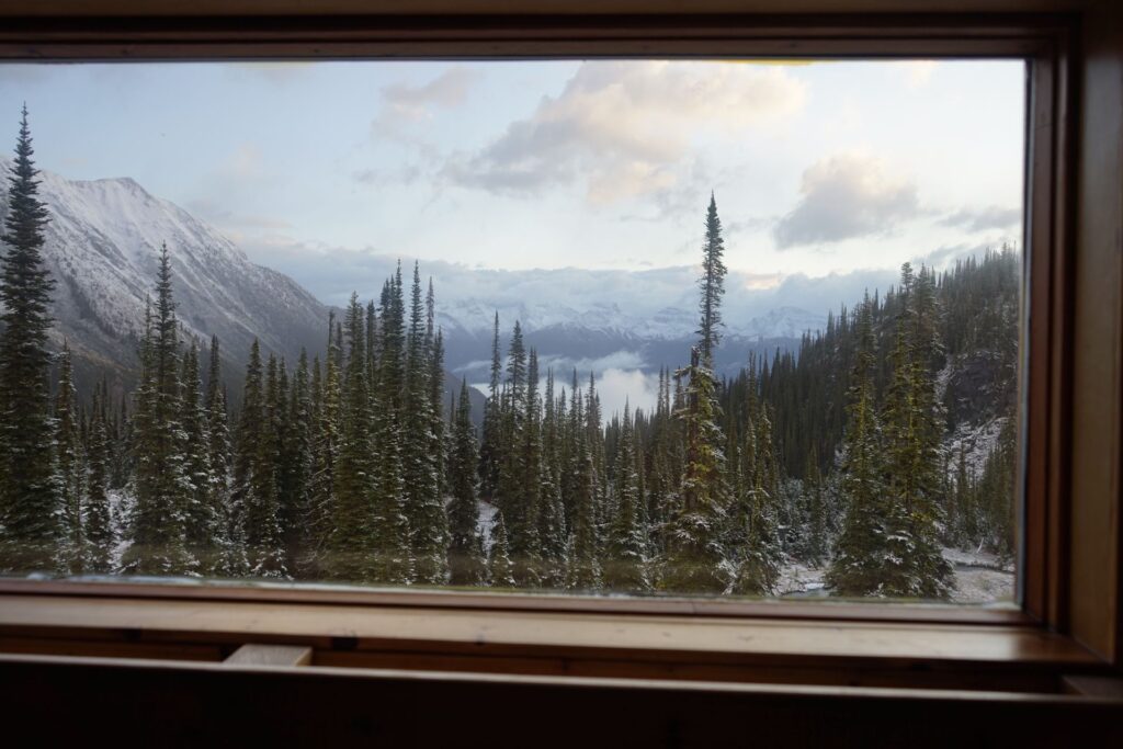
The love is simple – the view. Incredible vistas, alpine meadows, glacial serac fields, the list goes on.
The hate is more complex, but to sum it up – steep, muddy, marshy trail.
I’m usually a pretty nimble guy. Raised as a wee lad in the mountains, talus and scree were my playground. Throw me a wet or unstable rock, I’ll build a fortress on it. When it comes to steep muddy slopes above a raging river, when that slope is adorned in fern-like foliage and whispy, ankle-testing alder brush, I’m not a fan. Especially when I find myself on my ass more than once when my ego is used to dancing through difficult terrain.
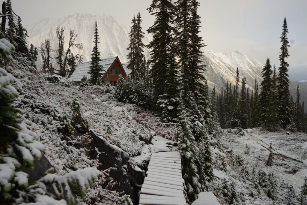
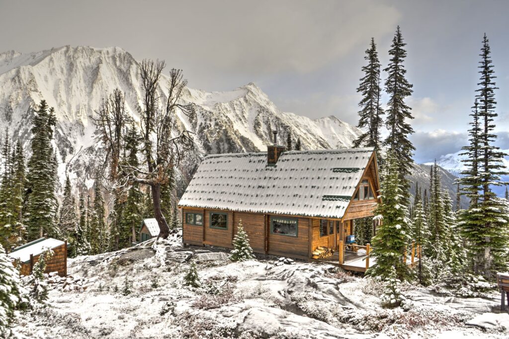
While this trail starts pretty decent (minus the 65km logging road approach), it certainly gives the most avid scrambler/hiker a run for their money once one reaches the middle-third. Relentless side-slopes and endless staircases of vertical make this a solid day in the woods. The saving grace is the final stretch to the hut, including a lateral moraine with a million dollar view, and a frolic through the Fairy Meadow just before reaching one of the most well-placed huts I’ve ever had the pleasure of inhabiting.
Well, lets get on with it…
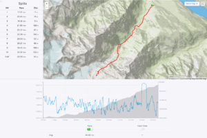
Stats
| Trailhead Altitude: | 1,020m (3687 ft) | Trail Length: | 10.48 km |
| Hut Altitude: | 2,015m (6610 ft) | Difficulty: | Class 3/4 |
| Net Altitude: | 1,005m (3297 ft) | Map: | 8 |
| Time to Hut: | 7-9 hours |
Trailhead
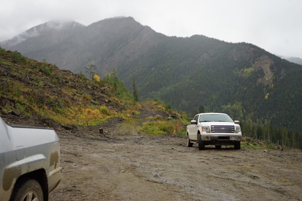
From Golden, drive approx 30 min west to the turnoff to the Kinbasket Lake Resort. Turning right, follow the well maintained gravel road down to the resort. At the parking lot, the road continues straight through across a one-lane logging bridge. Follow the road for 65km noting to stay alongside the lake. There are a few forks along the way, so note that you are looking for the Swan Basin Road. Generally, stay on the main road, and keep right if you encounter a fork (but not right on the little off-shoot roads). Once at the Swan turnoff, turn left and follow the road watching for a second fork, where you’ll turn right. You’ll follow the road for another few minutes until you come to a switchback at a clearing where the road forks again – this is the trailhead.
The Trail
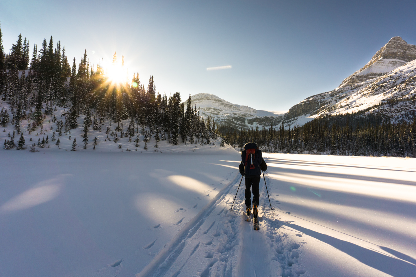
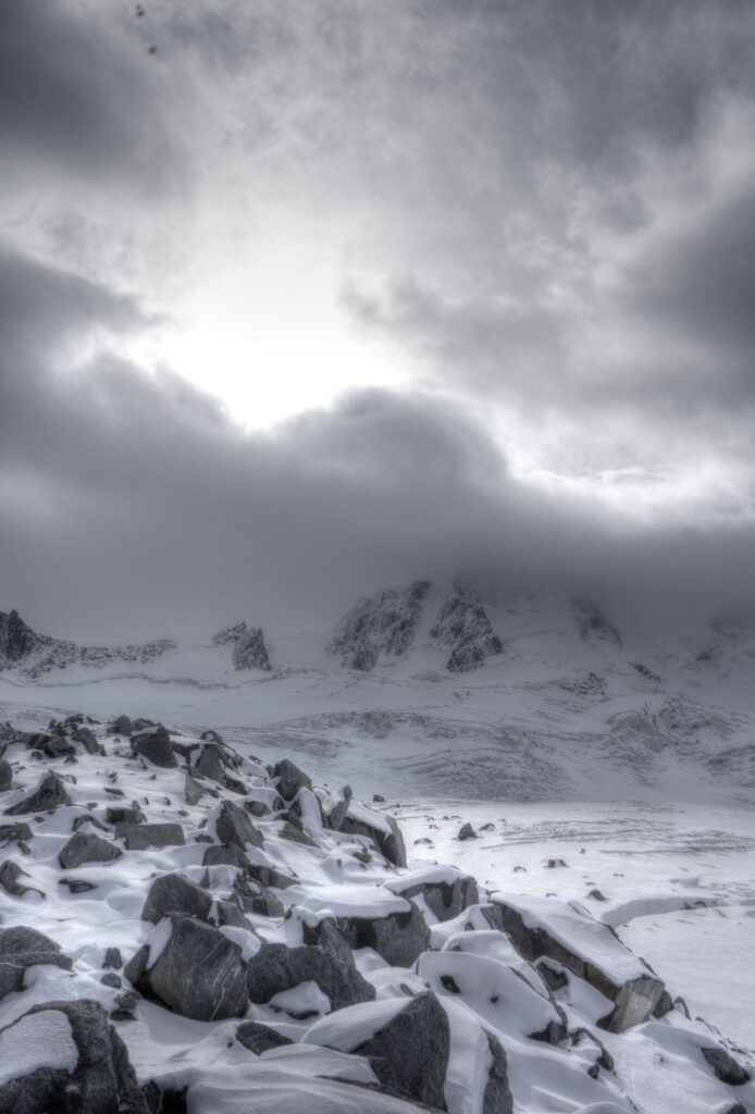
Winter Approach – While there are a few approaches to this hut in winter, they are all pretty epic (unless you’re an olympian, it’s a multi-day endevour). The only winter route I’d suggest: take the helicopter. The ACC has a winter lottery for this hut thanks to a vast selection of lines that would take 10 lifetimes to explore. It’s worth it – save your energy for the pow that is in dire need of being shred.
Summer Approach – Once parked at the trail-head, hike the road that climbs to the right, above the clear-cut area to the west. Approximately 200m up, you’ll see an obvious fire road branch to the left. If you have a clearing above you, you have gone too far. Note that this trail is well flagged. There will seldom be a moment when you can’t see a piece of surveyors tape marking the way. Don’t stray too far if you can’t find one – it’s there somewhere.
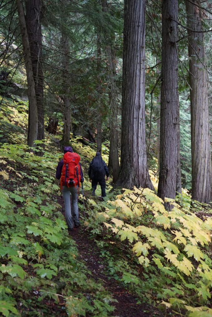
The fire road will be partially overgrown, although in recent years, groups have made a serious effort to clear the trail. Travel should be fast and easy for the first kilometer, when the trail will turn left into the trees abruptly and begin to gain elevation. As you wander through an ancient forest, take note that this will be the nicest part of the trail. Soak it in. The trail will meander up and down (but mostly up) around rocks and other dramatic features, occasionally using short lengths of rope for a few minor steep sections.
This is when the fun begins: You’ll exit the forest at an avalanche/slide path. While not obvious, the trail crosses ahead and slightly below you, around the shoulder below you to the left of the river. There was considerable year round snow when we arrived in late September. We slid down the slope to gain the snow and crossed a snow bridge over a second slide path (stay in the center and be careful as the bridge condition can vary). Once across, stay as high as possible on the ice and gain the shoulder higher rather than lower, but not so high that you’re fighting alder brush. Skirt right around the the shoulder and you’l find a difficult trail that clings to the soft slope under a heavily grown alder forest. The trail here is the worst. Expect wet boots and muddy hands.
Following alongside the river, you’ll experience many challenges that require you to cling to trees to make it through. Be careful not to grab the Devils Club. It’s not very friendly, and you’ll see much more as the trail continues.
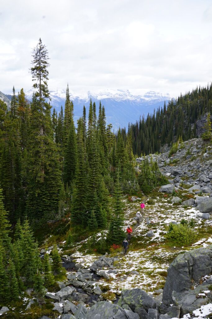
Eventually the river continues up a gully where you’ll start to climb up and to the left of the river on a well defined path through devils club. The trail eventually leads through sections of talus scattered through an alder patch and into a forest. You’ll know you’re close to the end when you come into an open marsh with many fallen trees. Pick your way across the trees and exit to lookers left from your entry point. As you gain altitude, you will find the alder getting smaller and smaller, making the route easier as you go. Eventually, you’ll start up the lower section of the lateral moraine. You are now on the last third of the trail.
The moraine will bring you to a short section where you’ll climb over a shoulder to gain the moraine again, only this time you will mostly be in the trees. Finally, you’ll be rewarded with a vast view as you exit the forest and follow the exposed moraine until you reach a very small meadow on your left. The trail cuts to the left where it drops down off the moraine to another friendly meadow. The trail will continue slightly left to a simple bridge (5″ wide) across a small stream. Once on the other side, you’ll wend your way up through an open mossy alpine forest. Shortly after beginning to gain altitude, you’ll find the glorious, wonderful hut.
What to do once you arrive
There are an endless number of objectives from Fairy Meadow Hut, so I’ll just touch on the easy ones.
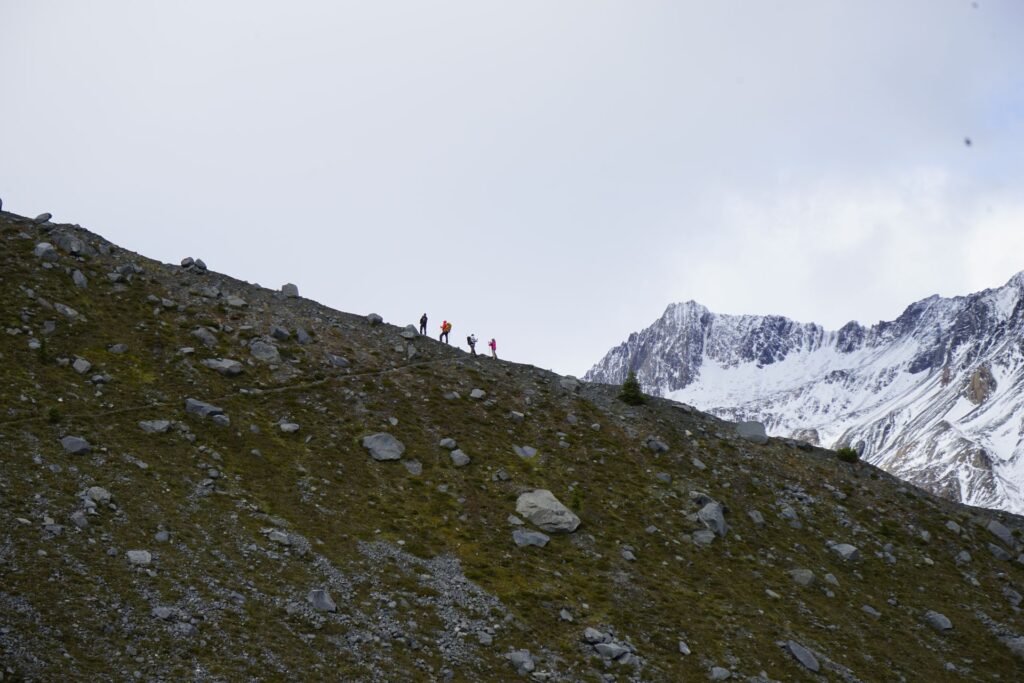
- Day Hike to the tarn under Friendship Col – Leaving the hut to the east, you’ll find a well defined trail switch-backing up to the tarn. 20 minutes to the tarn, and lots to explore beyond. This is the easiest route to Friendship Col.
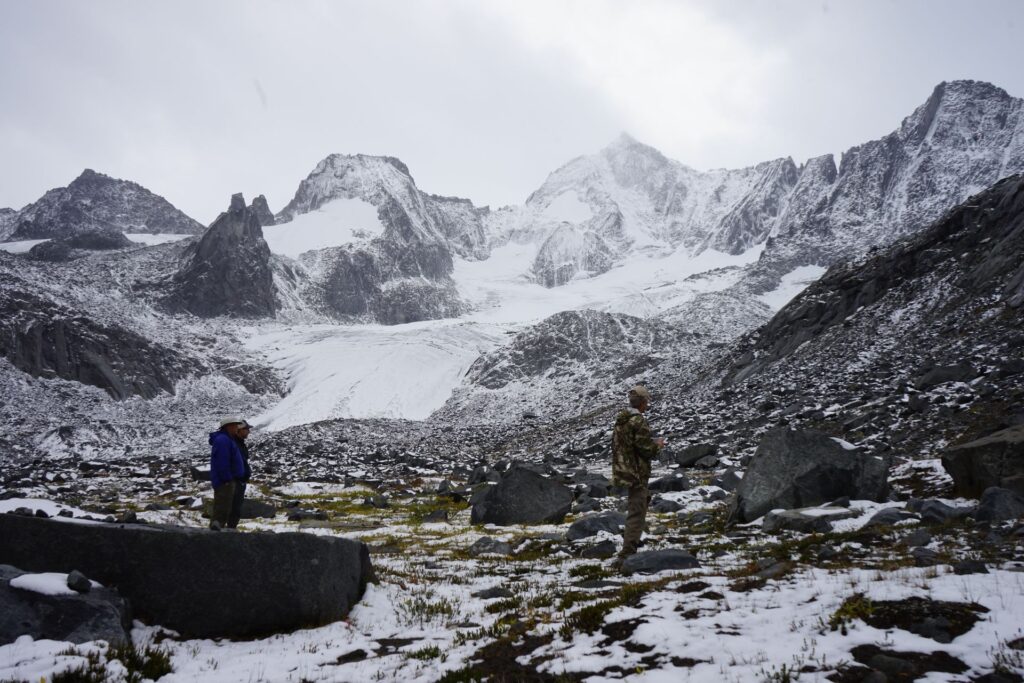
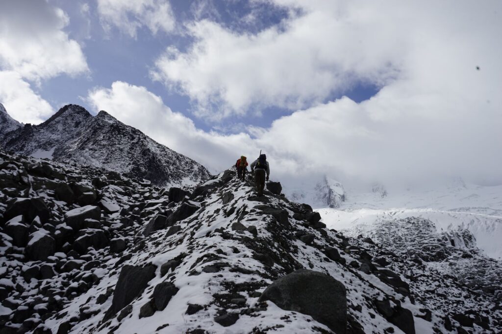
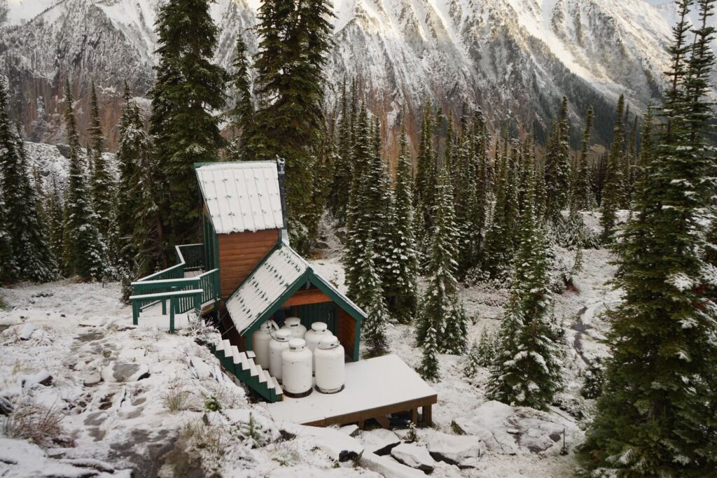
- Day Hike to Pioneer Pass – (requires glacier travel for final stretch) Leaving the hut to the east, you’ll follow a path that turns to the right, leading to the source of the water that is piped into the hut. THe trail scrambles up and to the right of the waterfall on an easy to navigate path. Above the falls, the trail turns to the west and gains altitude, skirting a rock-slide until you gain the lateral moraine. Once on the moraine, follow it up and to the right as it leads you above the glacier. Approx 45 minutes to the glacier.
More difficult destinations include
- Great Cairn Hut – a 12-16 hour glacier traverse starting from the Fairy Meadow Hut requiring expert mountaineering skills. The route, which requires crossing multiple glaciers, scree, and a steep section of ice (Azimuth Notch) that has become more difficult with time as glacier ice recedes.
If you are considering the possibility of an overnight bivi in the backcountry, check with local government for regulations. There are no designated campgrounds once you are in the alpine.
Where to stay
For those who like to camp, Waitabit Creek Campground is probably the closest (and free) campground, but is first come first served, so you may have difficulty finding a site. If you prefer hotels, Golden and Revelstoke have many options for every budget.
Routes
Download the Summer Trail Route – ACC Fairy Meadow Hut
What you need to know
This is not a National or Provincial Park, so rescue is limited. If there is an emergency, contact the RCMP directly.
Pictures
Comments 3
Hi, when was it that you do this hike? ACC website says it’s passable as of June 2024, do you know if it’s still passable? Thank you!
Also looking forward to the photos ; )
Author
We went up in September, so expect it to be wetter the earlier in the year you go. I know Foresty Forest on YouTube did a video on it and some trail cleanup after we were up there, so his video is most current I think. I didn’t take many photos on the way out as I was carrying some power tools to cut and trim the trail so no photos of that unfortunately!
Author
Oh, and photos are up! Only took me a few years, thanks for the nudge haha