“The scree on the way up to the shoulder is repugnant and does not resemble fun in any way.” – unknown
There aren’t any good reasons to visit this hut. None that outweigh the approach, anyway.
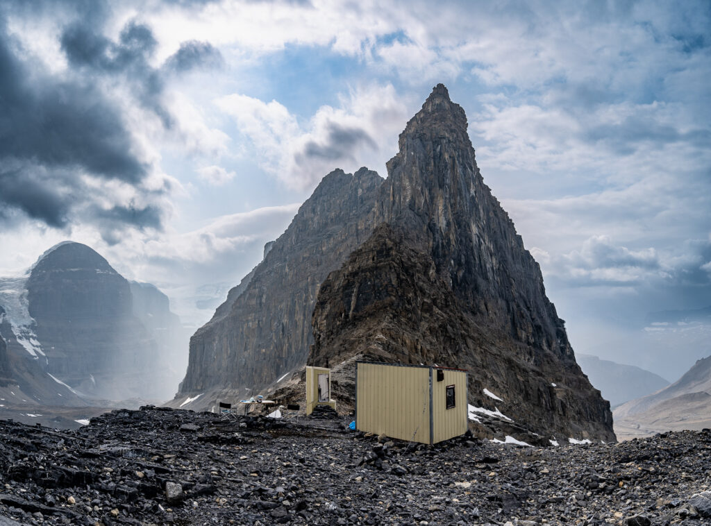
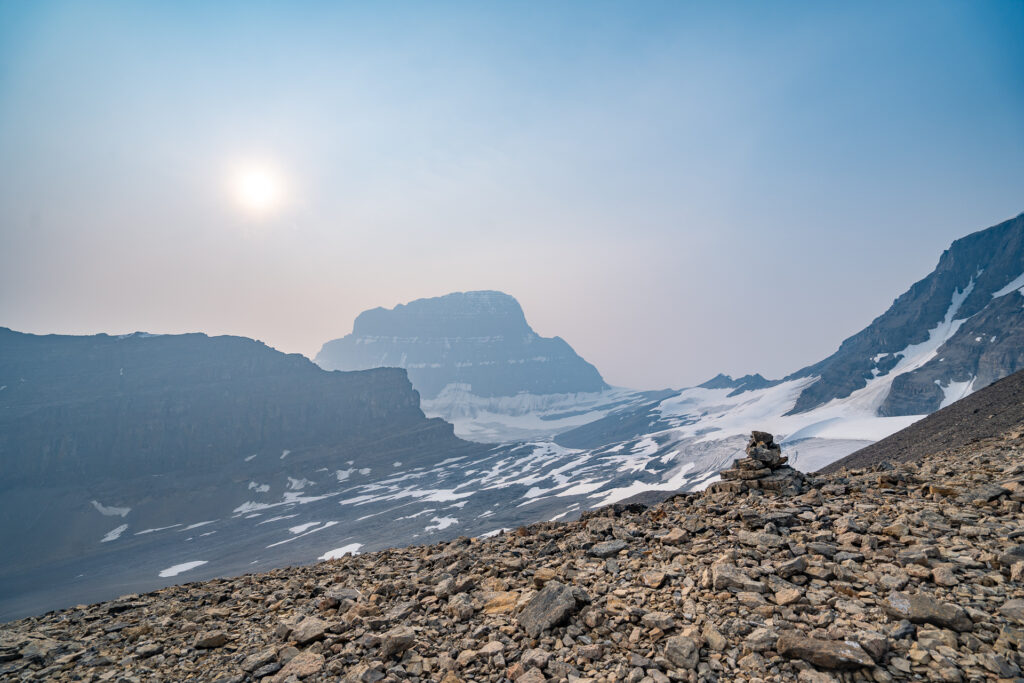
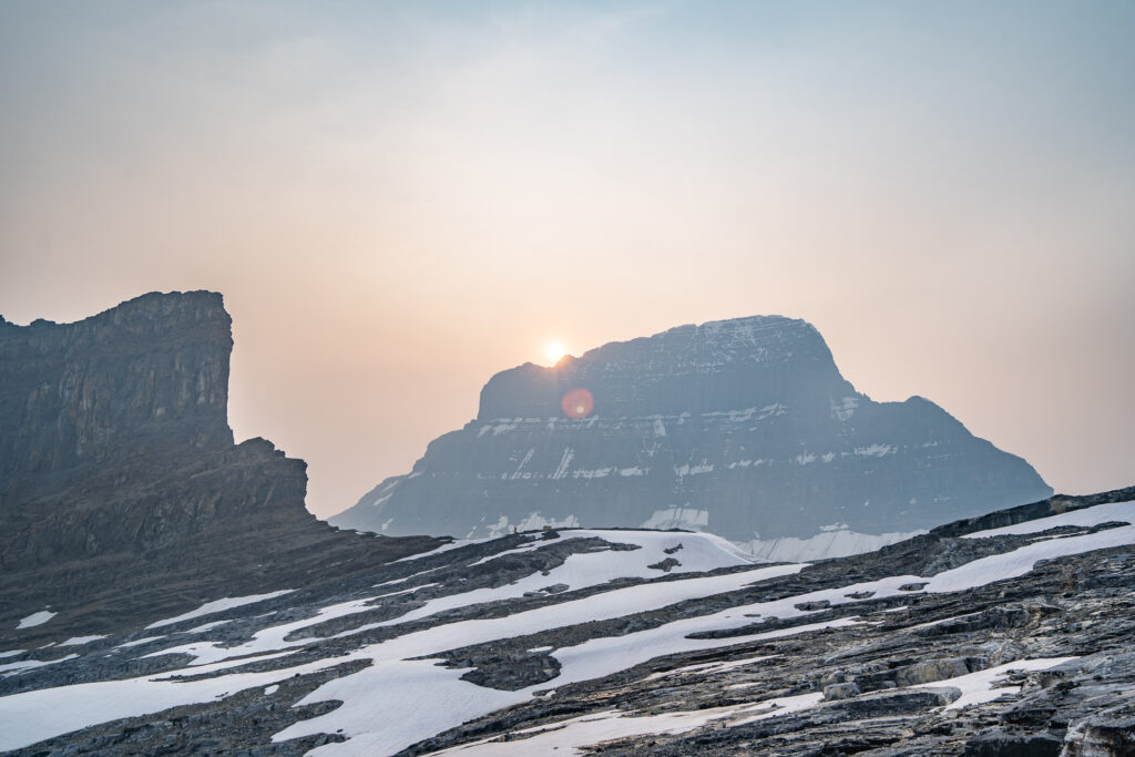
Don’t get me wrong, the hut is in a spectacular basin, perched on the shoulder of the dramatic Mount Little Alberta. You can see the headwalls of the mountains that hold the Columbia Icefield, and see endless vista of mountain ranges to the west. You can drool over the chossy cliffs of Mount Alberta, and are certain to be guaranteed solitude from any disruptions.
There is only one downside, and it’s a big and messy one – the Woolley Shoulder.
Stats
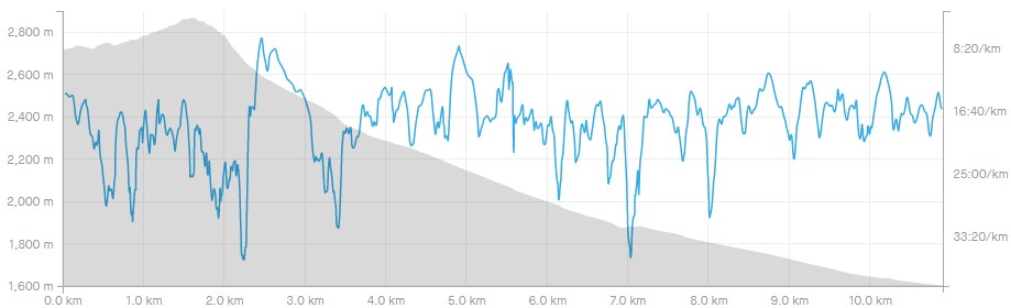
| Trail Length: | 10.9 km | Trailhead Altitude: | 1,601 m (5,252 ft) |
| Total Gain: | 1,351 m (4432 ft) | Hut Altitude: | 2,718 m (8,917 ft) |
| Time to Hut: | 5-7 hours | Difficulty: | Class 2 |
ROUTE NOTES: On the way in, we got suckered into climbing a lateral moraine when missing a cairn. The exit route follows the creek closely and is more accurate. That is the route I’ve included in the gpx file below.
Trailhead
On the Icefield Parkway, the trailhead to the Lloyd Mackay Hut is approx 13 km north of the Columbia Icefield Center, or approx 90 km south of Jasper, Alberta. There is a small partially paved pullout on the east side of Highway 97, just under Tangle Ridge. The trailhead requires you to cross the heavily braided Sunwapta River, which often requires crossing through braids that could be as high as the knee. Once across, you will find a well defined trail climbing abruptly up from the Sunwapta River basin, only 10-15 meters south of the Woolley Creek basin.
At the time of this writing, the trailhead was flagged with pink surveyors tape and was very well maintained. If you’re unsure if you are in the right spot, you’re not in the right spot.
The Trail
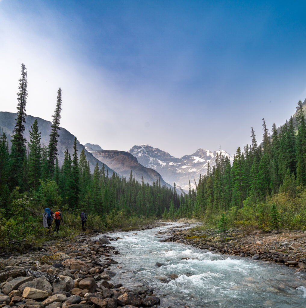
Starting from the Sunwapta River, the trail runs directly south up the high side of the Woolley Creek basin. It doesn’t waste any time gaining altitude.
At approx Km 1.5, the trail seems to level out (although it’s mostly mountain trickery – see elevations) as it runs directly beside Woolley Creek. At places, the trail can be washed out from the changing flow, but it is usually easy to pick back up again.
Soon, you’ll depart from the creek for a short distance before coming to a lateral moraine heading left and up toward Mount Cromwell. Don’t be fooled, this is not the moraine you are looking for. The trail turns abruptly to your right, returning to the side of Woolley creek.
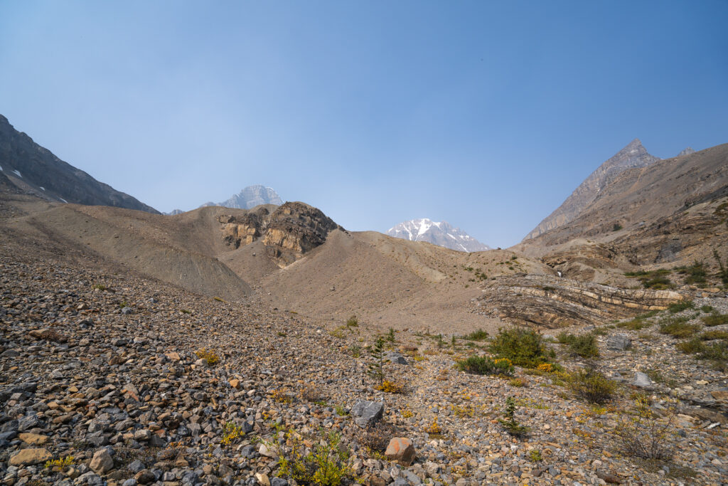
Abundant cairns will lead you along a mostly obvious trail when at Km 4.5, you climb briefly next to a small scenic waterfall. At the top, you’ll enjoy the last vegetation you’ll see on this trip, a quaint and comfortable alpine meadow. The trail continues to follow the south side of the creek, becoming faint briefly as you cross a rock field.

At this point, you can see a large rock buttress ahead of you in the center of the valley, the creek running to it’s right. The path is usually visible from the approach, between the buttress and the creek. Cairn’s abound, so if you’re not sure if you’re on the right path, you’re probably off trail.
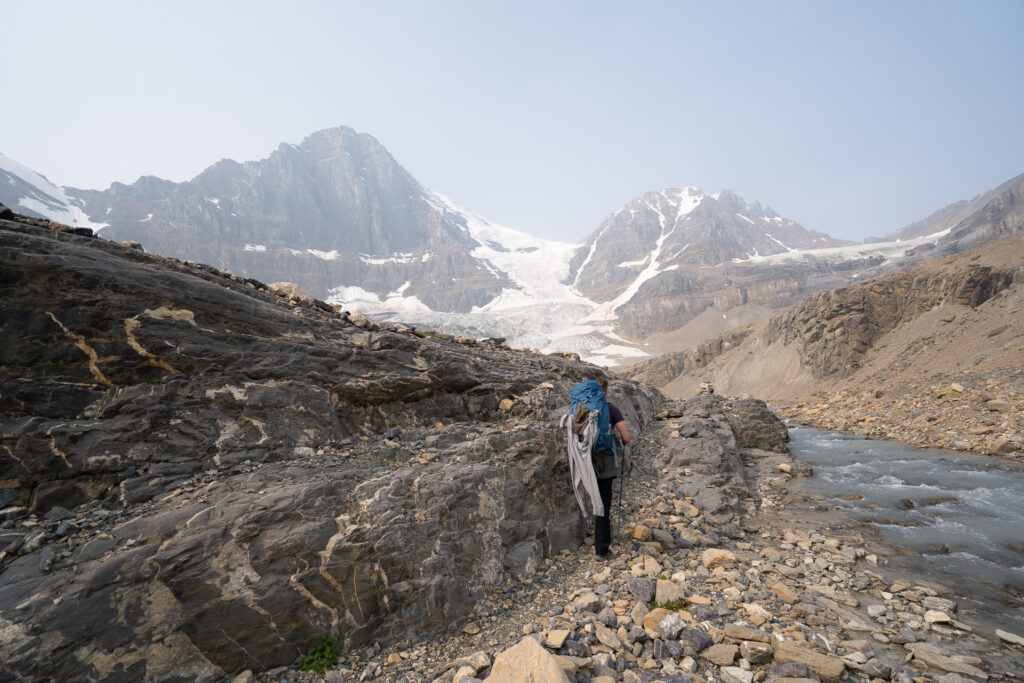
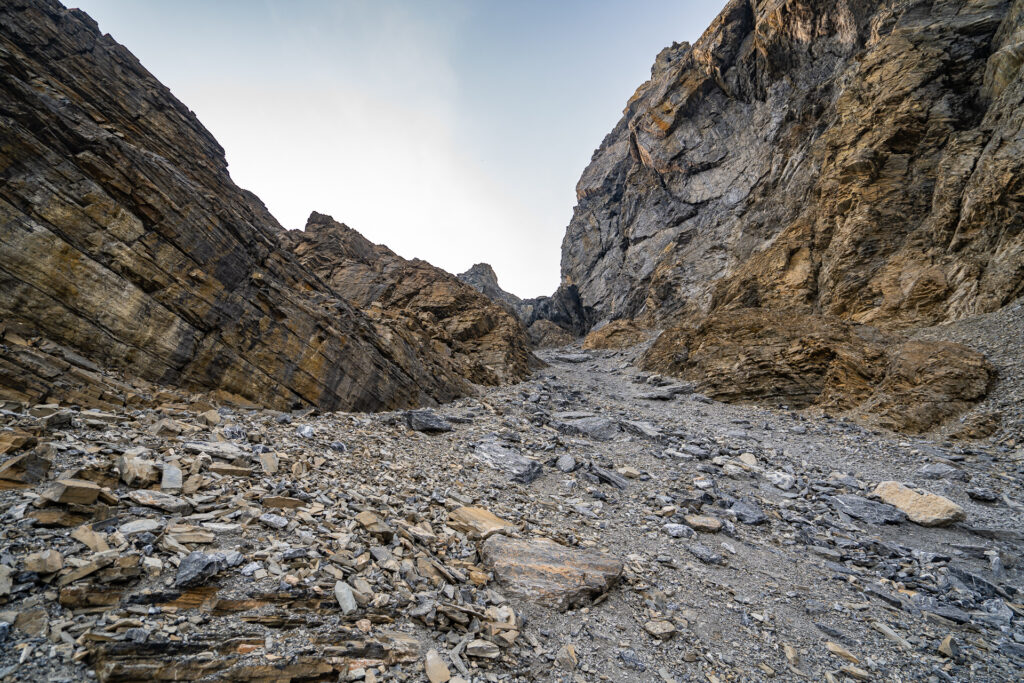
Continuing along the creekside, you’ll come to a rocky plain with multiple bivvy sites. You’ll notice 2 cairn’s, one to the northwest (leading up the glacier to the Woolley/Diadem Col) and one to the southwest – this is the one you want. Camouflaged in the rock field you’ll find abundant cairn’s leading up an obvious gully. Travel is easiest either in the bottom of the gully on larger (mostly) stable rocks, or on the right ridge of the moraine directly above the gully.

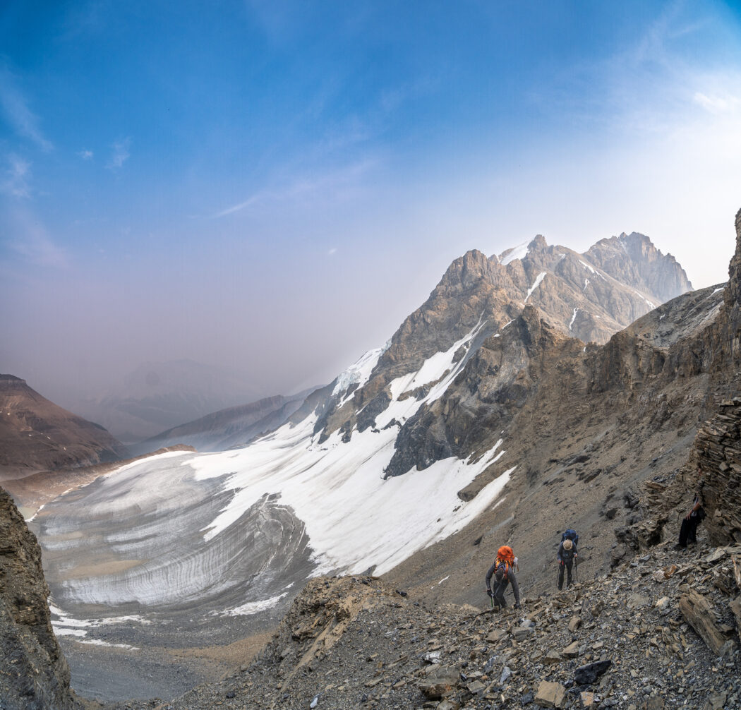
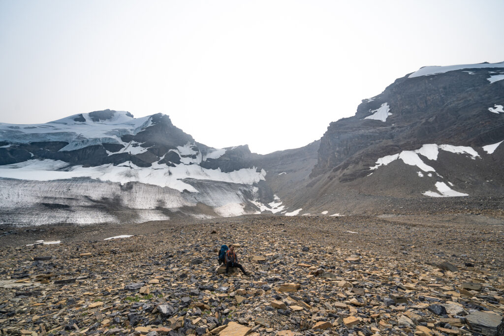
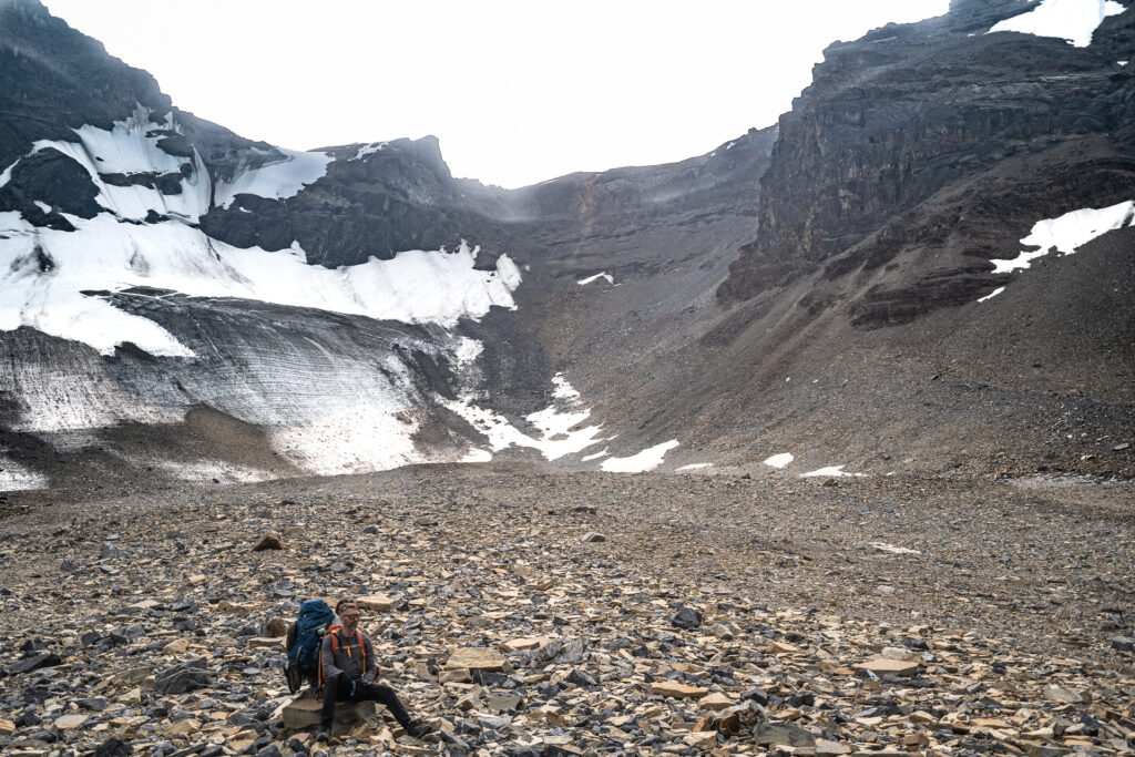
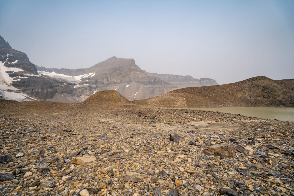
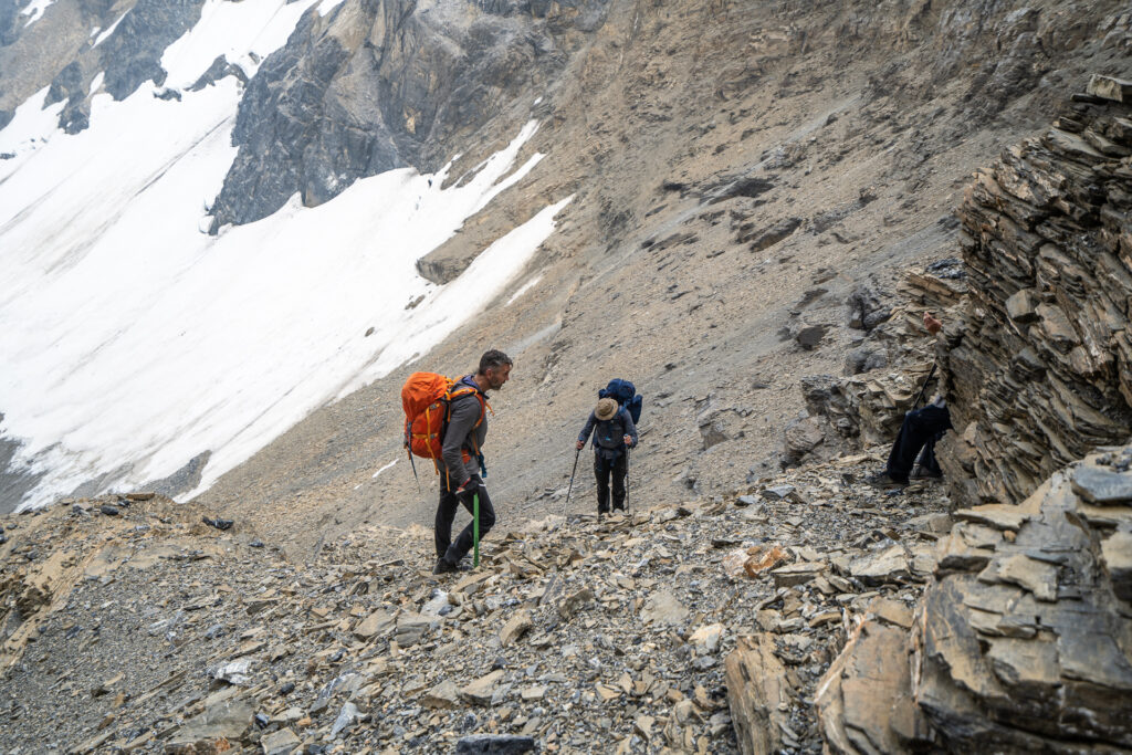
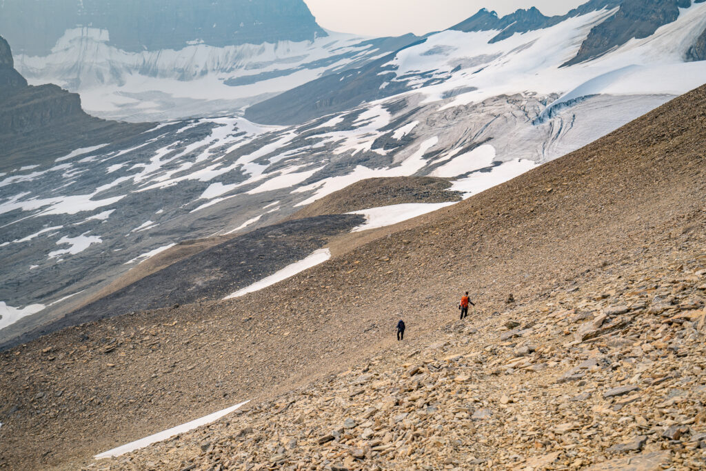
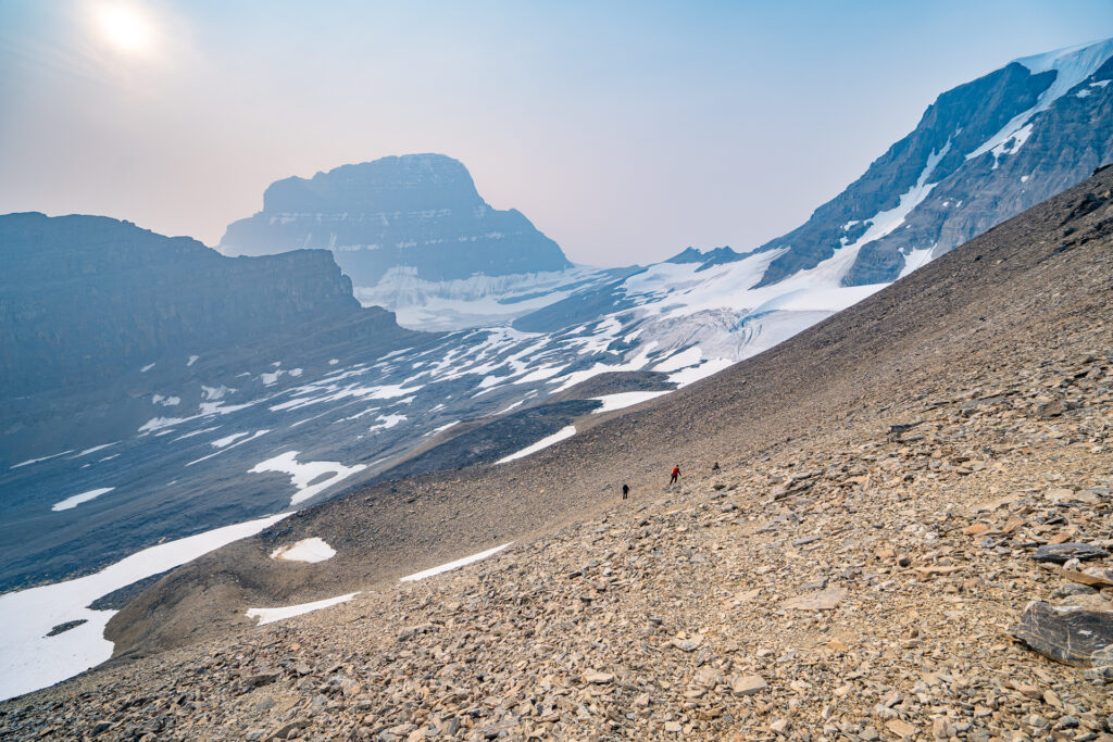
Soon you’ll be dumped out into a large glacial basin. At this point, Woolley Shoulder is just starting to reveal itself. Crossing the basin, you want to aim for the middle right, looking for a somewhat obvious ramp at the top of the loose scree. The scree becomes quite unfriendly before this point, but working your way up right of center is the best path I’ve found so far. Once you reach the rock outcrop, turn right onto an obvious ramp, gaining more altitude until you see a comfortable left turn. If you’re far enough right to be at risk of rockfall, you’ve gone a little too far. Another 20m to the left and you should be able to see to the top of Woolley Shoulder.

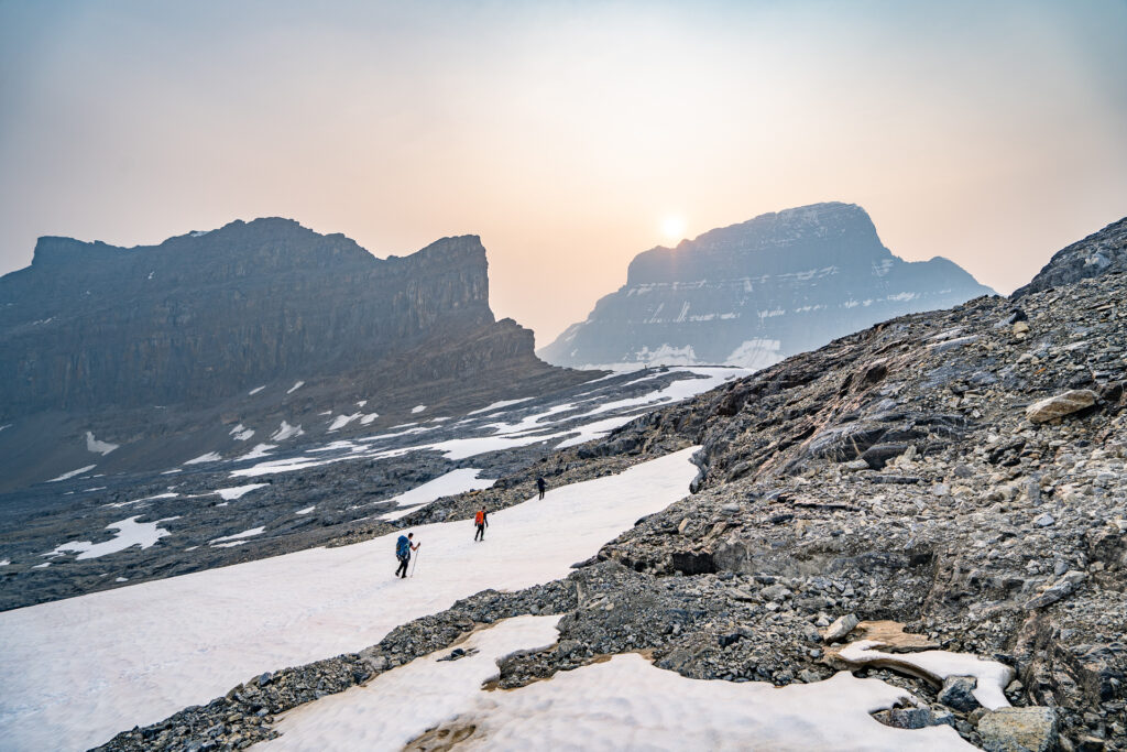
Once you are on the ridge, pat yourself on the back and look almost due west. If visibility is good, you’ll see the hut and it’s cute and cozy little outhouse cheering you on. The trail continues northwest down the scree and is much more enjoyable to travel on than what you just experienced. Pick your way across snow patches, ice and rock. My favourite route looses only a little elevation as it curves around to a snow bridge directly north of the Hut. Venturing out on to a glacier always carries risk – be sure you are prepared and experienced before walking on any ice.
What to do once you arrive
Be respectful of gear stashes. Mount Alberta is one of the most difficult climbs and requires copious amounts of safety gear and good luck. Even with the best weather forecasts, most attempts on the summit fail for a myriad of reasons. Groups will often stash just the right amount of gear and food in the hut while they wait for a window of opportunity to arrive. Messing with a stash can break the plans and hearts of those taking a shot at this behemoth of a mountain.
This is a unique spot with endless objectives, all of which should be done with a guide or by experienced mounteers.
- The easiest way to spend a day is to loop around Mount Little Alberta, finding a small alpine meadow on the south side. While generally easy, there are a few ledges to navigate on the southeast side.
- Mount Little Alberta is an easy day trip, but consists of garbage rock that is always sluffing off new scree. The approach is from the opposite side from the hut. Helmets are highly recommended.
- Mount Woolley and Mount Diadem are both accessible via a few routes, the most common being a couloir visible from the hut.
- Mount Alberta is accessible from this hut, but taxes the skills of the most avid mountaineer. If you are considering this route, you probably don’t need my advice. If you do, I’d recommend finding a guide to help you plan and execute your attempt.
- The Twins and access to Columbia Icefields. Again, if you need advice from me on these, you’re probably best contacting a guide to accompany you.
- Skiing – While seldom visited in winter months, the skiing should be spectacular here. The route to access the hut would be identical to the summer route.
Where to stay
Lloyd Mackay Hut – a 5-7 hour hike up the Woolley Creek basin. The hut must all be booked through the Alpine Club of Canada‘s website or by calling their Canmore Office. You MUST have a booking to stay, as all huts are locked and allow room for only a certain number of patrons.
Refer to Parks Canada’s rules if you are considering the possibility of an overnight bivvy in the backcountry.
What you need to know
Parks Canada requires:
- an entry pass that can be purchased at the entry gate.
- a back-country permit (or annual wilderness pass).

Comments 2
You are a poet. You have nailed the the spirit and the reality of this slog perfectly. You should write for the New York Times Fossil Fuel Support editorial team
And I was fooled by the fkng lateral moraine….
Author
Haha, well, thank you. It’s hard to put extreme pain and extreme euphoria into words…I’m glad this resonated with you!
And yes, that lateral moraine is hard to resist. I guess it’s a rite of passage!