If it weren’t for the ticks, this would be a favorite spot for me. All told, the three of us picked at LEAST 20 from our bodies. When it came down to it, they weren’t as bad as folklore tells. We didn’t get bit even once. Don’t let that fool you, though, there are some potentially serious health concerns, but after finding them everywhere from our hair to our underwear (one of them after 2 showers), none of us fell victim.
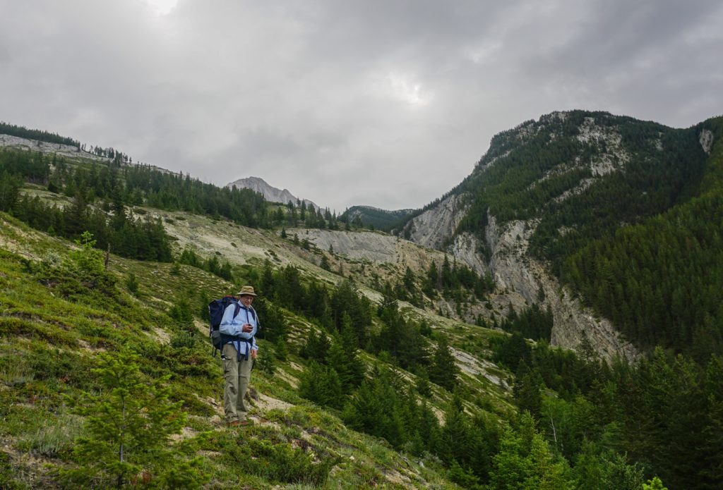
Now that the dirty part is out of the way, this route is a fun one. As I said, it would easily find its way into my favorites other than the tick-factor being high. While the trail is quite well defined, for the most part, there are frustrating sections that can challenge even the best route-finding skills. Ample game trails create more confusion than one would think. I love a good, steady climb – and this trail does not disappoint with steady altitude gain for most of the route
Stats
| Trailhead Altitude: | 1890 m (6200 ft) | Trail Length: | 12.6 km (5.66 km if crossing river) |
| Summit Altitude: | 2,697 m (8,848 ft) | Difficulty: | Class 3 (Traverse: Class 4) |
| Altitude gain: | 860 m (2820 feet) | Map: | 83 C/13 (Medicine Lake) |
| Overland Jct to Hut: | 4-6 hrs to hut | Hut to Summit | 3-4 hrs return |
Trailhead
This trail has 2 starting options:
- The first begins at the 6th bridge in Maligne Canyon and heads 7 km north along the historic Overlander Trail which parallels the Athabasca River. This trail allows mountain biking which can shave off some time (lock it to a tree once you reach the Garonne Drainage). From what I hear, no overnight parking is allowed at the trailhead.
- Park at the Jasper Airport and canoe across the Athabasca River. This is by far the fastest, provided you have access to a canoe. Having friends in Jasper that are willing to ferry you make this even easier (Thanks, Nathan). Once at the airport parking area, head southwest along tire tracks that you can see from Google Maps. Once at the river, you should know what to do. The Athabasca has a pretty strong flow at times, so make sure you have some experience before you push off from shore. From the east riverbank, head into the trees until you hit the Overlander Trail (well-defined singletrack about 30m east of the river).
The Trail
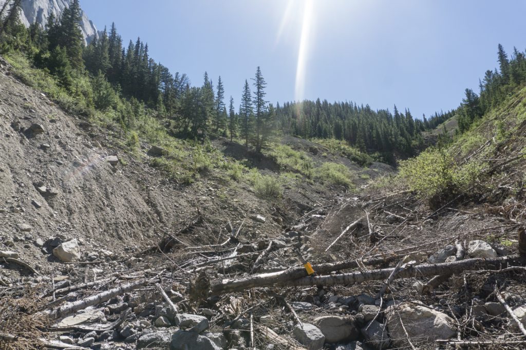
Once you reach the Garonne Creek drainage, turn east and follow it for a little over a kilometer, when you’ll see the rising creek bank rising steeply above the trees on your left. This part is a bit of a crap shoot. There were no markers we could see that were guaranteed to guide us in, but somehow we happened to stumble right onto it. Bushwack to your left until you reach the bank, and look for a well-defined trail that begins to climb the steep bank. As it rises, it tends to follow the edge of the bank where it meets the trees. Part way up, the trail begins to braid into game trails and turns into a choose-your-own-adventure. Fear not, head up the most obvious trail you can find and aim for the bottom edge of the ridge above you. Once you’ve gained it, follow the canyon rim to the extreme right, and you’ll eventually see the trail come back to life. When you’ve reached the end of the rim, you’ll find a fencepost with a yellow marker.
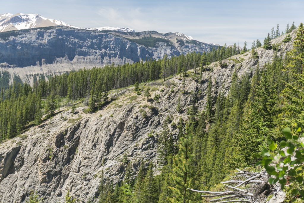
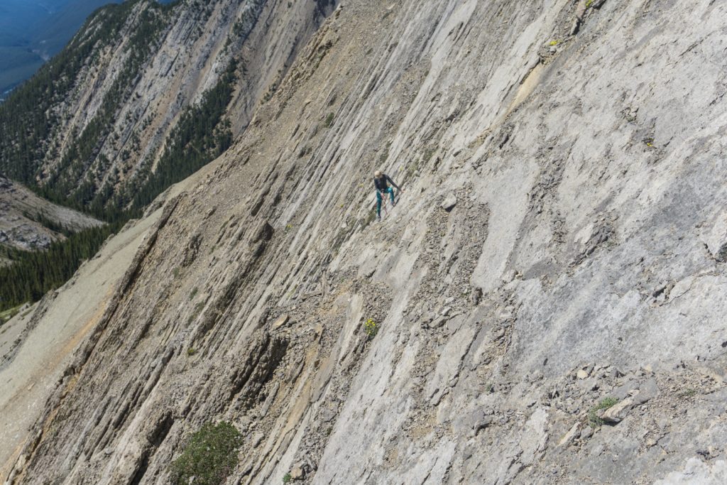
The trail will now cut sharply to the left, continuing to follow the canyon rim. Rising steadily, the trail will stay to the right side near the edge of the canyon till you pass the remnants of a plywood sign nailed to a tree. There is also a large cairn just past the sign, indicating the ease of getting sidetracked by game trails that continue up the ridge. Keeping right, the trail quickly winds its way over the edge and down through cliff bands. You know you are in the right spot if you find some handlines about 15m past the old sign. The bands are not particularly difficult, but with some exposure below, they may test the confidence of some.
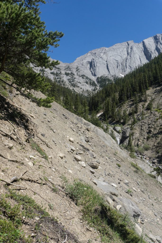
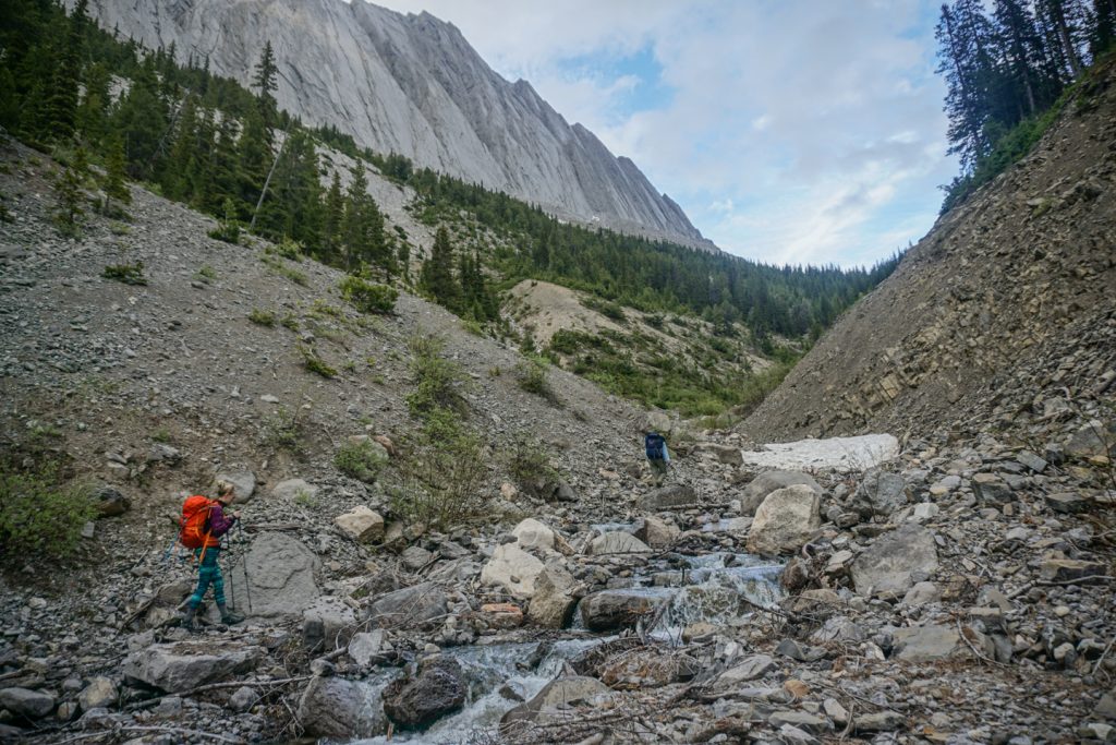
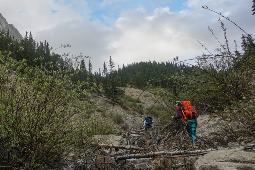
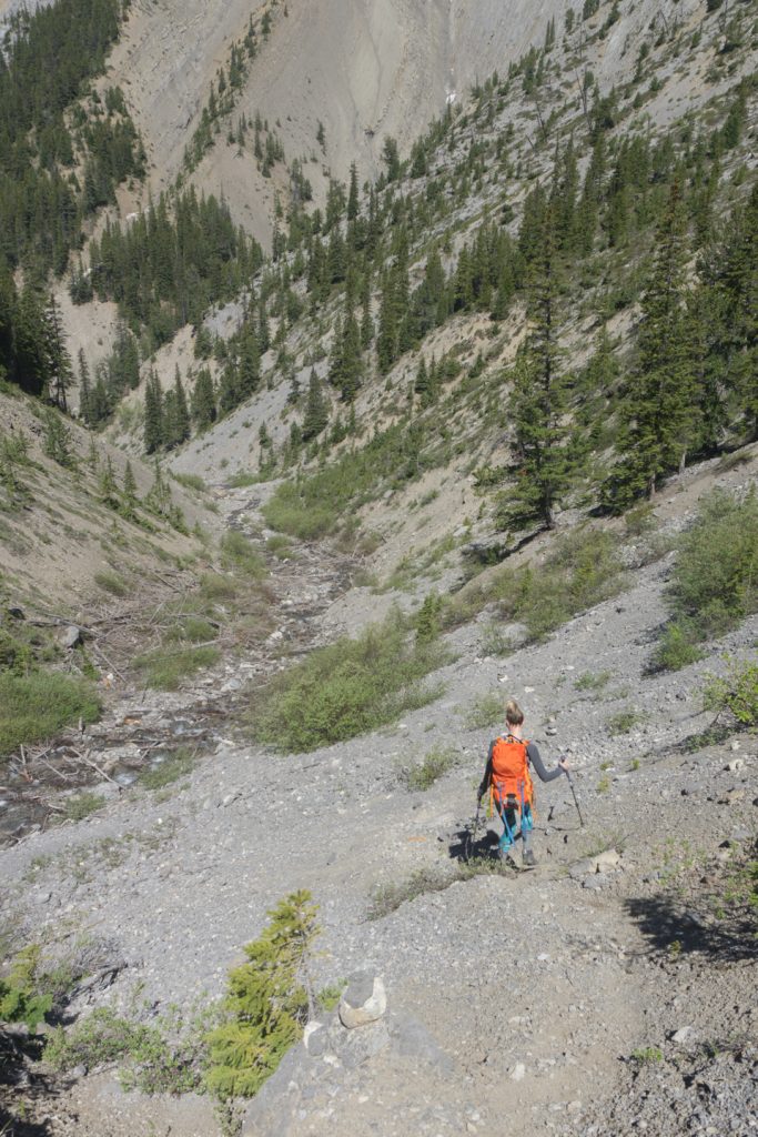
Once past the cliff bands, follow the trail as it contours to the right through the trees. Despite all the deadfall, the trail is still quite clearly defined. After crossing a number of drainages and cutting across the bottom of a small rock field, the trail begins to gain elevation as it leaves the Garonne Drainage. As you round the corner to the left, you’ll come to the second exposed section – again, not technically difficult, but would leave the beginner feeling a bit exposed. From here the trail drops down to the creekbed, but not until you cross a particularly annoying mudslide that will leave you wishing you had crampons. Follow along the creek bed till it turns right.
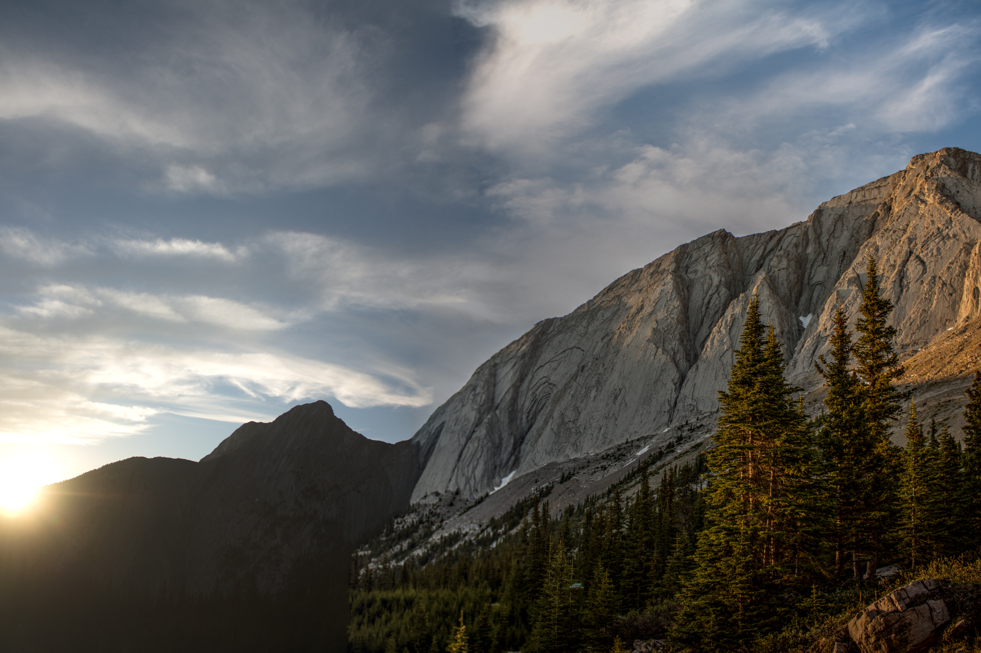
Mount Colin NW to SE Traverse Access
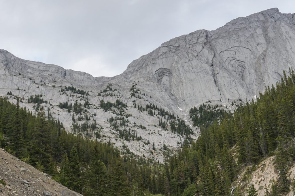
If you plan to traverse Colin from NW to SE, look up to find a slabby gully that heads up into a hole in the mountain that looks like an aerial view of a strip mine. For a description of the NW to SE traverse, see Dr. Dirtbag’s post. His beta is what lead me to Mount Colin to begin with.
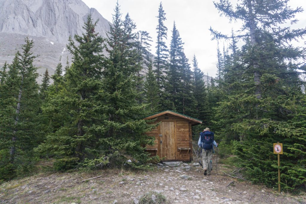
Mount Colin Centennial Hut
To reach the hut, follow the creek to the right until you see a yellow marker attached to deadfall in the middle of the creek. At that point, climb up the moraine to the left into a treed mound high above the creek. Cairns should be ample. Follow the well-defined trail up into the trees and after taking a few deep breaths, you’ll find yourself on the doorstep of the Hut.
Mount Colin SE to NW Traverse Access
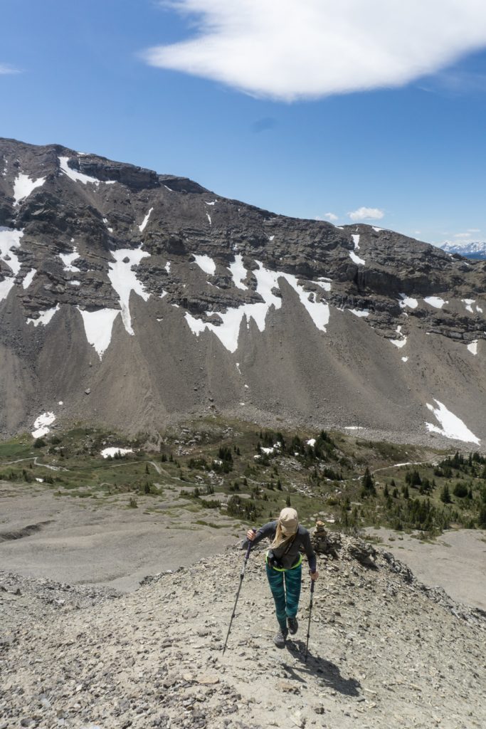
For the SE to NW traverse, continue past the hut through the trees. When you reach the stream (water source for the hut), bear right alongside the creek and follow it to the top of the meadow. By this time the trail is non-existent. Once you clear the trees, you’ll see the ridge between Colin and CR6 up to your left. Scamper up the scree keeping an eye out for a cairn perched atop the first rock band. With nothing but the odd game trail, it might take some trial and error to reach the ridge, depending on your confidence level.
Where to stay
The most comfortable accommodation in the area is the luxurious 6-person Mount Colin Centennial Hut (or just jog in and out in one day like its no big deal).
There is no official campground in the area. Refer to Parks Canada rules if you are considering the possibility of an overnight bivi.
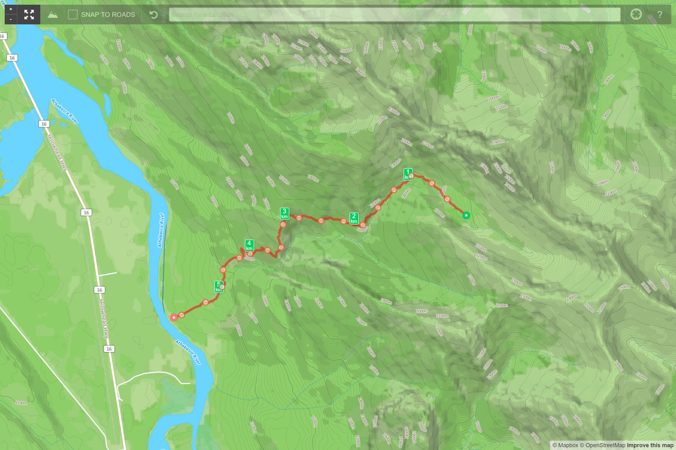
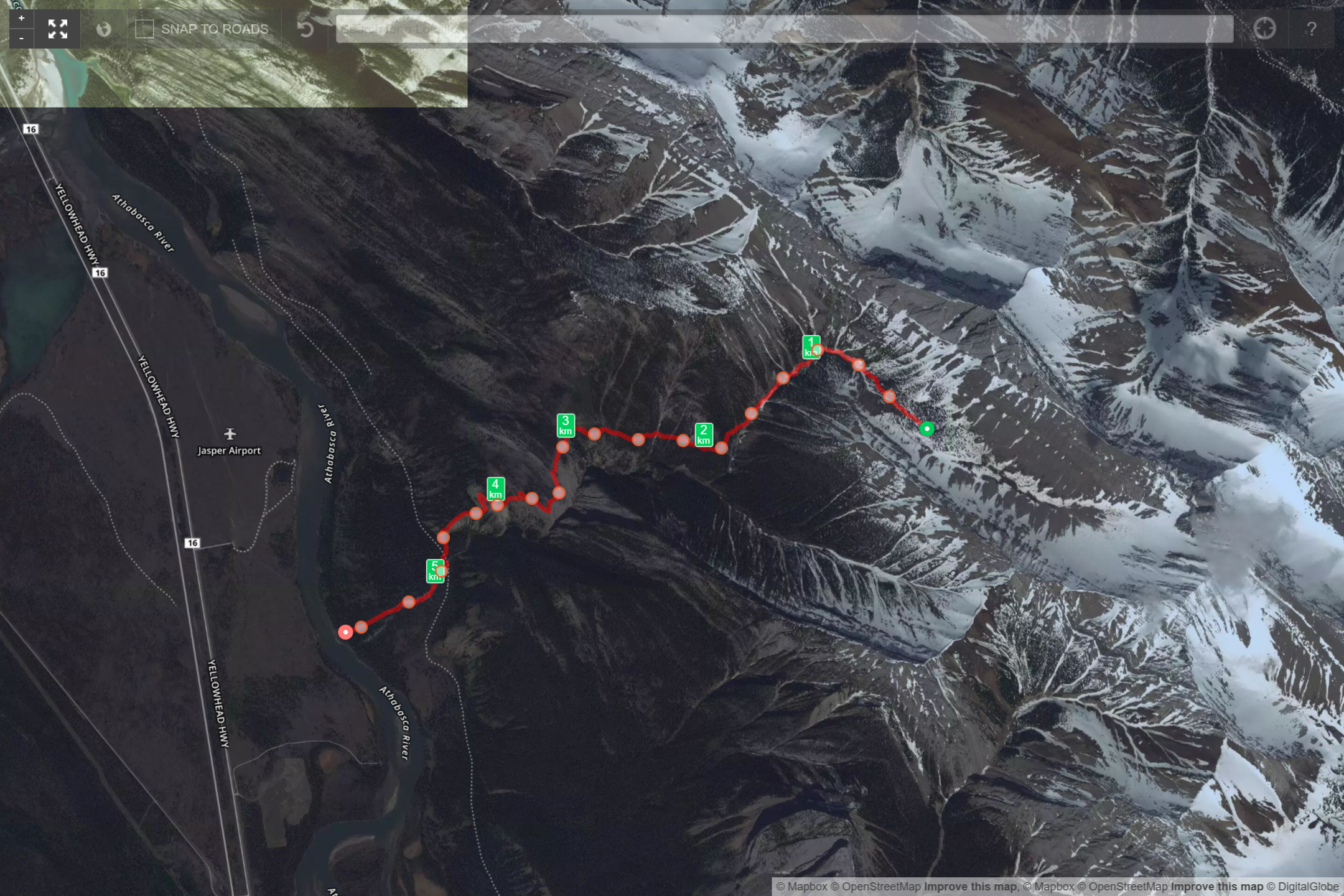
Routes
Download the Mount Colin Centennial Hut to Overlander Trail – GPX
What you need to know
Parks Canada requires:
- an entry pass that can be purchased at the entry gate.
- a backcountry permit (or annual wilderness pass)
Alpine Club of Canada requires reservations and payment to gain access to the locked Mount Colin Centennial Hut. Voluntary registration with the warden is optional but recommended.
Pictures