Updated: Feb 21, 2020.
This trail is my all time favorite day hike. To my knowledge, there is no better bang for your buck in the North American Rockies (challenge me on this, I dare you). The view from the top is unprecedented, and the dynamic of the hike up will keep the most seasoned dirtbag entertained.
There is, however, a downside. People. And lots of them. Because of its reputation and revere, this trail sees truckloads of people of varied experience. There are a few different groups that hike this trail:
- The ones that take pictures from the parking lot (about 20 steps from the car/bus),
- The ones that climb the terminal moraine (big pole-o-rocks) at the end of the lake,
- The ones that walk around the lake,
- The ones that only hike to the top of the switchbacks (I don’t have any nice words for someone who would only hike the worst part of a trail before turning back),
- The ones that will stop in awe at the first meadow (a small oval meadow about 300m at its longest) thinking they must have gotten to the Larch Valley,
- The ones that actually get to the Larch Valley (where the views are just starting to get good),
- The ones who hike to the top of Sentinel Pass (a respectable turn-around point for someone not accustomed to hiking),
- The ones who attempt to climb Mount Temple (If you don’t start early enough, you likely won’t make it),
- And the ones who do.
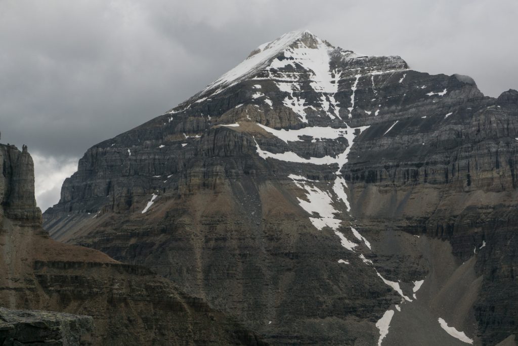
Mount Temple is a daunting hike and it is not for the faint of heart. Unless you consistently hit the low side of the estimated timeline in hiking guide-books, plan on this trip being a day long epic thanks to the continuous rise in elevation, and the 2 technical sections (technical, but not sustained).
A few notes for someone who isn’t sure if this is over their heads:
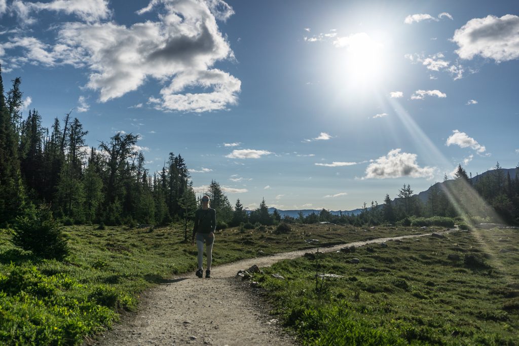
- Start early. Like, 5am early. The method to this madness? You get the first kick at the can (although you probably still won’t be first on the trail), and you get the best light when you reach Larch Valley. You also have a better chance to come down in daylight in case it takes much longer than anticipated.
- Don’t go too fast. This is a loooong hike. The combination of distance and elevation gain is nothing to take lightly. By cutting your speed back by 10%, you’ll be able to go double the distance in the long haul. Just remember to pace yourself and don’t burn all your fuel on the ugly switchbacks at the start.
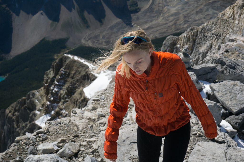
- Bring a helmet. Mount Temple is made of a big, heaping pile of garbage rock. At some points, you should wear a helmet to protect yourself from rocks falling from above. Many won’t, but personally having been hauled off of a mountain after a rock oh-so-gently kissed my helmet at a pretty good clip, I’d rather you be safe than sorry.
- Bring 2 lunches. On your average day, you won’t burn a fraction of the calories you’ll burn climbing Mount Temple. A few granola bars likely won’t cut it. If this turns into a 12-hour long epic (that’s a real possibility), you’ve got all the fuel you need. Just remember to stop and snack at regular intervals.
- Prepare for all kinds of weather. Snowstorm in July? I’ve been there. Plus, it is pretty much always windy and cold at the summit, even if it is sweltering at Moraine Lake.
Stats
| Trailhead Altitude: | 1,885 m (6,183 feet) | Trail Length: | 7.45 km (14.9 km return) |
| Summit Altitude: | 3,544 m (11,627 ft) | Difficulty: | Class 3 and some Class 4 |
| Net Altitude: | 1,659 meters (5,444 feet) | Map: | 82 N/08 (Lake Louise) |
| Time to Summit: | 5-7 hours to summit | Total Time: | 9-12 hours return |

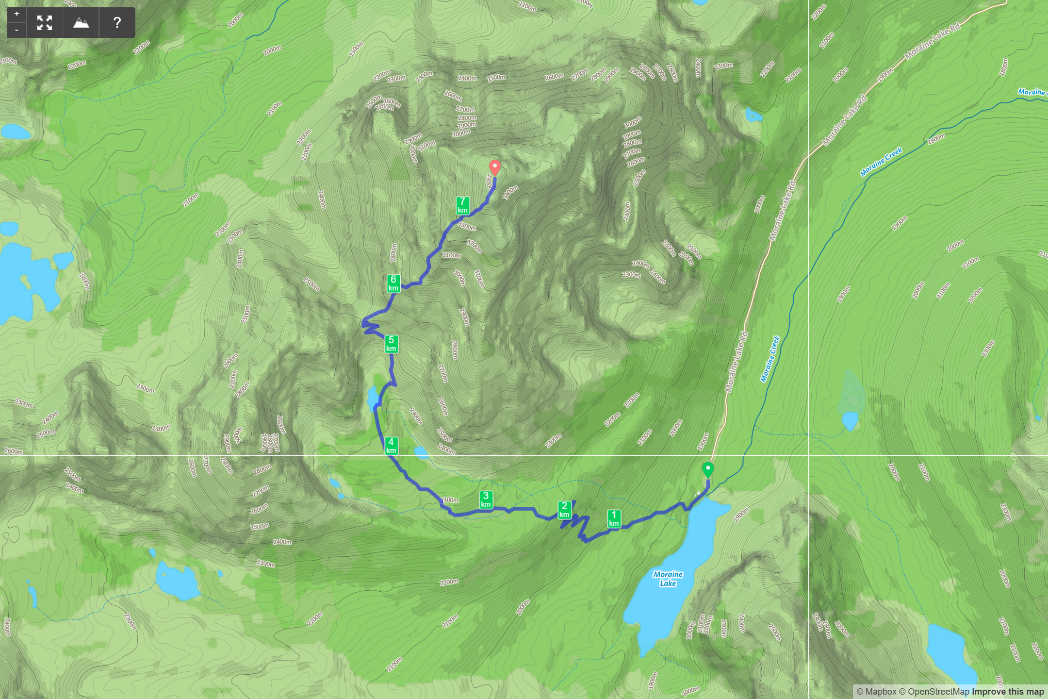
Trailhead
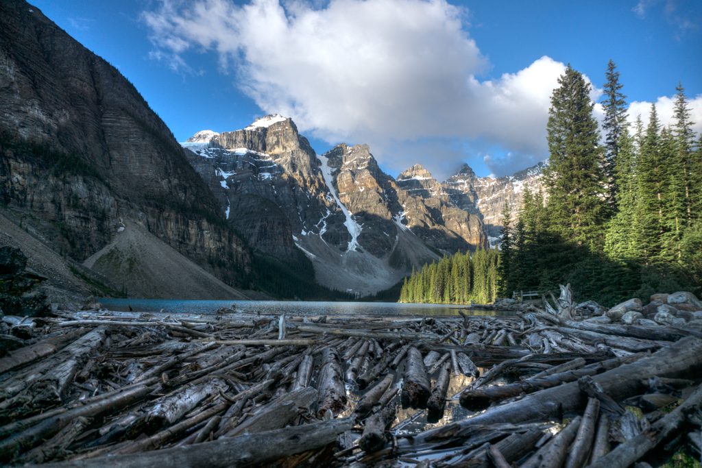
From the Moraine Lake parking lot, head between Moraine Lake and Moraine Lodge. Shortly after you pass the lodge and cabins, the trail turns up and to the right (look for grizzly warning sign).
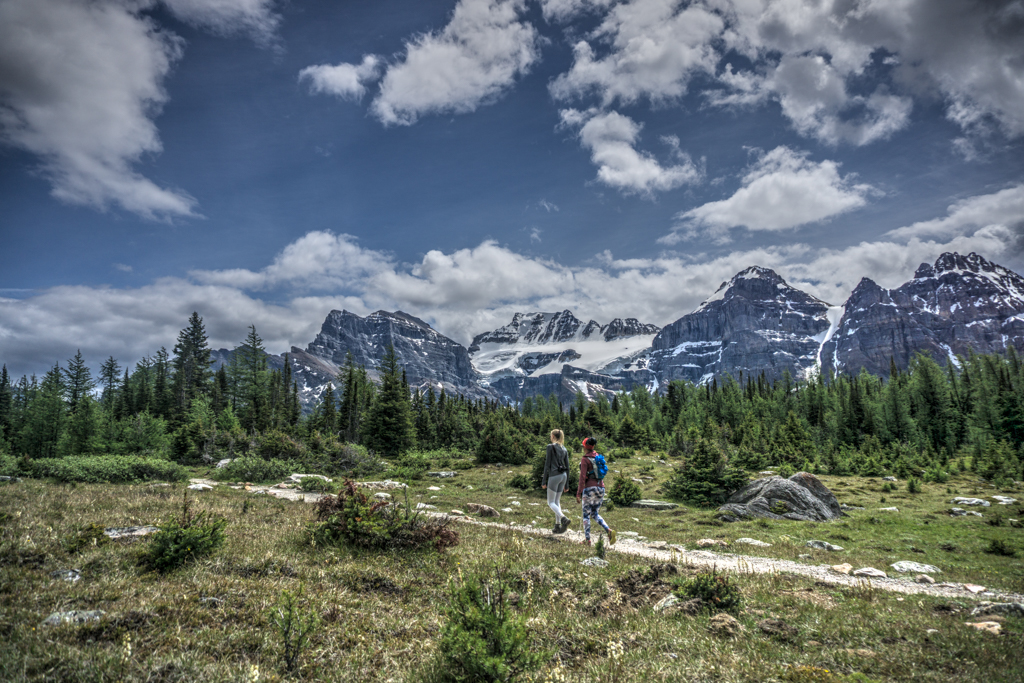
The Trail to Larch Valley
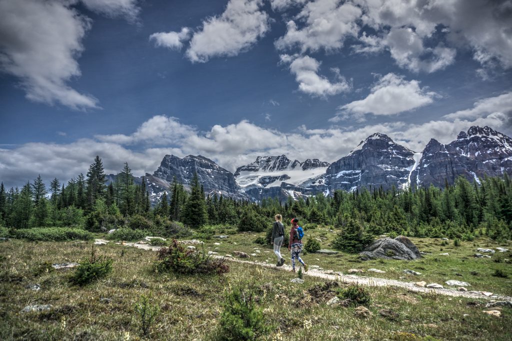
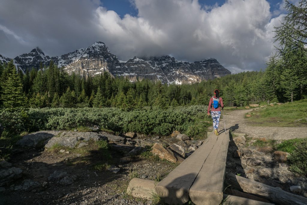
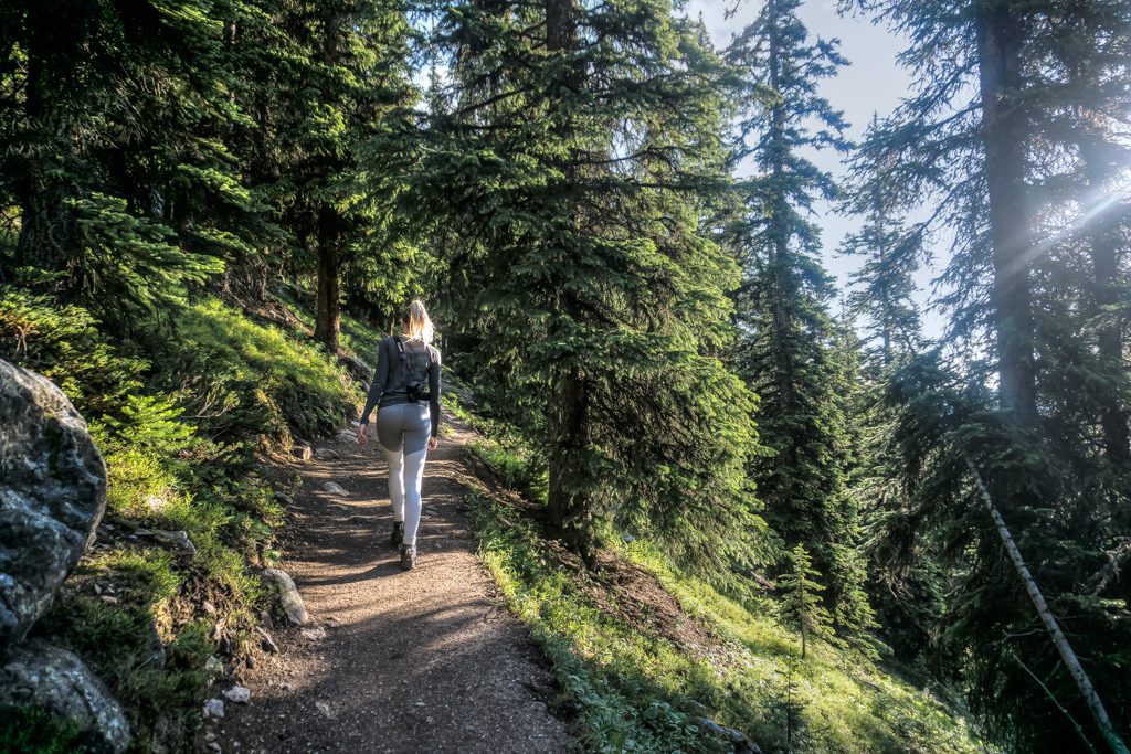
Follow the very well maintained trail up the switchbacks till you get to a large wooden bench where the trail forks. Keep right (left takes you to Eiffel Lake/Wenkchemna Pass) where you’ll find the trail gets a bit smaller and meanders through a larch forest. The forest will thin as you move along until the Ten Peaks unfold before you in a small enclosed meadow. You will cross a stream and walk a short distance alongside the trees until the trail bears to the right and starts to climb back into the forest.
As the trail continues to gain slight elevation, you will be greeted by 2 permanent wood benches, one on either side of the trail. At this point, the trees will be thinning considerably. Continue past the benches into the meadows. As the trail levels out, it will lead you past the beautiful glacial Minnestimma Lake before crossing to the right side of the basin ascending abruptly.
This is where it gets real. The trail above Larch Valley to Sentinel Pass (which is highly visible) gains elevation quite quickly. It is imperative you have lots of water at this point, you likely won’t see any after this point. Follow the trail up the right side of the valley as it curves to the left and climbs the switchbacks to Sentinel Pass. You’ve just gotten a small taste of how the rest of your day will go. That short jaunt was 175 m, now you have only 1,000 m of elevation left to go!
Sentinel Pass
The views from here are incredible, placing you thousands of feet above the Larch Valley to the south and the Paradise Valley to the north.
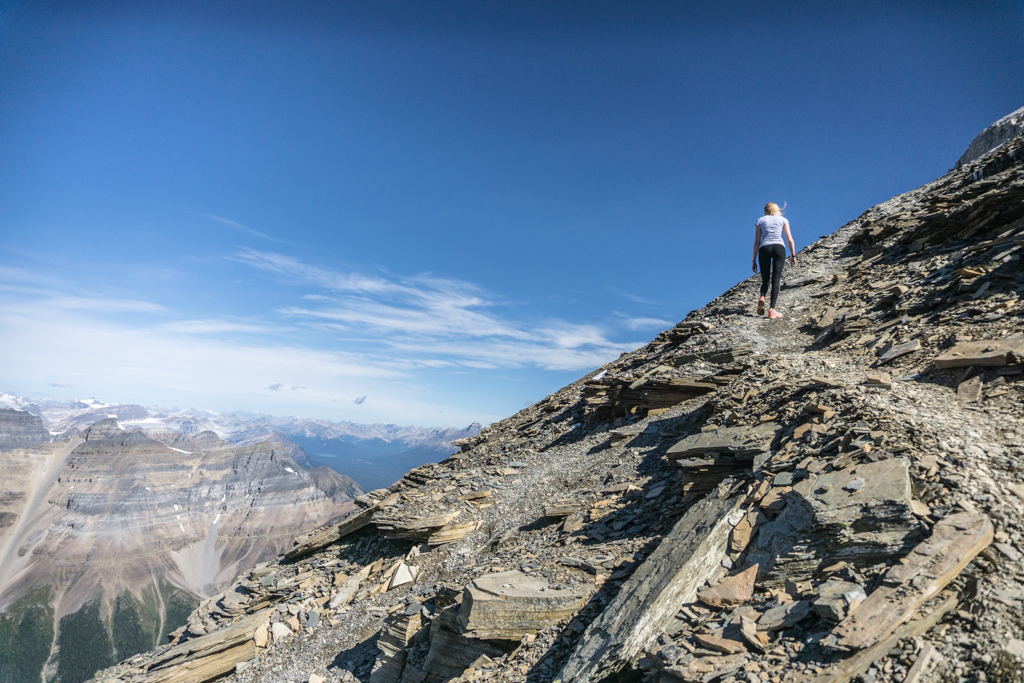
Once you’ve caught your breath, you will turn to your right and begin heading up the talus and scree just to the right of the ridge. Cairns are scattered here and can lead you astray as much as they can help. As you leave the light gray rock near the pass, you’ll find yourself in a reddish brown rock band. Trails are generally obvious through this section and you have a few to choose from. The only guidance is to generally stay to your left. As the trail approaches a head wall, the trail will bear slightly right across into a gray scree.
As the scree continues to rise, you will find a rock gully that is often filled with snow well into the late summer. If you are comfortable and familiar, you can kick-step your way up the gully (it is quite exposed, so only do this if you know what you are doing), or, a few meters (like, 3 or 4 m) to the right of the gully is a fun chimney in the rock. While rated a 5.6 or a 5.7 by some, it is very protected, as you only have 2 or 3 meters below you, thanks to a 90° turn to the right about half way up. The most exposed section by far is the top, where you exit the chimney. It is a high class 3, but to trip and stumble could result in an expensive helicopter ride off the mountain, so don’t be afraid to use your hands for about 10 m where things get a little more sensible.
From the top of the chimney, head up and to the right. The trail can be difficult to find along this section thanks to people who find more difficult ways to gain this rock band, but it will generally bear to the left as you clear the band and get back into the scree.
As you climb the scree, you’ll approach a band of white rock. This is the second exposed section. Gain the first knob (a great place to soak in the view and refuel) and head to the right, scrambling up one of a few sections that are an unsustained 5.5. When you come out on top, follow the scree to the last rock band before the final scree.
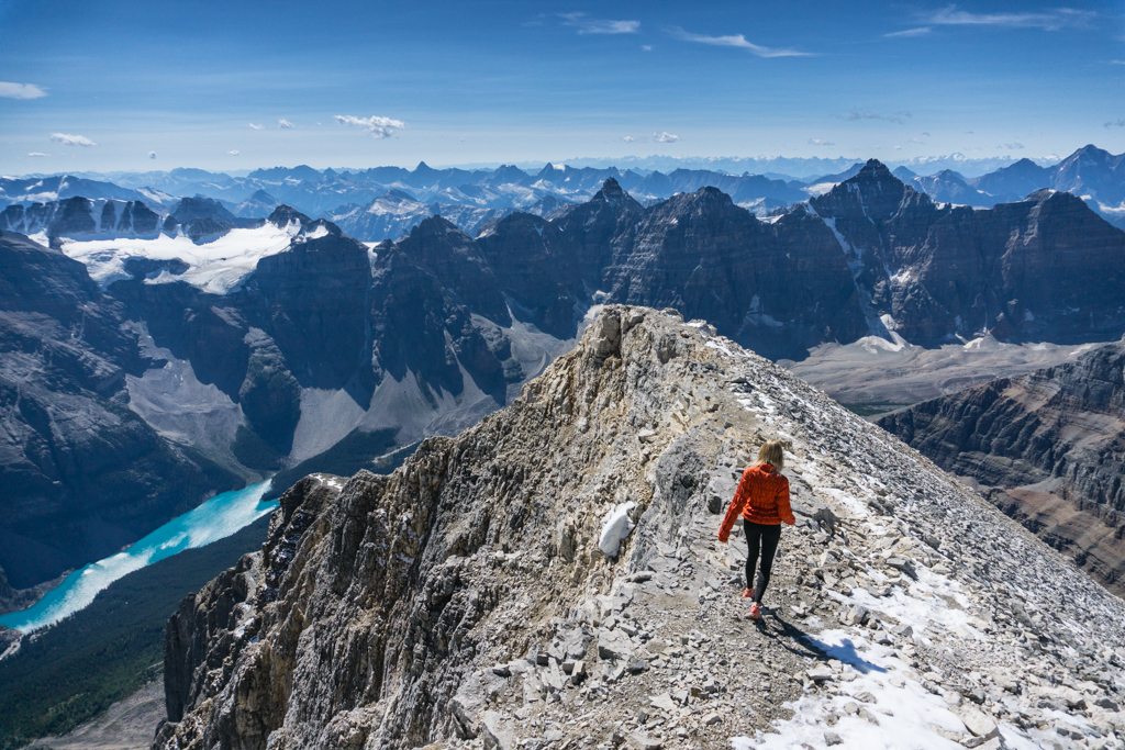
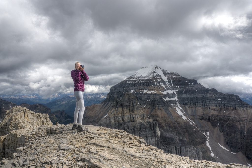
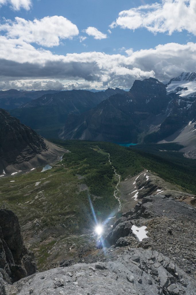
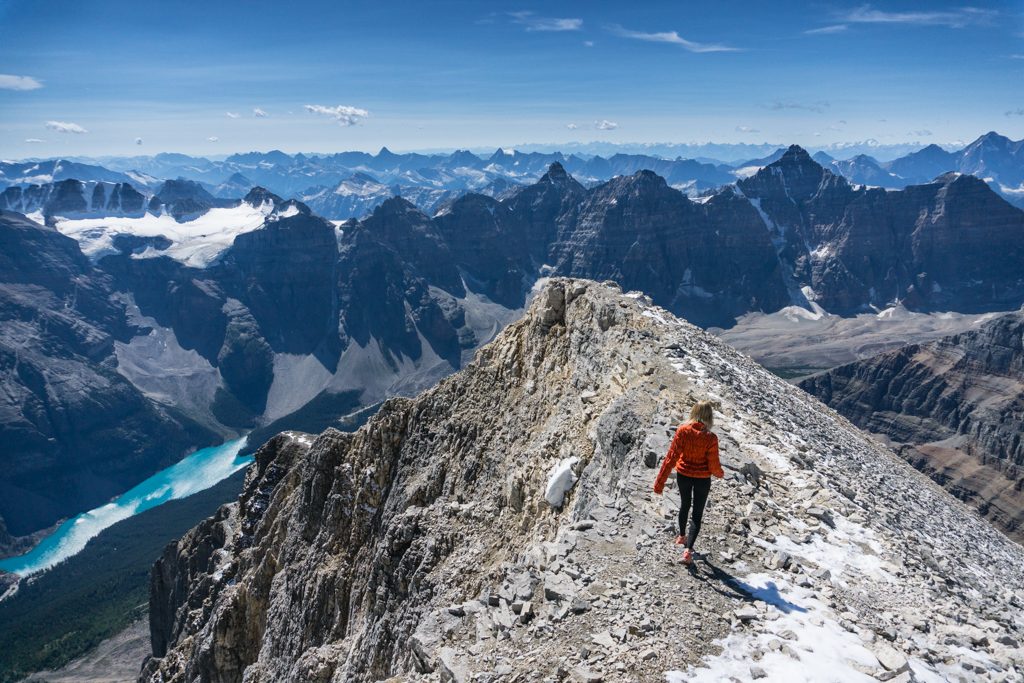
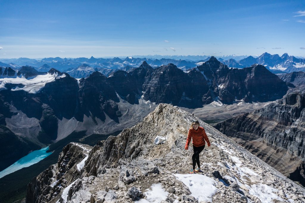
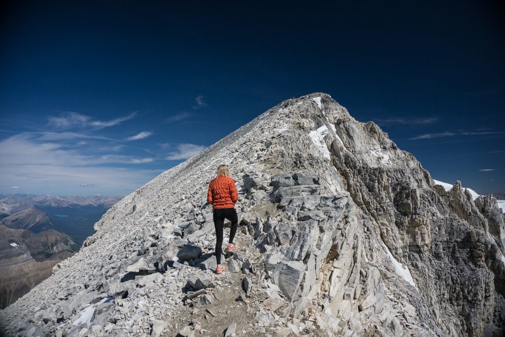
This is probably the worst part of the hike. The trail braids and none of the options are good, well-trodden paths. The trick is to get to the ridge on the right far above you. The lower section of the ridge isn’t very nice, so I find that heading up and slightly to the right is best. Once you get to the ridge (careful, it’s a long way down), the views open up. You will see the Valley fo the Ten Peaks like never before. Moraine Lake, Consolation Lakes, Paradise Valley and the Lake Louise townsite all lay before you as you stand a good 500m (1,5oo ft) above any neighboring mountain.
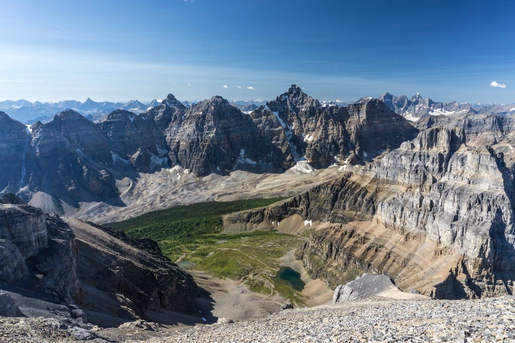
Once you arrive, you will be greeted by a stunning 360° view of the Lake Louise townsite, Paradise Valley, Moraine Lake, Consolation Lakes, Larch Valley, Valley of the Ten Peaks, and Mounts Lefroy, Deltaform, and Hungabee which are the most notable nearby peaks along the Continental Divide. You can also see the Lake Louise Ski Area, and on a clear day look straight down the bow valley toward Castle Junction.
Where to stay
The most comfortable accommodation in the area is Moraine Lake Lodge (ca-ching…) while the most reasonable accommodation is the HI-Lake Louise Alpine Centre (hello, snoring strangers that are less than arms length away).
The nearest camping is found at the Lake Louise Tent Campground (limited RV spots). Refer to Parks Canada’s rules if you are considering the possibility of an overnight bivi. There are no designated campgrounds and camping is restricted because of the delicate Grizzly bear habitat surrounding the area.
Routes
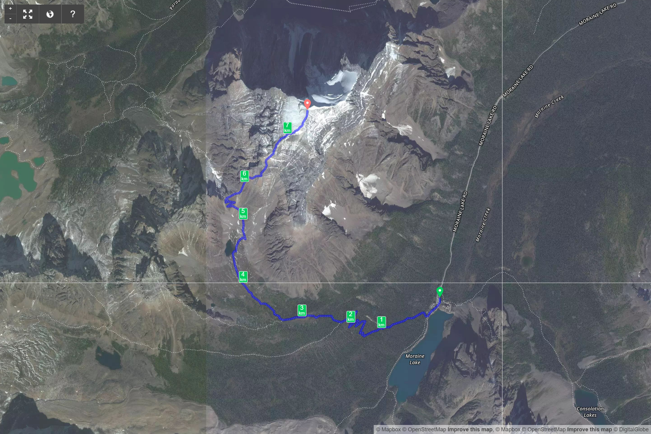
Download the Mount Temple Summer Route – GPX
What you need to know
Parks Canada requires:
- an entry pass that can be purchased at the entry gate.
- a backcountry permit (or annual wilderness pass)
- groups of 4 or more traveling through the Grizzly habitat between Moraine Lake and Larch Valley
Pictures
Comments 2
Nice scenery and nice tight buns tooo!
Hiking does that to you! 😛