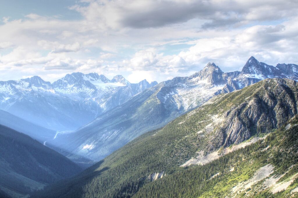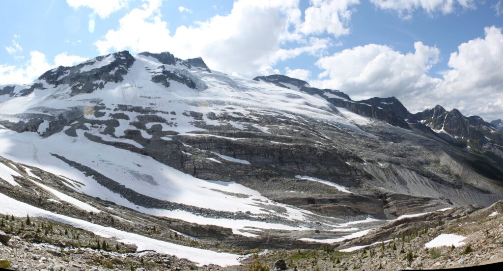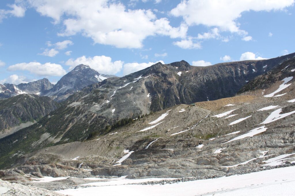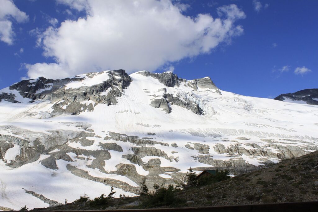
There are many reasons to get on this trail. Being on the west side of the continental divide, the greenery at the bottom of the valley may seem foreign to those east of the divide. Ferns, moss, and tropical flora seem to grow uninhibited in this sub-alpine wonderland. Mountains jut out of the ground and rise thousands of feet into the sky in true form of the Selkirks, nestling the diverse Asulkan Valley between abrupt, rugged and picturesque mountain ranges.
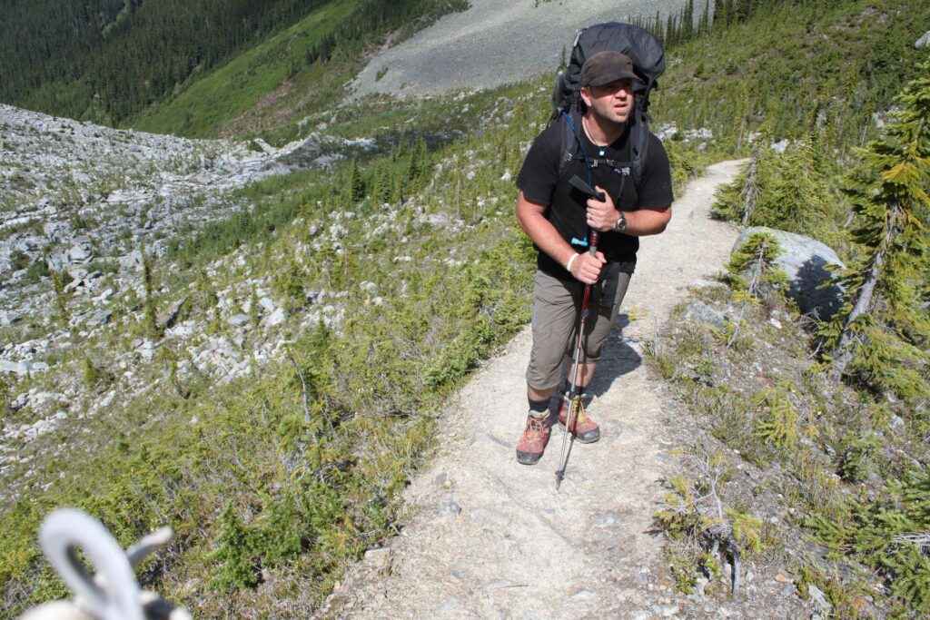
These wide and well-maintained trails are great for hikers of all skill levels. I’d even venture to say that a good chunk of the trail is even wheelchair accessible for the first few kilometers. As the trails break off and begin to gain altitude, they start to narrow into well-worn paths, with rocks and roots occasionally jutting out of the clay and sand. At no point is route finding difficult on this trail.
Stats
| Trailhead Alt: | 1,250 m (4,101 ft) | Trail Length: | 6.89 km |
| Hut Alt: | 2,100 m (2,789 ft) | Difficulty: | Class 1 |
| Net Alt: | 850 m (4,396 ft) | Map: | 82N/6 (Blaeberry) |
| Time to Hut: | 3-5 hours to summit | Total Time: | 5-7 hours return |
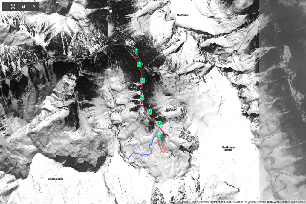
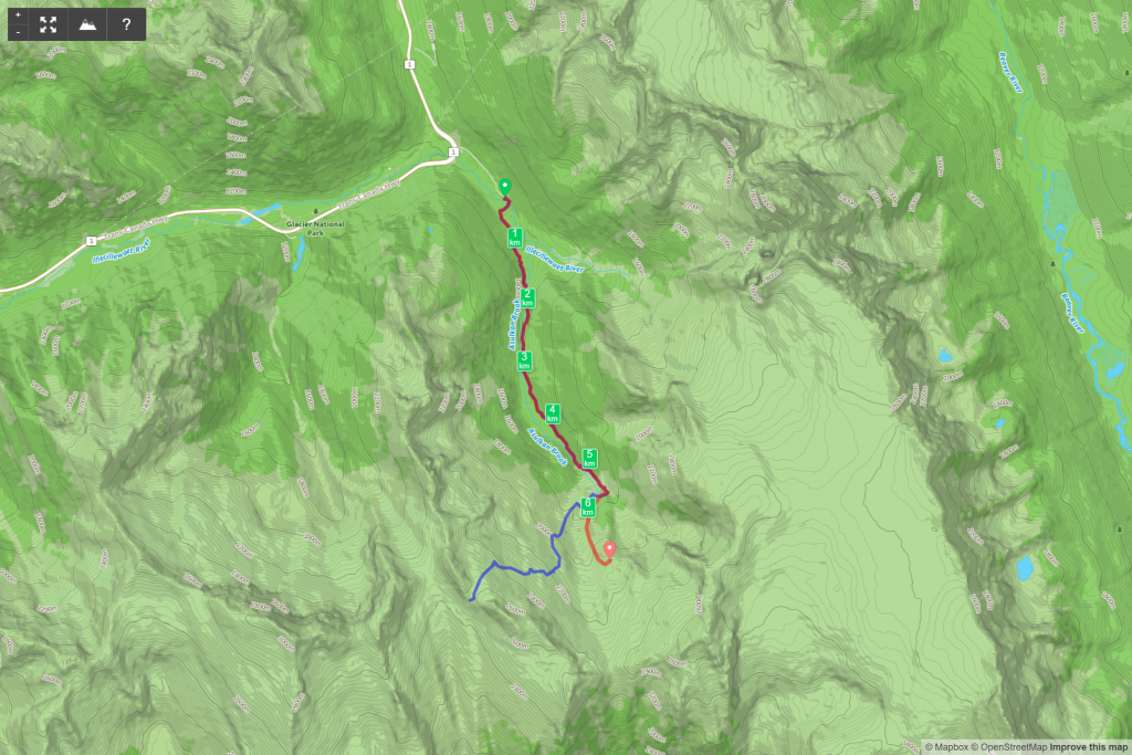
Trailhead
Pull into the Illecillewaet Campground, driving straight to the back, bypassing the campsites themselves. At the back, you will find a parking area used to reach the A. O. Wheeler Hut and hiking trails (full by 8 am on ideal days). Heading southeast, follow the old railroad access road up, away from the parking area. Once you reach the old railroad, follow it to the right for 150 m. Turning left into an obvious opening in the trees, you’ll pass the remnants of Glacier House as the trail rises slowly into the forest. (Winter – Park at the Illecillewaet parking lot just off the highway. A parking permit that is obtained from the ACC is needed to park overnight during the winter.)
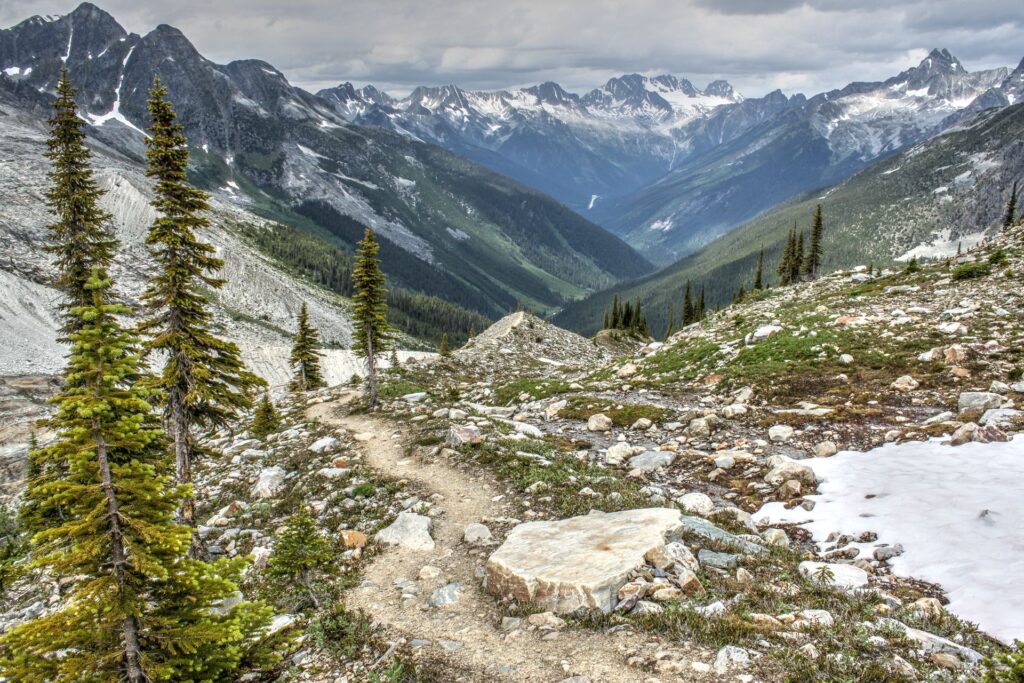
The Trail
The trail up to Asulkan Hut is very well defined and maintained. It essentially follows the Illecillewaet river up into the Asulkan Valley. The trail is wide and well marked with signs at each junction.
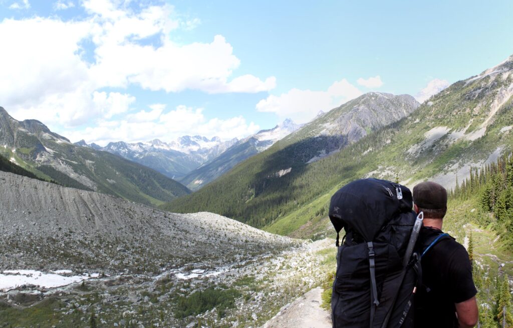
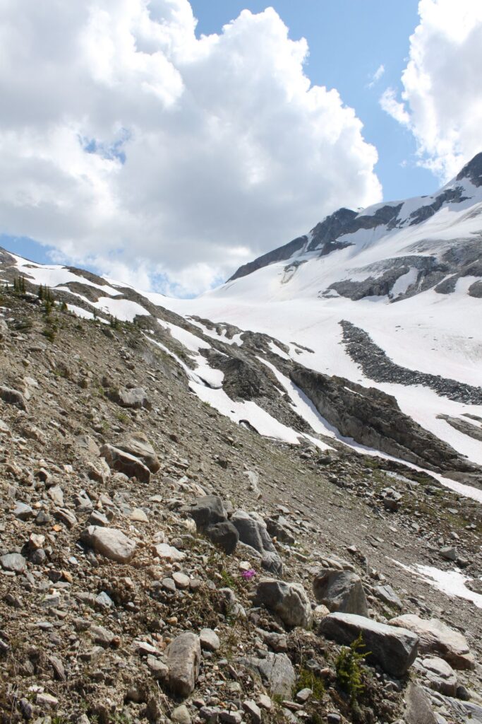
Once past the Glacier House remains, you can pretty much just keep right at every junction. You’ll find yourself within earshot of the river the entire way while following the signs to the Asulkan Valley. Soon , you’ll come out of the trees alongside the river. After a short run through a brook-side meadow and small talus field, the trail bears specifically to the left as it enters the “mouse trap”.
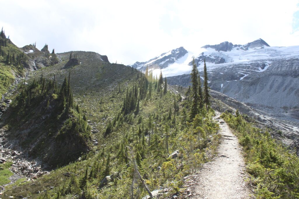
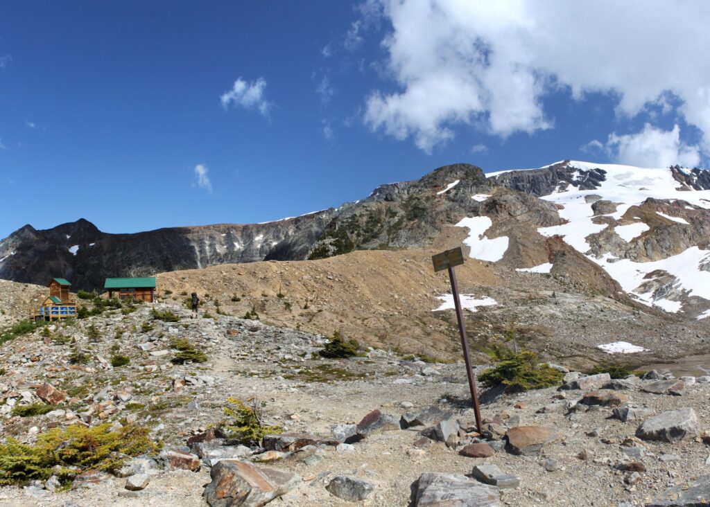
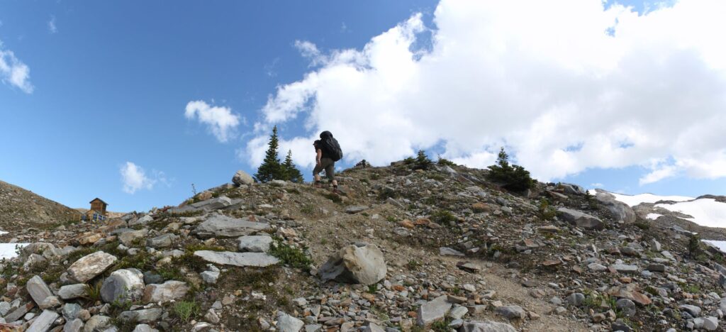
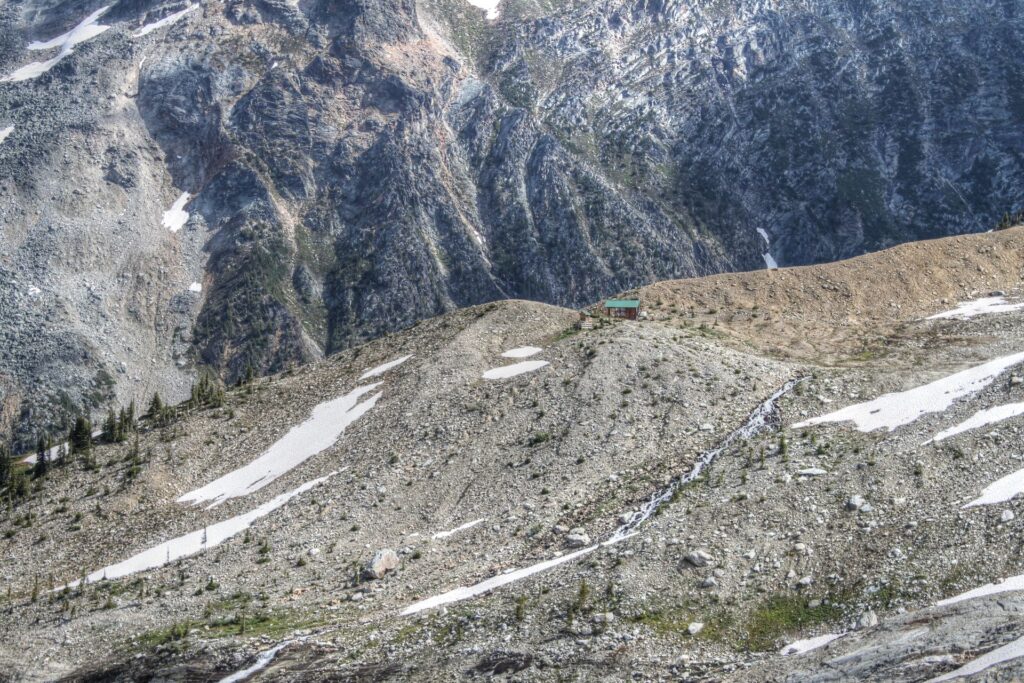
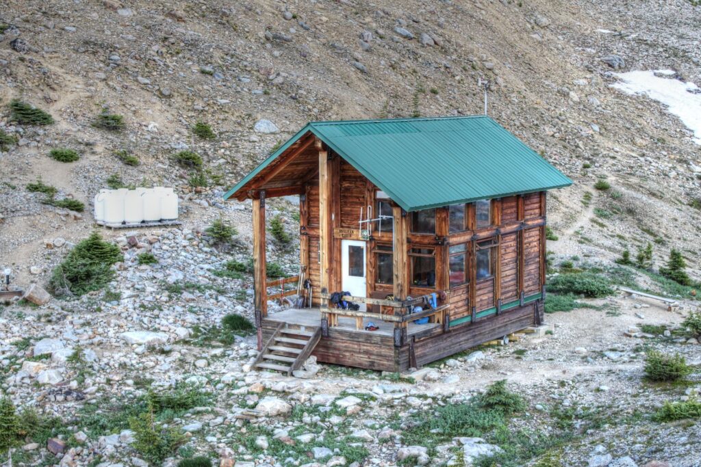
Continue along the trail toward Asulkan Hut. As you gain elevation, note the left and right lateral moraines – you will be heading to the left moraine. Continuing up, alongside the brook, you will come to a bridge where the trail turns to the right, leading you into the trees. As you come out of the trees and gain the left moraine, the trail will rise up in front of you, following the top of the moraine closely. This part of the trail is the steepest, and you won’t be done till you can see the hut. Near the top of the moraine, the trail turns left still rising steeply via a handful of short switchbacks. You know you’ve arrived when you see a sign that mockingly announces the “End of the Trail”. Continuing past the sign, the hut should be in sight.
What to do once you arrive
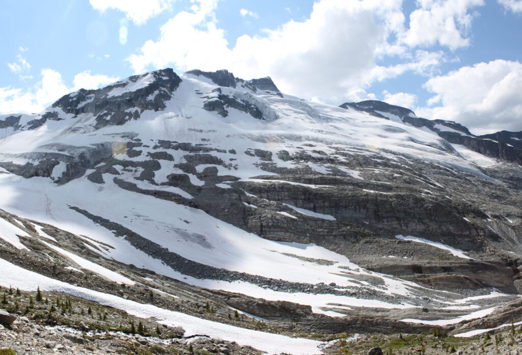
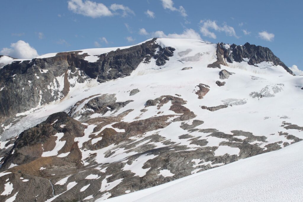
There are a number of objectives from the Asulkan Cabin.
- Hiking south to Abbot Pass.
- East from Abbot Pass takes you up Young’s Peak and gives access to the Illcilewaet Glacier.
- West from Abbot Pass traverses the Jupiter Range (via Leda Peak, Mount Jupiter, and Castor Peak) to Sapphire Col.
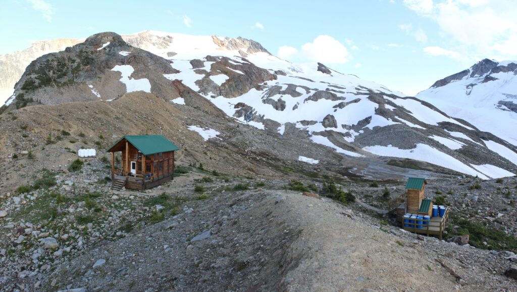
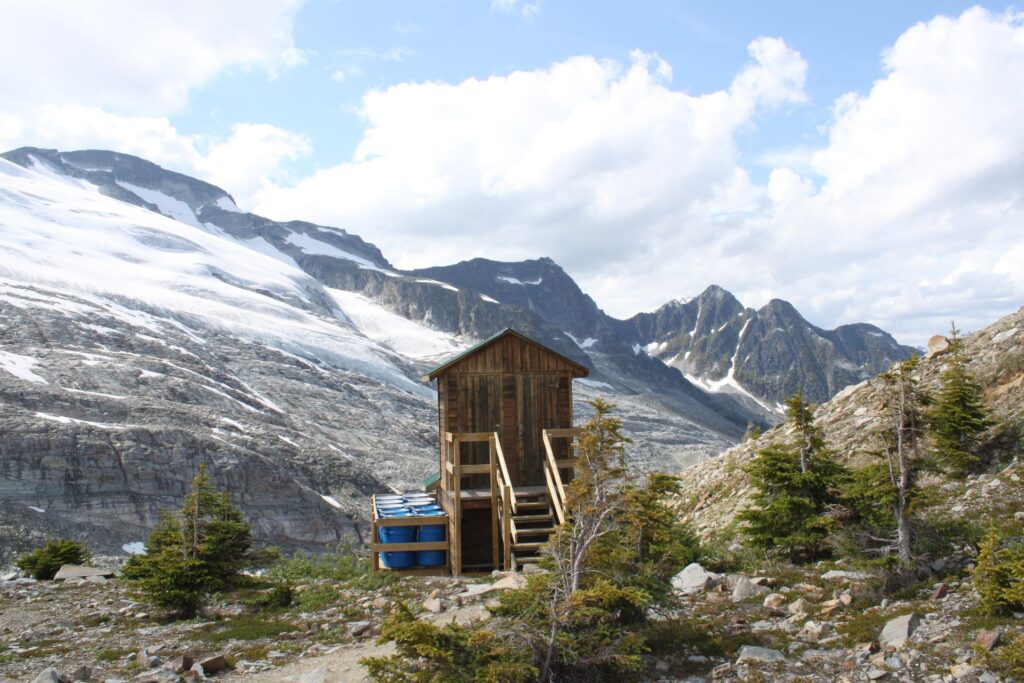
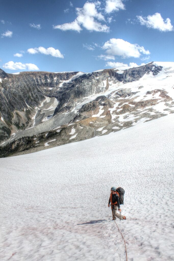
- Continuing to the Sapphire Col Hut.
- Accessed by crossing the glacier under the Jupiter Range.
- Alternatively, hiking to Abbot Pass, then west traversing the Jupiter Range (via Leda Peak, Mount Jupiter, and Castor Peak). The Sapphire Col Hut isn’t much to look at but is a memorable and scenic stop. A long but rewarding day would include continuing north to the parking lot over the Abbot Range (leading over The Dome, The Rampart, Mount Afton, Mount Abbot to reach the Lookout).
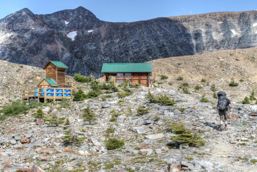
- Continuing to the Glacier Circle Cabin.
Where to Stay
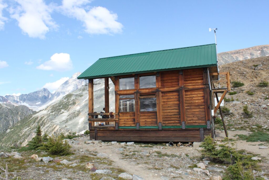
The A. O. Wheeler Hut is the most convenient place to stay in the area, but its ease of access (stones throw from summer parking) can make it a bit of a zoo, and hard to book on popular dates.
More difficult destinations include the Sapphire Col Hut, which is a 4-6 hour hike from Asulkan Cabin and the Glacier Circle Cabin (a solid trek across the Illcillewaet Glacier) found in the aptly named Glacier Circle. Wheeler, Asulkan, Glacier Circle, and Sapphire huts must all be booked through the Alpine Club of Canada‘s website or by calling their Canmore Office.
The nearest camping is the adjacent Illecillewaet Campground. Refer to Parks Canada’s rules if you are considering the possibility of an overnight bivi in the backcountry. There are no designated campgrounds once you are in the alpine, and camping may be restricted because of the delicate Grizzly bear habitat throughout the Parks.
Routes
What you need to know
Parks Canada requires:
- an entry pass that can be purchased at the entry gate.
- a back-country permit (or annual wilderness pass).
- Visiting the cabin during winter? Then you must have a Winter Permit from Parks Canada. They can be obtained at the Rogers Pass Discovery Centre, operated by Parks Canada. They have detailed records of snowfall and give you valuable information about closures and conditions you might expect when crossing the glacier.