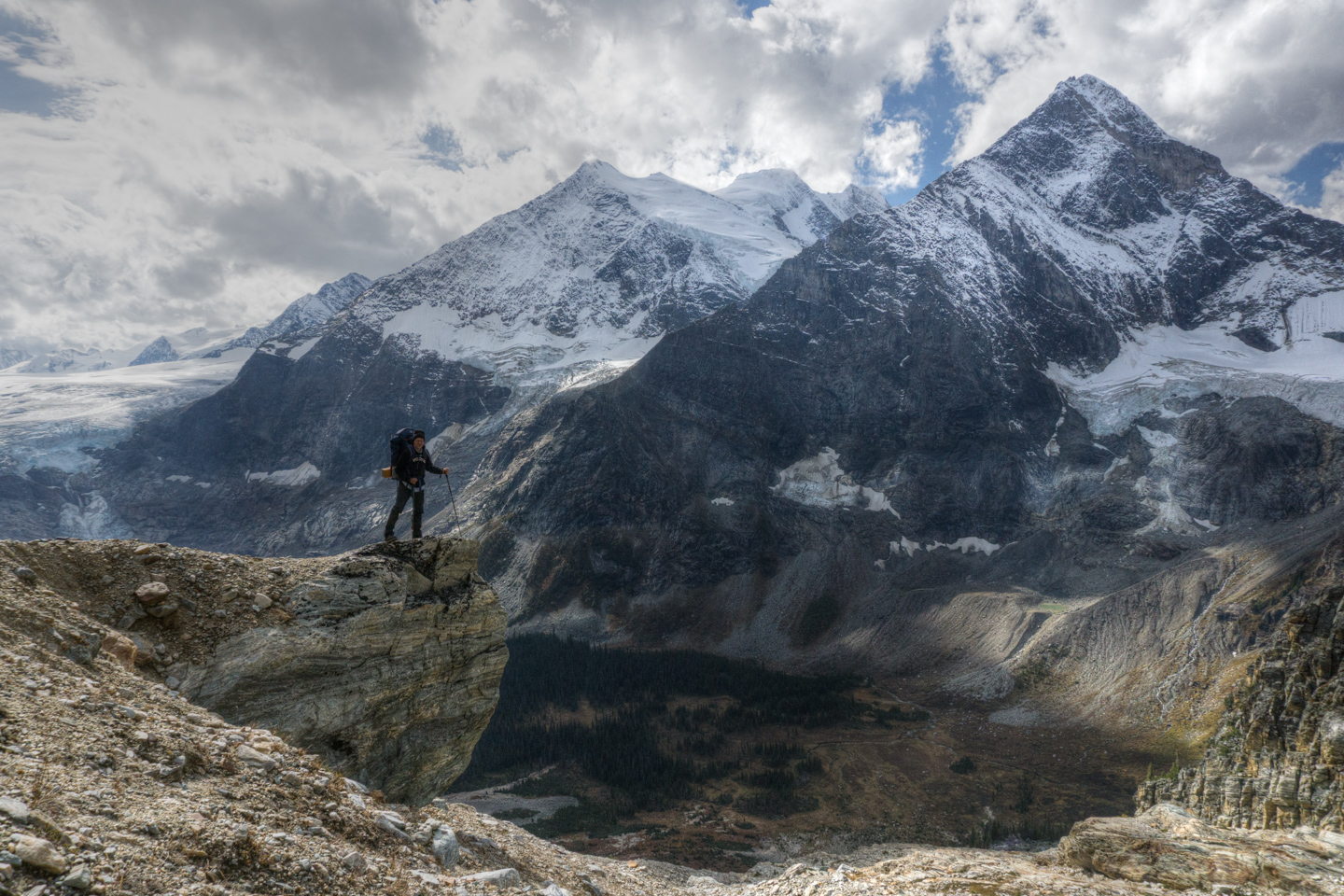
It may seem like a lot of work just to get to one little hut, but Glacier Circle is a veritable cornucopia of objectives, boasting numerous ridgeline scrambles that are all pretty much all low fifth class (5.0-5.5). From skiing to climbing, parties have spent weeks here without ever tapping a fraction of what you’ll have at your fingertips.
While an amazing playground, there is a reason that this hut gets visitors only 4-5 times a year. With a loaded pack, complete with trad gear and a week or two worth of food, the 16 km slog will feel more like 20 or 30. Since you are reading this, I’m going to assume you’ve already made up your mind, so I’ll refrain from trying to talk you out of it.
Stats
| Trailhead Altitude: | 1,250 m (4,101 ft) | Trail Length: | 15.7 km |
| Hut Altitude: | 1,800 m (5,906 ft) | Difficulty: | Class 4 |
| Net Altitude (Névé Summit): | 2,650 m (8,694 ft) | Map: | 82N/6 (Blaeberry) |
| Time to Hut: | 9-12 hours | Total Time: | 2 very long days return |
Trailhead
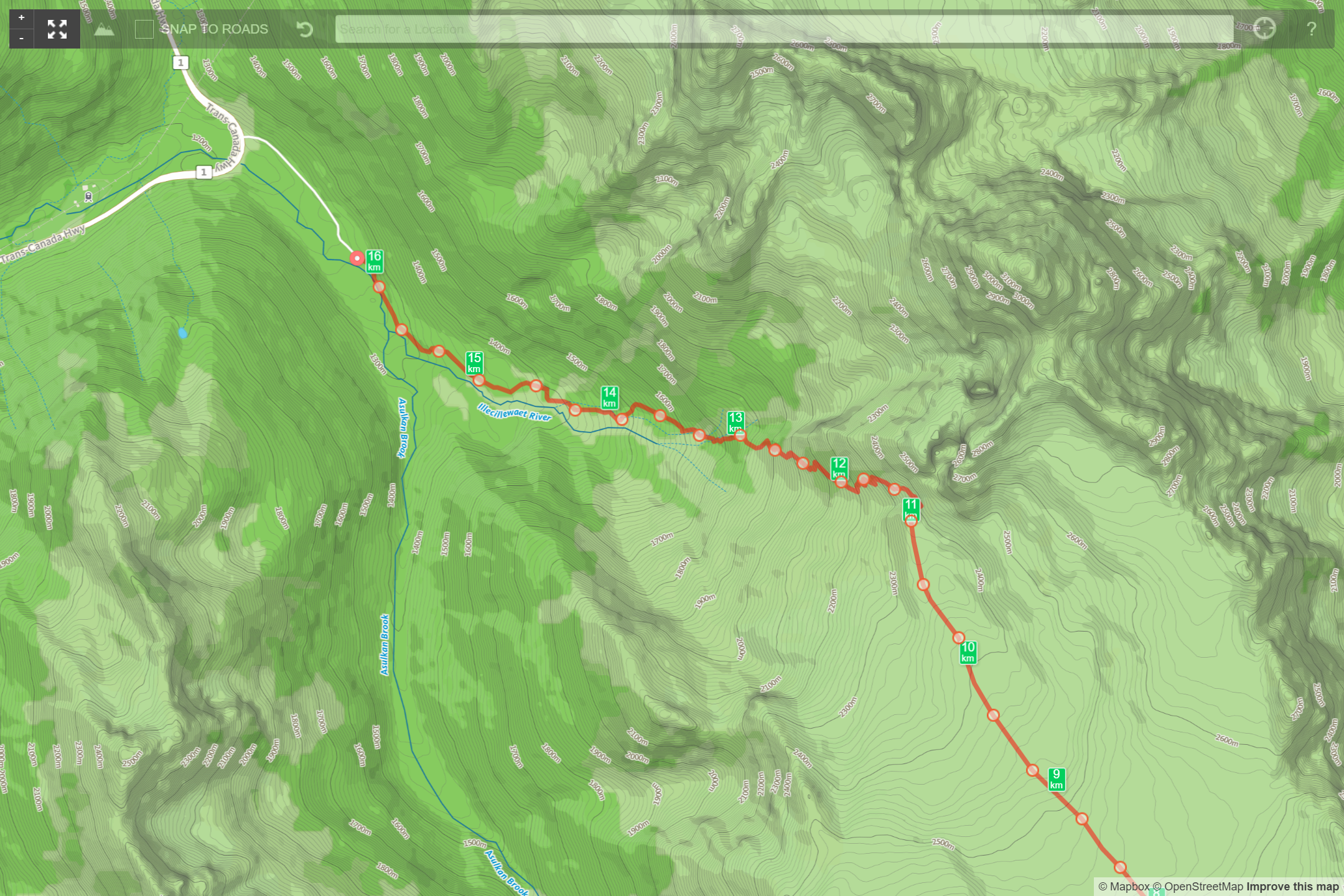
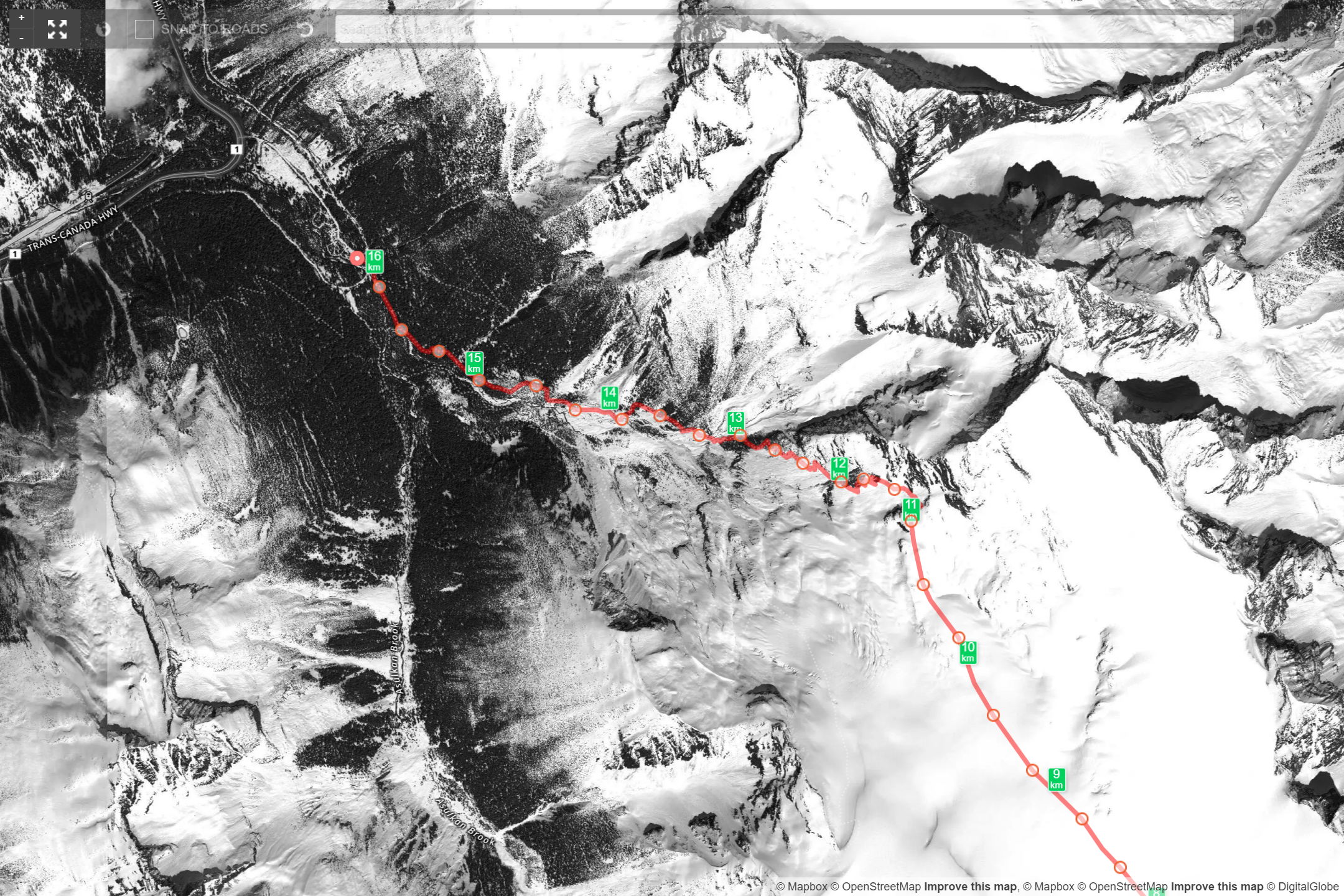
Pull into the Illecillewaet Campground, driving straight to the back, bypassing the campsites themselves. At the back, you will find a parking area used to reach the A. O. Wheeler Hut and hiking trails (full by 8 am on ideal days). Heading southeast, follow the old railroad access road up, away from the parking area. Once you reach the old rail alignment, you have 2 choices. Your first is the Perley Rock Trail directly in front of you, the second is along the old railbed. Follow it to the right for 150 m and turn left into an obvious opening in the trees where you’ll pass the remnants of Glacier House as the trail rises slowly into the forest. (Winter – Park at the Illecillewaet parking lot just off the highway. A parking permit that is obtained from the ACC is needed to park overnight during the winter.)
Gaining the Illcelieawaet Glacier
To gain the glacier, you have 2 obvious choices (both well documented and maintained tourist trails) from the Illcileaweat Campground Parking Lot:
The first is Great Glacier Trail which takes you on the south side of the glacial drainage. The official trail is very well maintained and ends where the lateral moraine meets a polished, red rock band (that looks like a large diameter, fossilized tree) that you can follow up most of the way ’till you decide to head over to the toe. This seems a bit more direct, and gives you the advantage of getting to the ice sooner, but also leaves you to cross the transverse crevasses and seracs at the toe of the glacier. If ice bridges are a significant danger then this is not the best route.
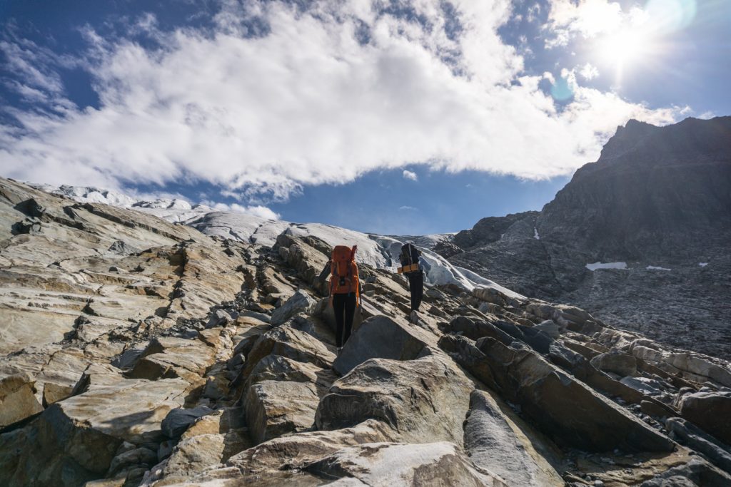
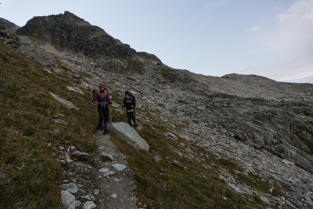
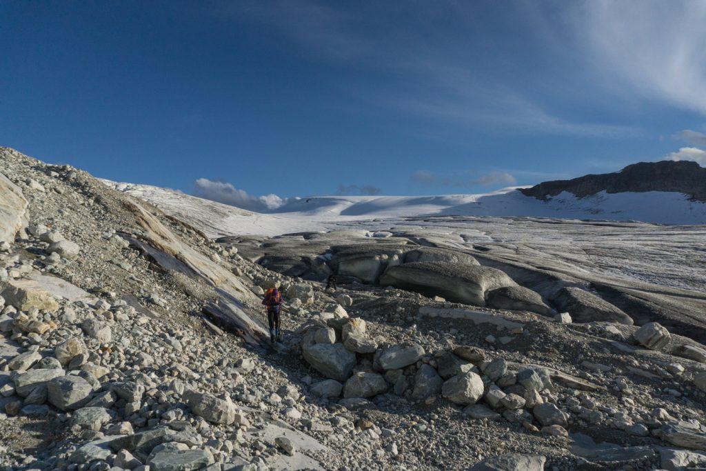
The second is the Perley Rock Trail that takes you along the north side of the glacier drainage and ends much higher near the glacial plateau. It is my preferred route because it gets you past most of the elevation while your feet are on solid ground. From this trail, you have 2 choices. First, when you reach the last set of switchbacks, just under Perley Rock, you can cut to your right, toward the glacier over the talus, or continue up to the end of the Perley Rock trail, and gain the glacier just past it (which is the route we took). Both options on this trail leave you just above the transverse crevasses above the crest of the glacier giving you good access to the highway in the center of the Névé.
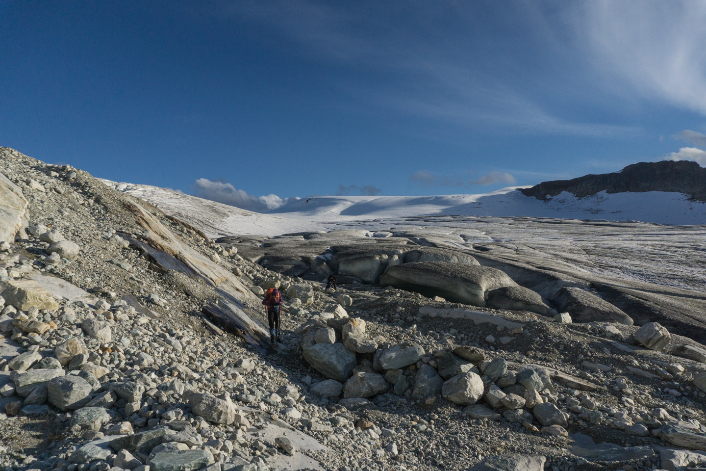
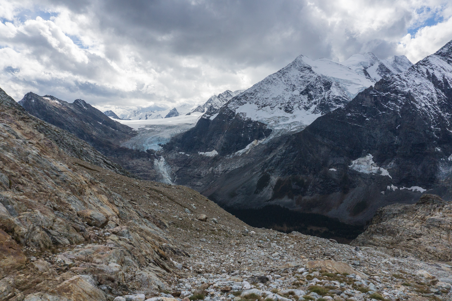
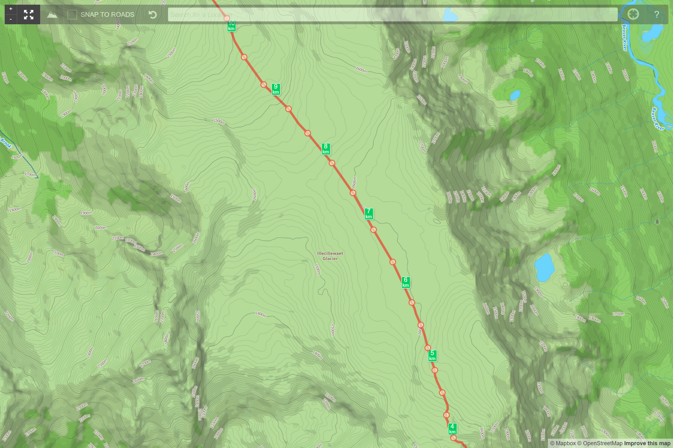
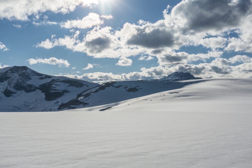
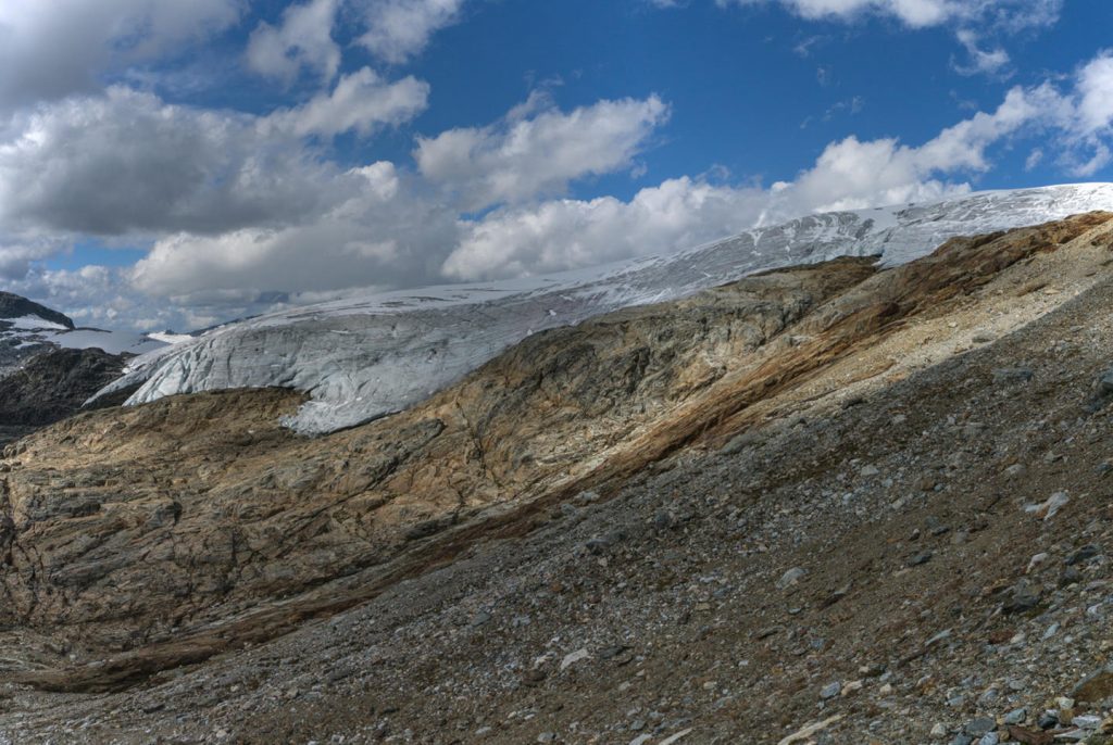
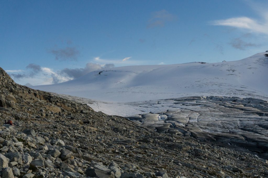
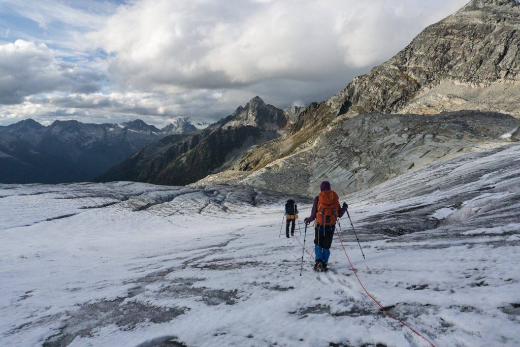
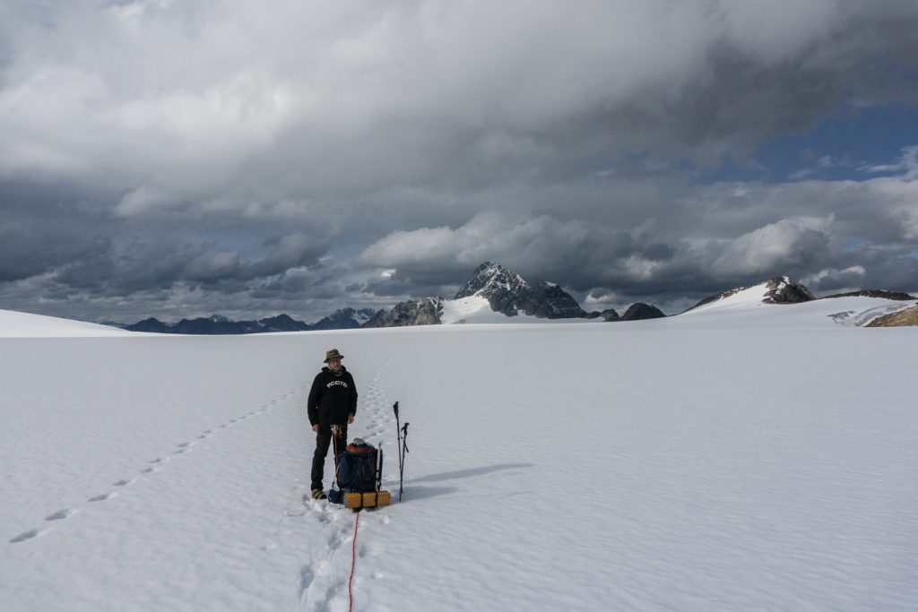
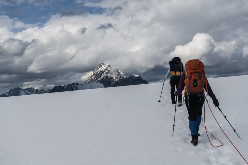
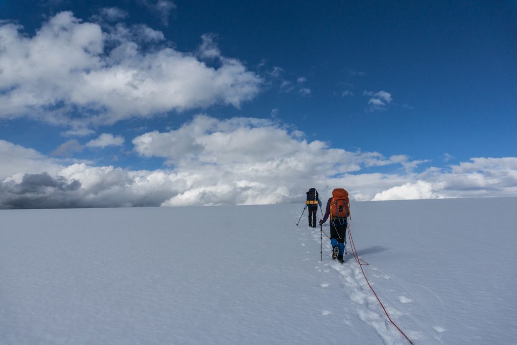
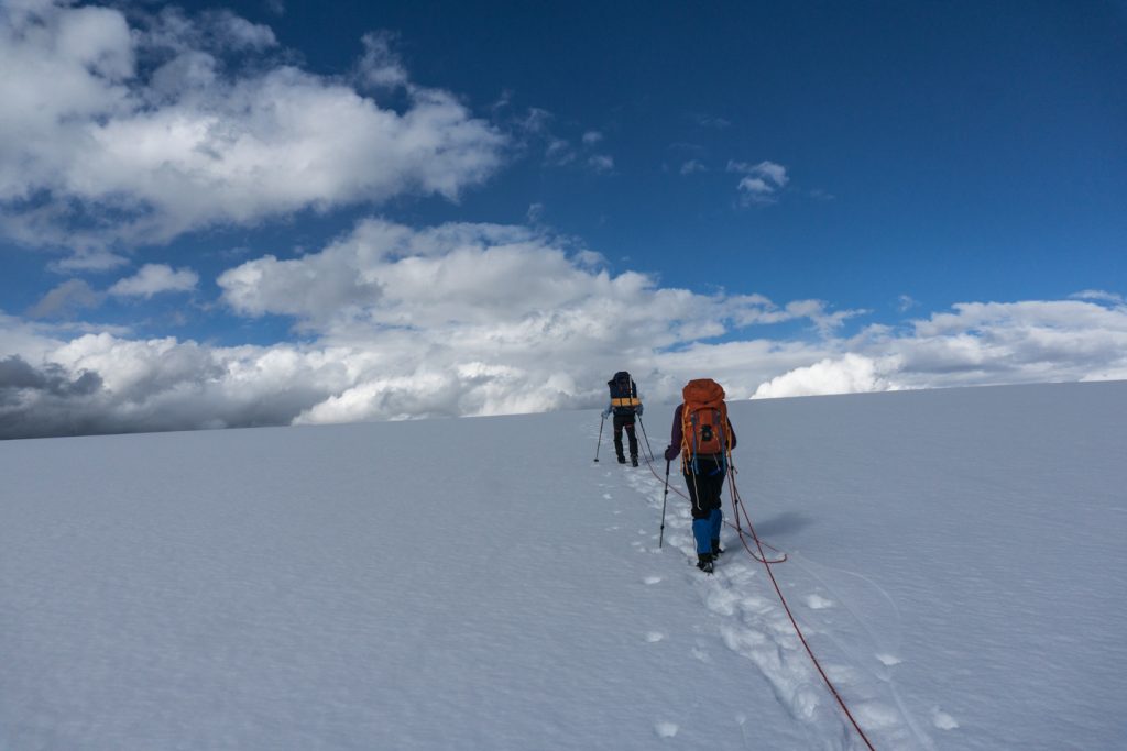
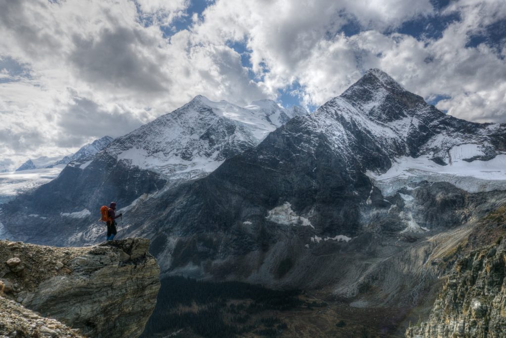
The Glacier
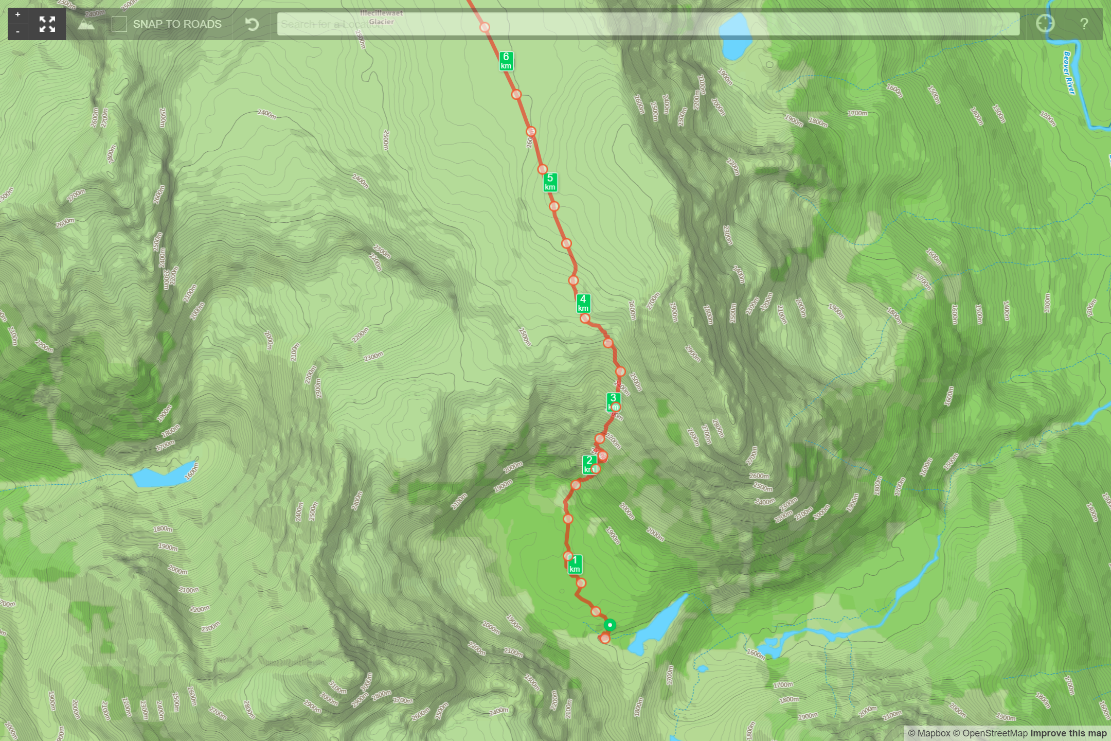
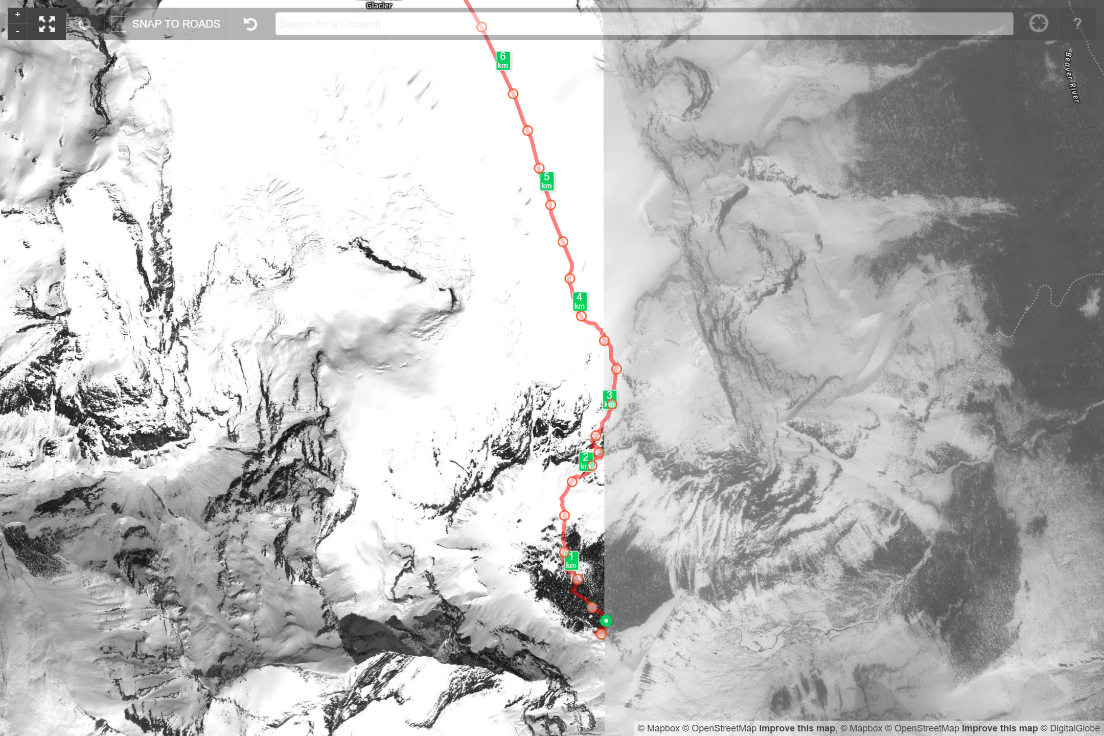
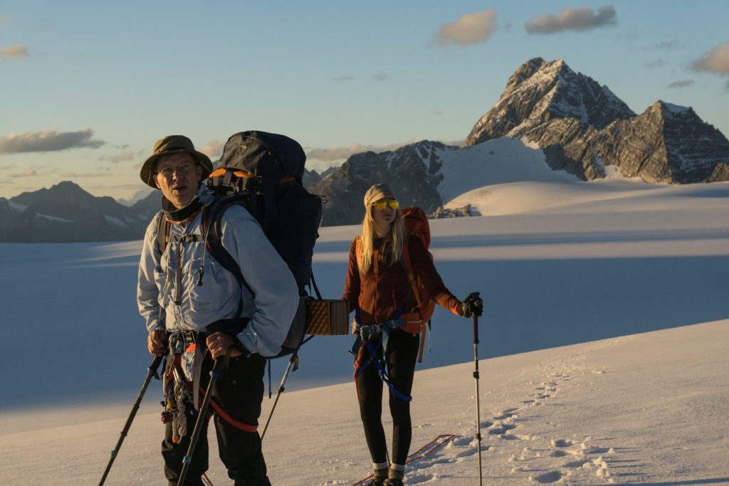
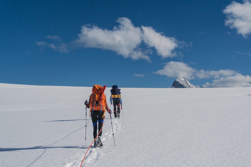
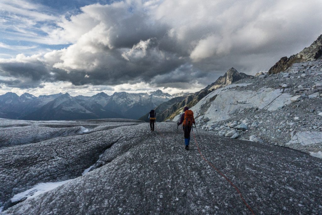
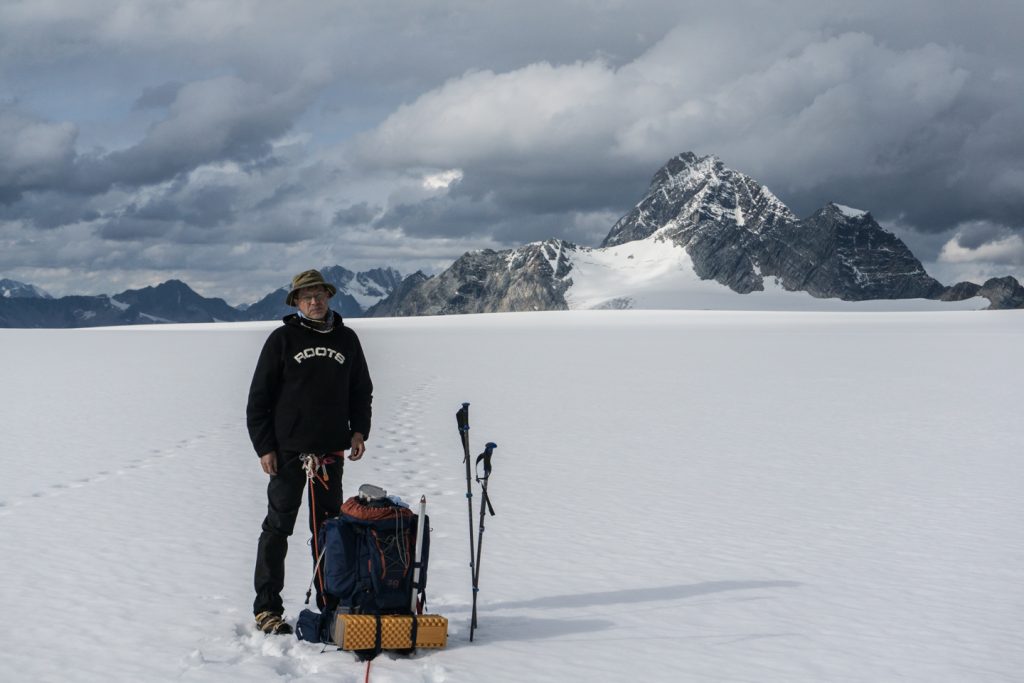
Once you have your feet on the ice, head toward the center of the Névé and then continue southeast along the center of the vast icefield. Keep a keen eye for kilometer markers (aluminum poles sticking out of the glacier), and use these as your guide, eventually heading almost straight south. At some point, Mount Macoun will begin to peek over the horizon – I used the summit as my target. If you don’t have visual, we took a bearing of 153° (give or take), but that will entirely depend on where you are on the glacier, so make sure you have a map and know how to get your own bearing.
As you draw near to Macoun (which will take forever), you will see the approach to Youngs Peak where you can find your way down to Asulkan Hut. If it is wintertime, the Seven Levels of heaven begin just to the south of Youngs Peak.
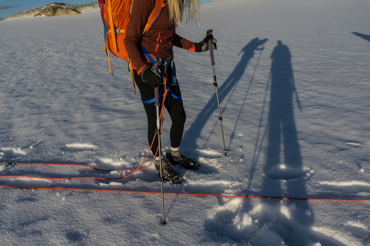
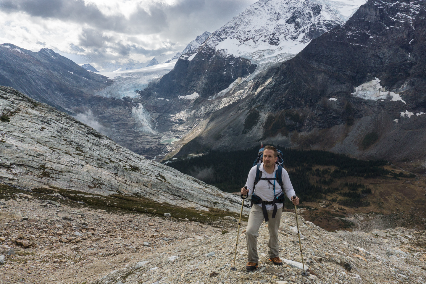
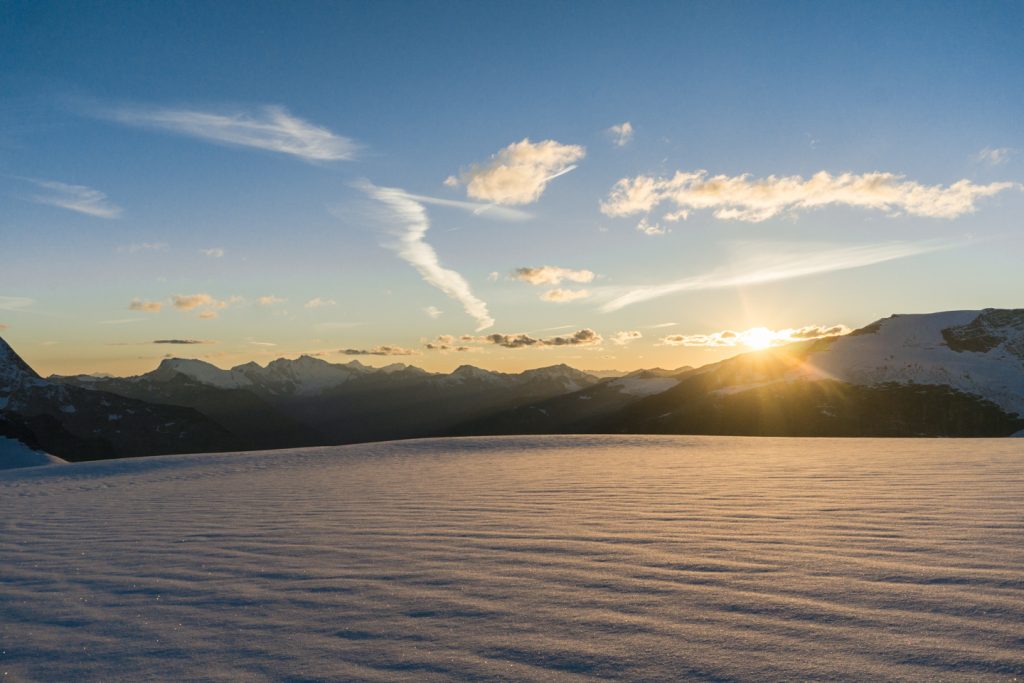
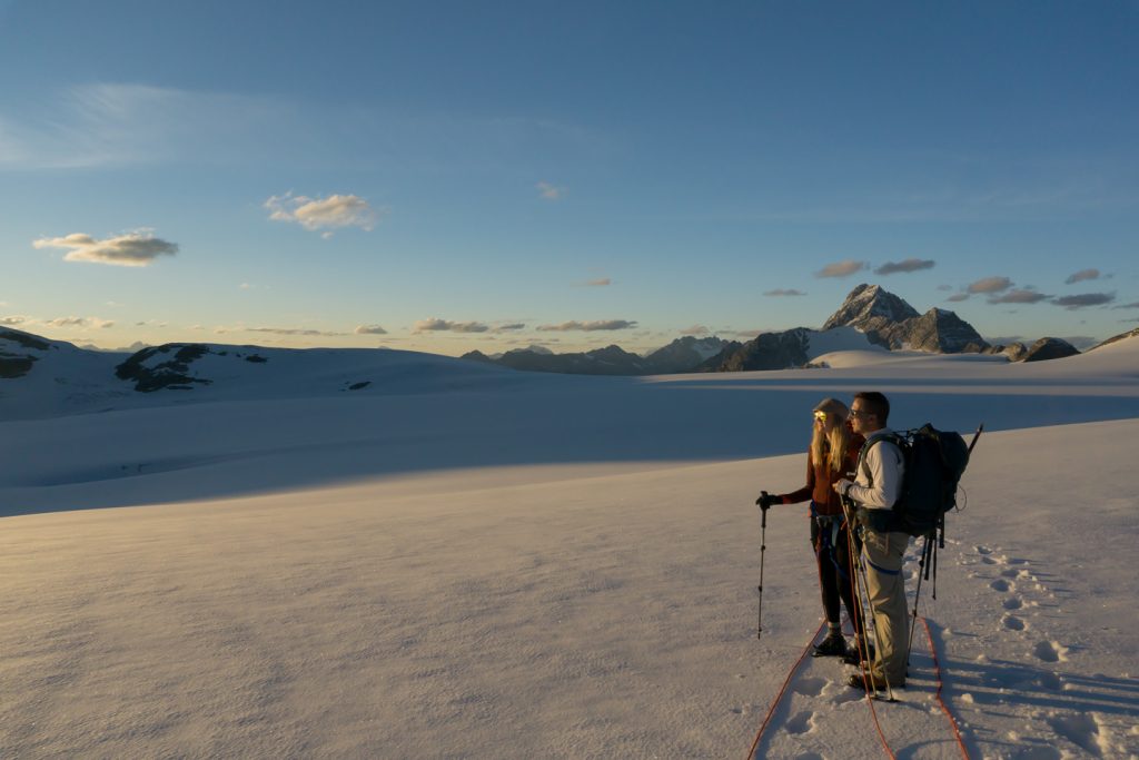
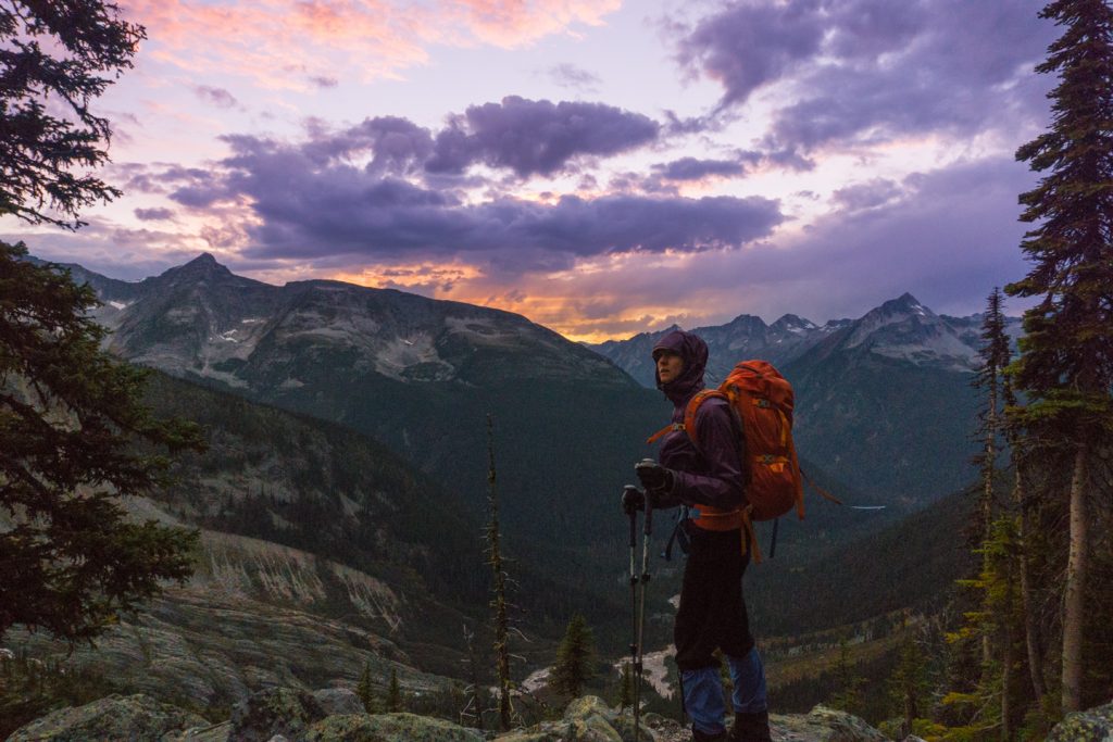
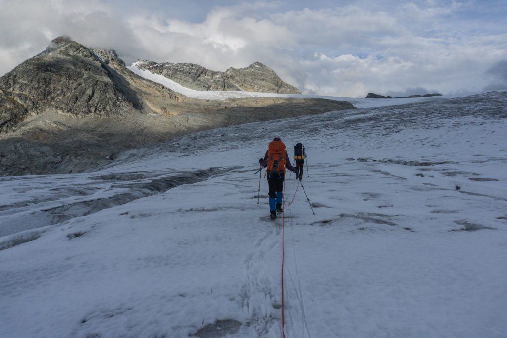
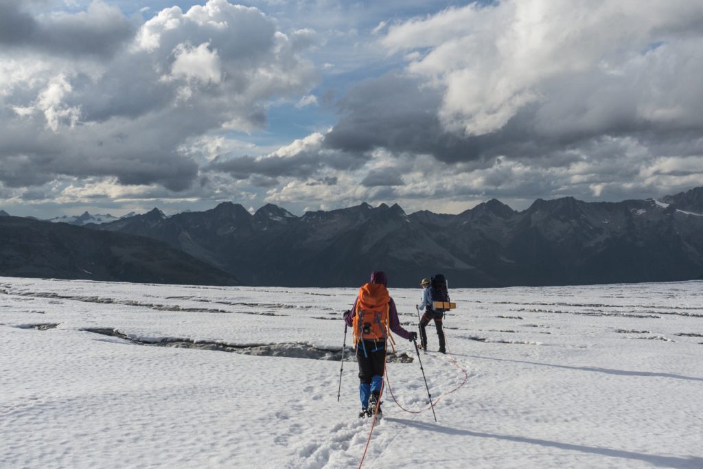
Your only real objective is to head east enough that you avoid the depression of the Geikie Glacier, which isn’t difficult if visibility is good. When you hit the highest point on the Névé, do a little dance, because you are about 1km from the end of the glacier. We were lucky enough (and unlucky enough) to arrive here at sunset. The light was spectacular, purple and yellow hues intermingled with exceptionally long shadows . Unfortunately, it made the next portion of our trip far harder than it should have been.

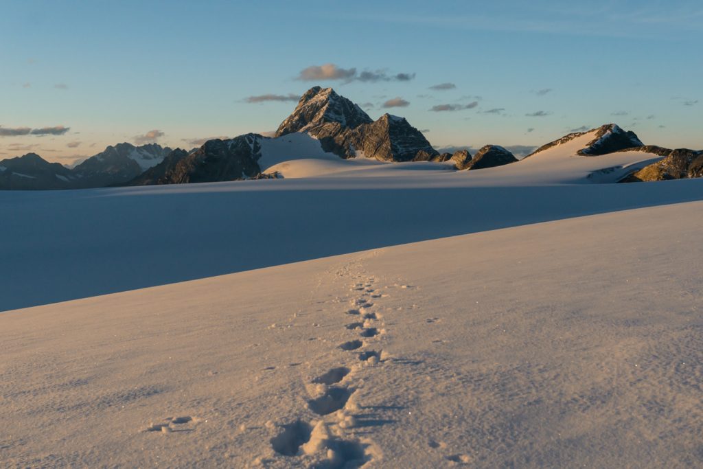
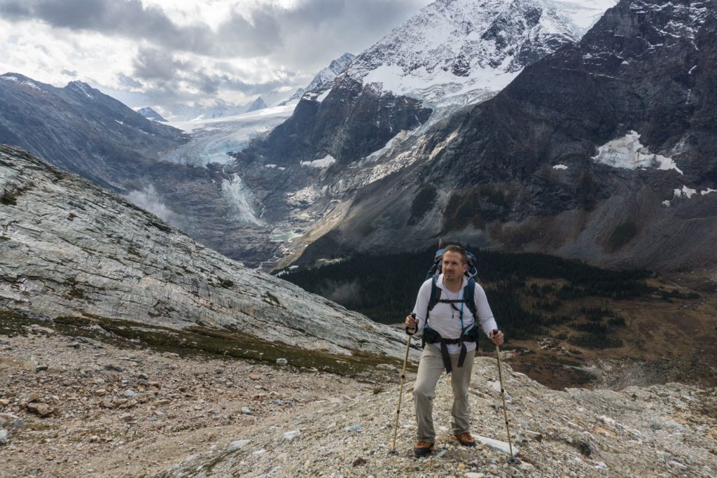
From the top of the Névé, start heading directly south aiming for the steep western side of Macoun. There were a few safe glacial basins to descend, leading us to our right for a short distance (avoiding the marginal crevasses), but then sharply to our left where the glacier met the rock on excellent terms. If you are too far to your right (100m west from Macoun), the toe and rock below gets unfriendly, and fast. Staying left against Macoun is an easy handrail to gain the moraine that will take you part of the way down.
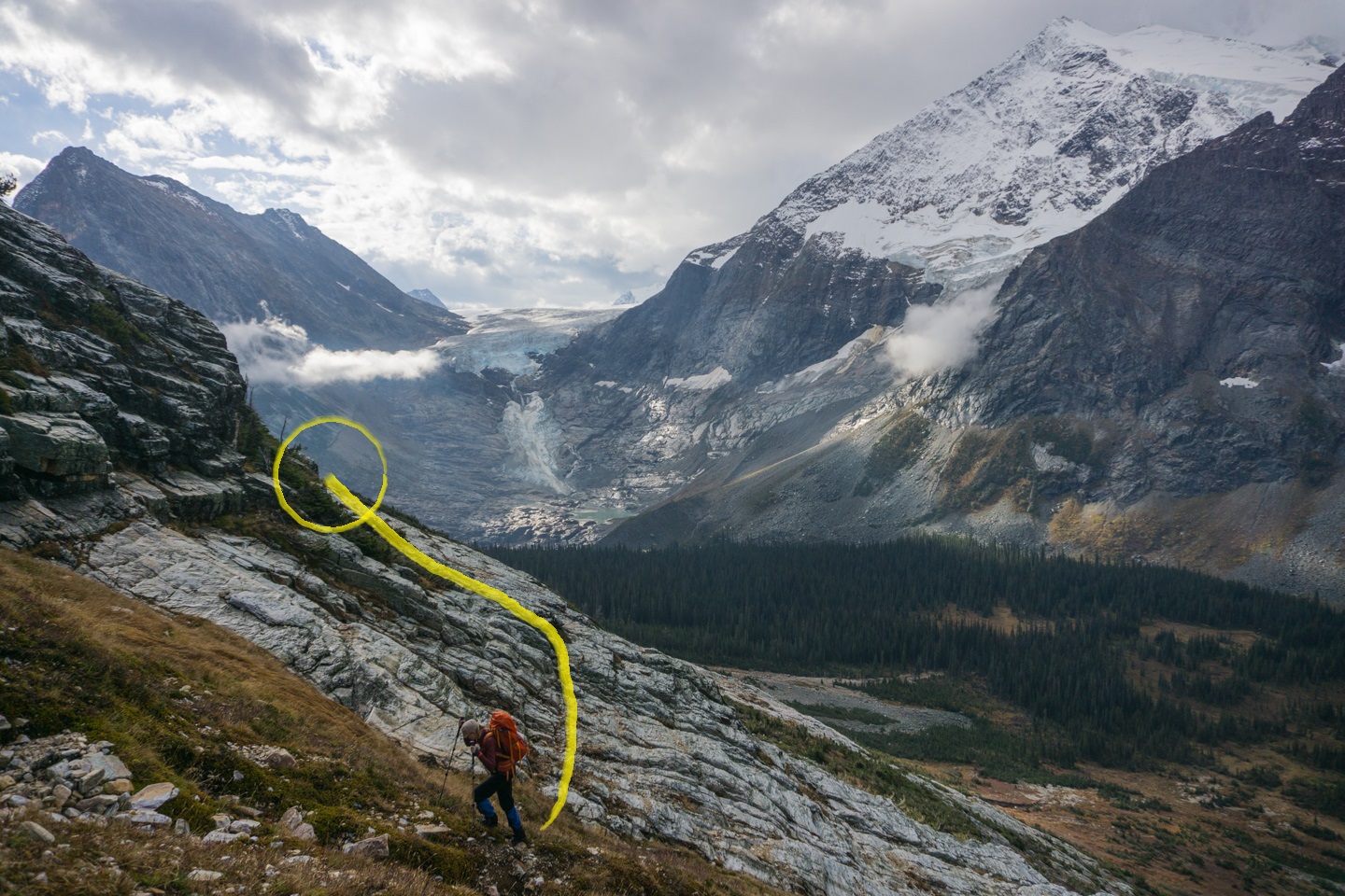
Descending into Glacier Circle
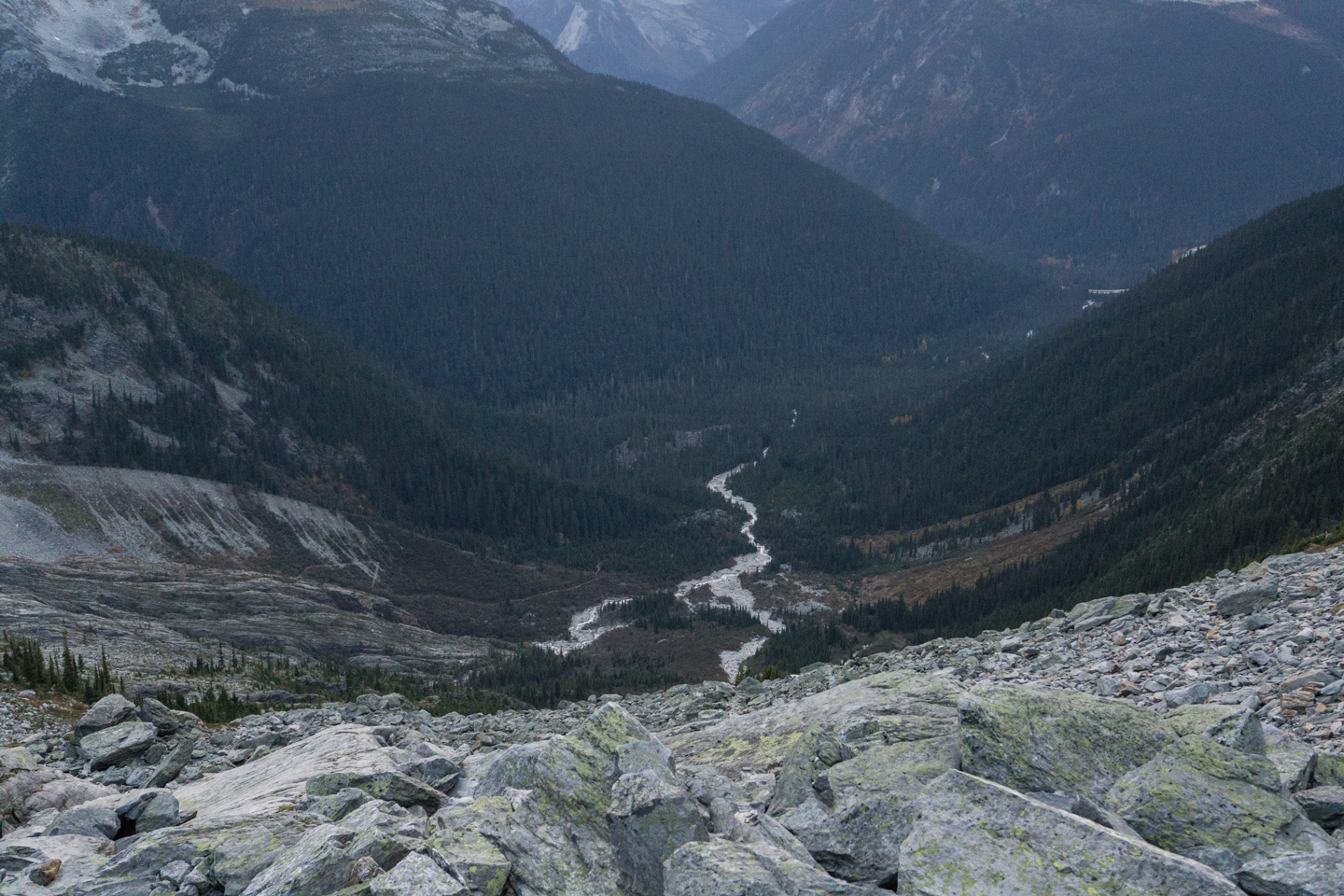
Once off the glacier, contour down to your left and scamper down to a moraine that breaks away almost perpendicular from the west slopes of Macoun before turning abruptly to the south and heading down into Glacier Circle.
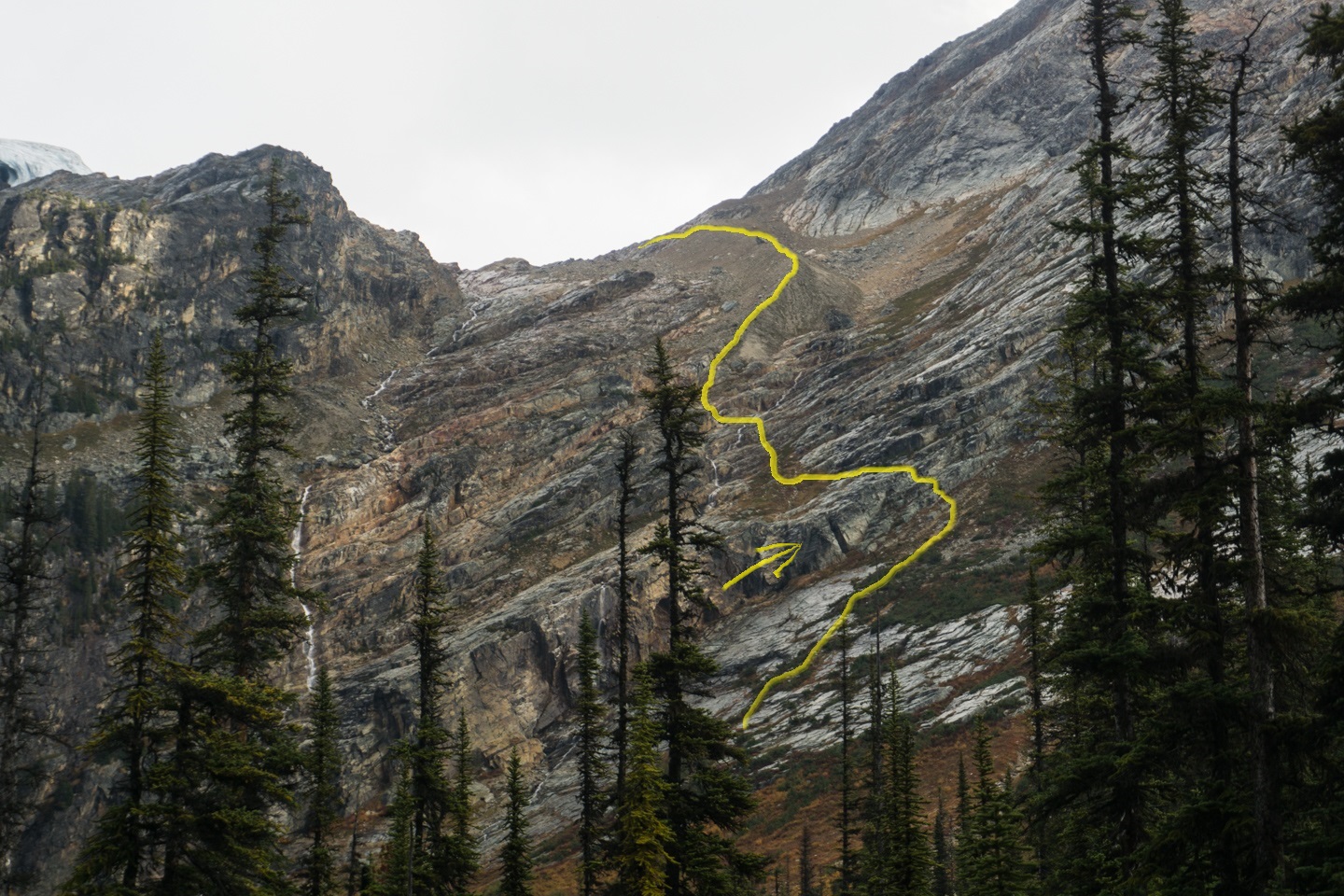
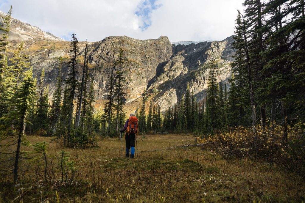
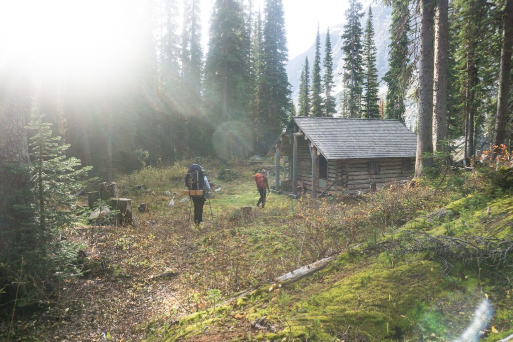
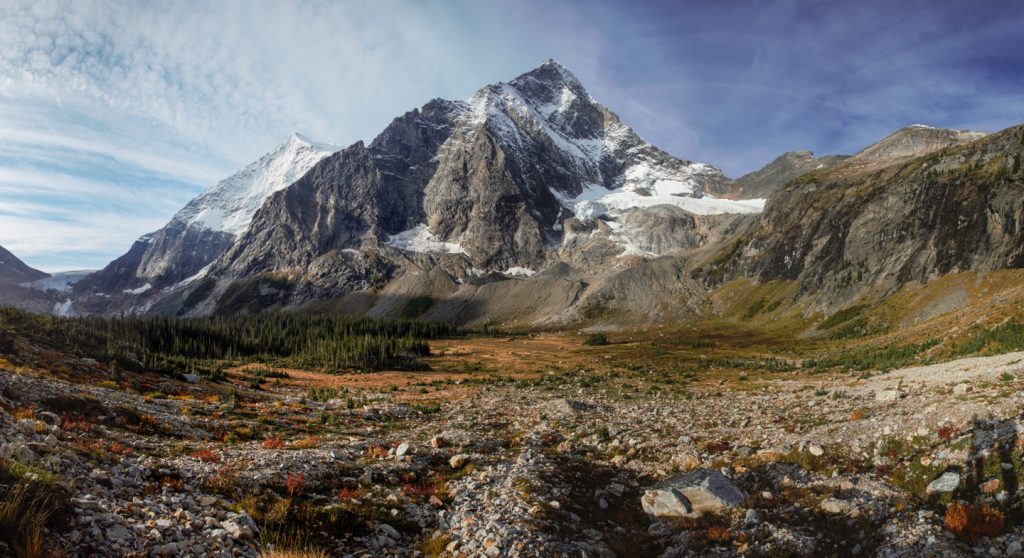
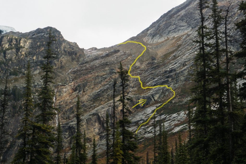
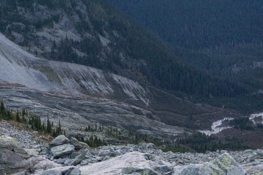
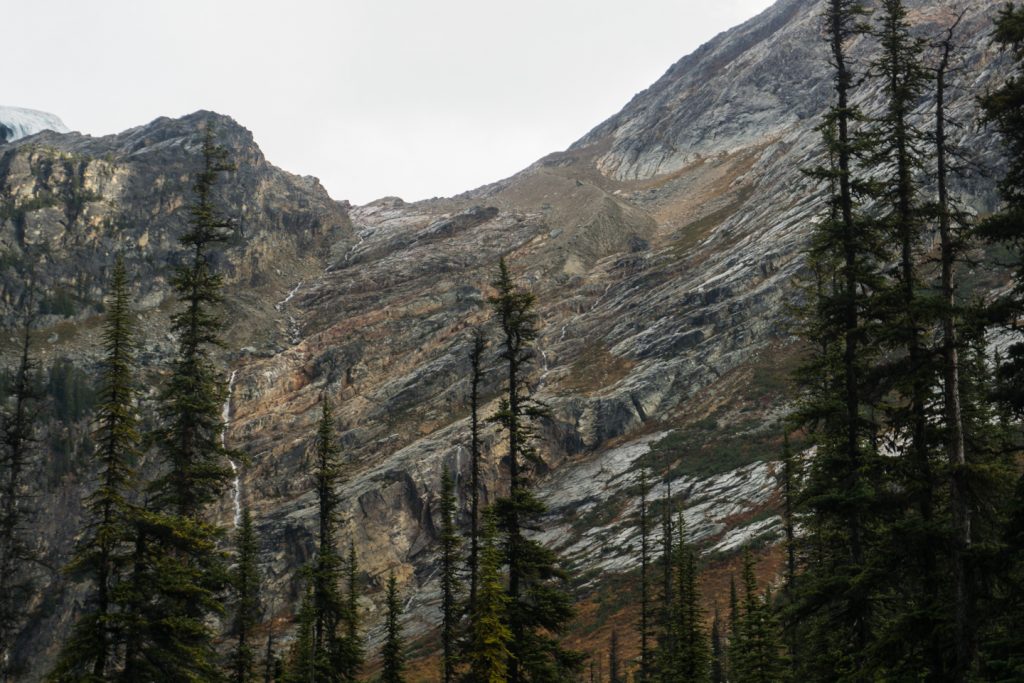
If visibility into Glacier Circle is good at this point, stop here and take a mental note: there have been countless parties that spent far too long wandering that tiny little patch of trees below you, trying to find the hut. Save yourself some grief and use this photo as a reference (or better, the GPS track). The hut is further to your left than you think. Just above the south end of the trees, you should be able to see a lake below the talus under the Deville Glacier.The hut is JUST to the right of that lake in the trees. If the lighting is right, you can see the tin roof of the outhouse reflecting through the far edge of the trees. Now, look in the center of Glacier Circle, where there is a large clearing.
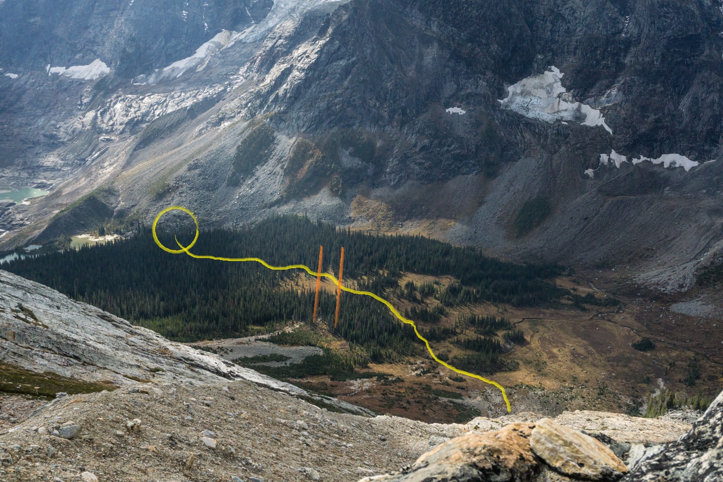
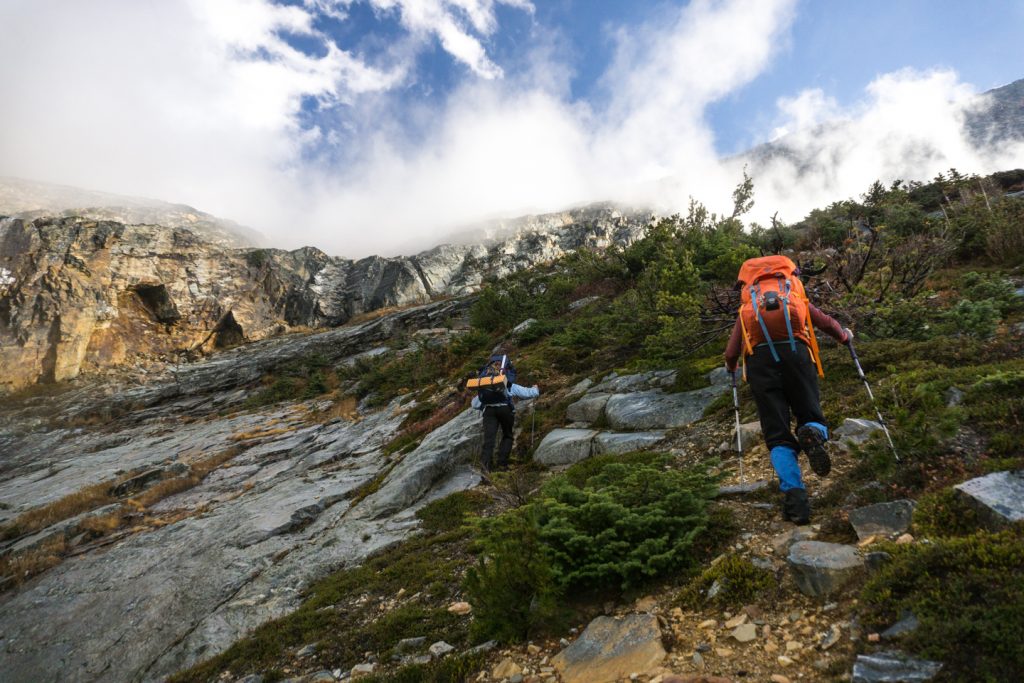
From that clearing, there is a marsh that cuts into the trees in a distinct line heading Southwest (away from you). The trail to the hut CROSSES that jutting marsh at the edge of the clearing. Get yourself to that point, and you’ll find a cairn on the left side, and the trail to the hut. Or feel free to wander the bush like we did, your choice.
The moraine bottom dumped us into a rocky maze. In daylight, this is a fun little jaunt, but in total darkness, devoid of the moon, it left us wandering more than we had hoped. As this is the end of the day, the chances of reaching this rocky mess in the dark are pretty high, so do yourself a favour and get an alpine start to this trail. We ended up bivvying on a rocky ledge, thankfully on a clear, warm fall night. With the aid of copious amounts of down, fleece and thermal underwear, we were able to get a decent nights sleep and awaken to the blue and orange hues of a breathtaking mountain sunrise. In the daylight, our path became quite clear, and we only had to backtrack a few times to find our way down.
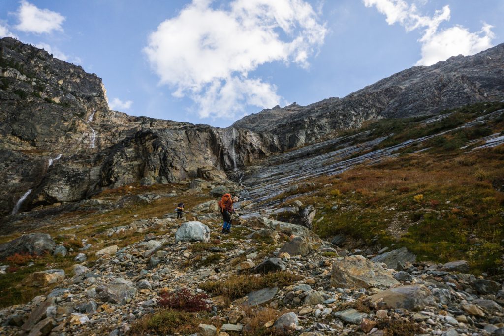
The Rocky Maze
From the bottom of the moraine, continue directly down, looking for cairn’s (that were non-existent on our decent, likely due to avalanches and rockslides that must keep the rock pretty tidy). Somewhere below the moraine, you’ll find a few suitable places to cross the drainage on your left. Once across, continue left (you’ll cliff out if you go too far down). You will know you’ve found the right spot when you can handrail below an outcrop of rock on your left, and rock sloping down on your on your right.
Once at the edge, you can see a short fourth class route to the runout below. Once down, head down the most suitable route to the scree below. As you lose elevation, look over your right shoulder for a large triangular slab that has broken away from the cliffs just below the 4th class route. This rock serves as a strong landmark for reference on your way out.
Find your way to the left (south) at the bottom of the scree and follow the landmarks you eyed up when up at the moraine, generally through the marshy openings almost directly south. Once you are at the last clearing, look for the cairn and follow the trail to your left. It will seem like you are going too far east, but trust me on this one. When you find the trail, it is easier than bashing around in the trees. Once on the trail, follow it till you see the hut, about 20 minutes.
Heading back, you are pretty safe retracing your steps unless visibility was/is less than desirable. If so, use the large triangular block as your landmark. About 20m above the rock, you’ll find the class 4 route carrying you up the rock band. Navigate the rocky maze, catch the moraine to the glacier, and you’re on your way. Once on the glacier, Mount Sir Donald (or your footprints) will act as your guide, much like Mount Macoun did on your way in.
What to do once you arrive
I can’t even begin to describe what can be done from this hut. Rather than try and write about 100+ options (pick your poison: rock and ice climbing, backcountry skiing, peak bagging, and the Bugaboo-Rogers Pass Traverse are just the beginning), I’m just going to tell you to find a guide book at the library or online.
Where to stay
The A. O. Wheeler Hut is the most convenient place to stay in the area, but its ease of access (a stone’s throw from summer parking) can make it a bit of a zoo, and hard to book on popular dates. The Asulkan Cabin is another target that is easy to reach (except for elevation gain) in a 4-6 hour hike.
More difficult destinations include the Sapphire Col Hut, which is a 4-6 hour hike from Asulkan Cabin. Wheeler, Asulkan, Glacier Circle, and Sapphire huts must all be booked through the Alpine Club of Canada‘s website or by calling their Canmore Office.
The nearest camping is the adjacent Illecillewaet Campground. Refer to Parks Canada’s rules if you are considering the possibility of an overnight bivvy in the backcountry. There are no designated campgrounds once you are in the alpine, and camping may be restricted because of the delicate Grizzly bear habitat throughout the Parks.
Routes
Download the route to Glacier Circle Cabin – GPX

What you need to know
Parks Canada requires:
- an entry pass that can be purchased at the entry gate.
- a back-country permit (or annual wilderness pass).
- Visiting the cabin during winter? Then you must have a Winter Permit from Parks Canada. They have an intensive avalanche control program that uses heavy artillery to release at risk slopes.
I also recommend you stop by the Rogers Pass Discovery Centre, operated by Parks Canada. They have detailed records of snowfall and can give you valuable information about the conditions you might expect when crossing the glacier.
Pictures


Comments 6
Awesome account of an impressive tour! Would love to tackle this someday.
Pingback: Asulkan Cabin | GotMountains
GPX track link is dead. Any chance for a repost?
Hi there, for some reason I can’t access the gpx files. Could you possibly share them over email?
Author
Yeah, Google Drive broke how their links work so I have to make them downloadable from the site itself. Do you want me to email you the one you need?
Hi Eric. I love your website. Please can you email me the gpx file too. Thanks!!!