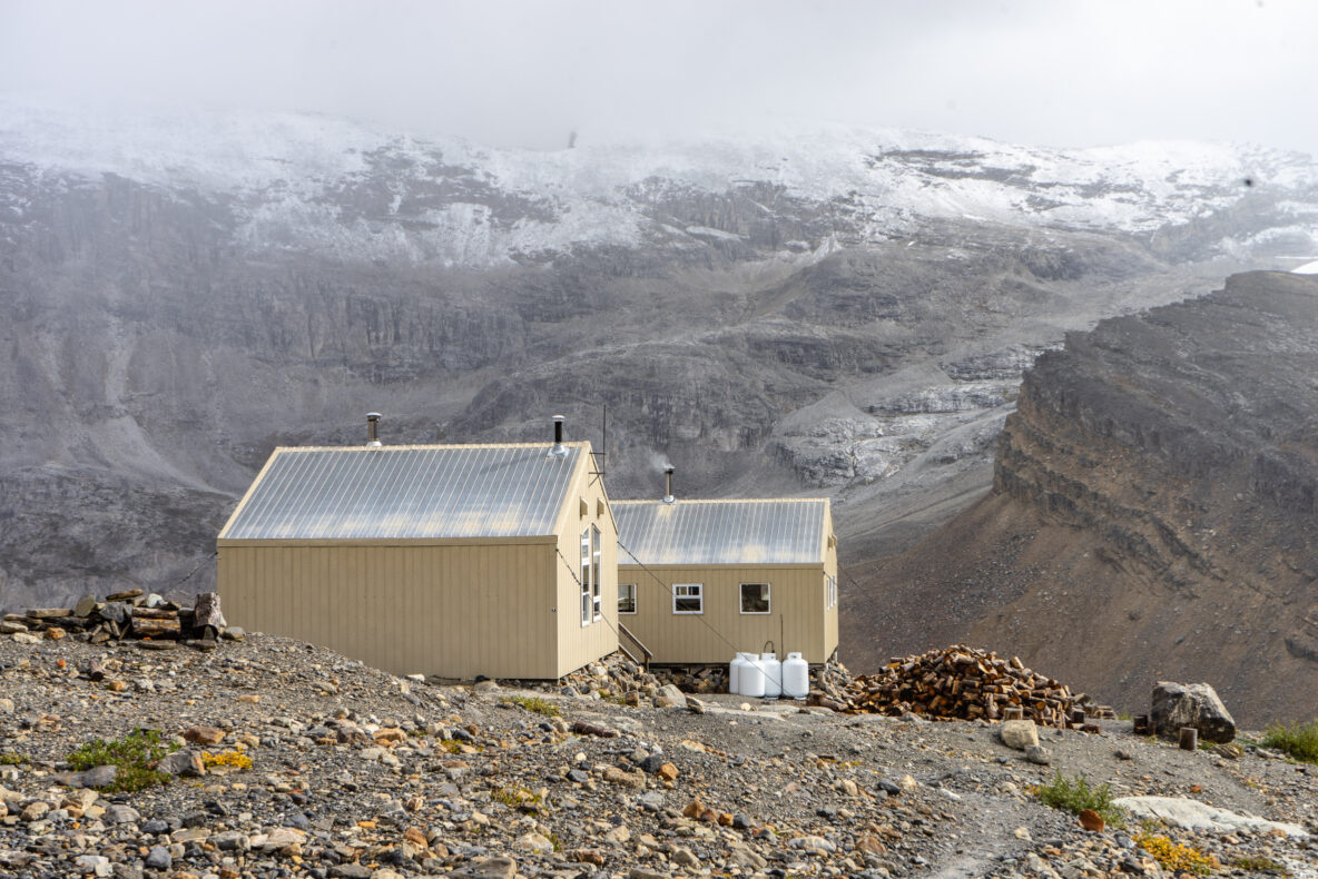
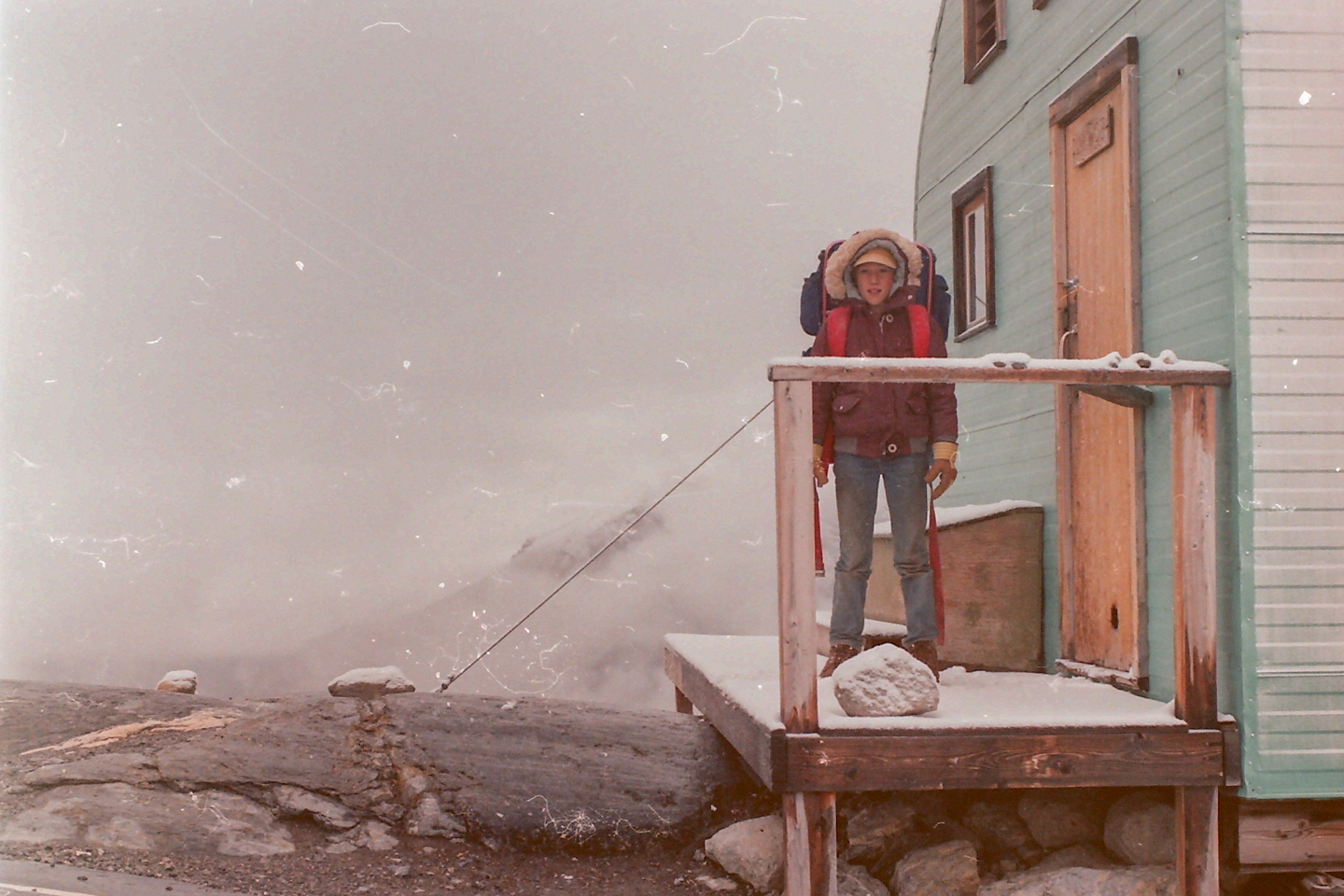
I have mixed feelings about the Bow Hut. I think I was 12 when I first visited the well used (read: abused) metal-clad ramshackle blue-box that once stood under the guard of St Nicholas. Today, you’ll find a large multi-building compound that sleeps and feeds up to 32 in the summer. Being just a few hours from the highway, the ease of access has always been the “hate” part of our love-hate relationship. It is often uncomfortably full – and that’s why I lovingly refer to it as the ACC Zoo.
Oddly, I’ve only ever visited the hut when it is empty or packed full. My most recent visit was punctuated with -30°C temperatures during the day leaving the inside of the hut at about -20°C when we arrived at 7pm. Being the only occupants that night (a blessing) it took until the next morning before the extents of the room rose above the freezing point. Needless to say, this is a great hut with a myriad of objectives.
Bow hut also plays a part in two greater traverses. The larger Wapta Traverse (see objectives, below) stretches from Peyto hut to the Scott-Duncan Hut. While Bow Hut is a stop along the larger route, many skip Peyto Hut altogether making Bow their first stop. The smaller Bow-Yoho Traverse stretches from Bow Hut (or Peyto Hut as an alternative) stopping at the Louise and Richard Guy Hut, then to the Stanley Mitchell Hut.
,
Stats
| Trailhead Altitude: | 1,920 m (6299 ft) | Trail Length: | 6.89 km |
| Hut Altitude: | 2,350 m (7710 ft) | Difficulty: | Class 2-3 |
| Net Altitude: | 430 m (1410 ft) | Map: | 82N/9 (Hector Lake) |
| Time to Hut: | 3-6 hours |
Trailhead
Bow lake is the most convenient starting point for this trail, although it is approached from Peyto Hut as a stop along the Wapta Traverse (and less commonly from the remote Balfour Hut). Unless you have a hobby collecting parking tickets, be sure not to park up by the lodge. Instead, park in the lot near the highway or near the battery of outhouses as you near the lake.
To gain the trail, parade yourself past the hordes of tourists wandering around the lodge heading toward the lake. Look for a pronounced trail skirting the north side of the lake.
The Trail

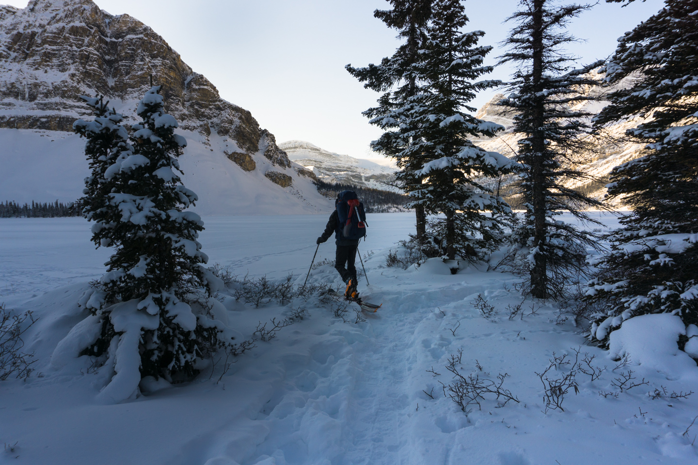
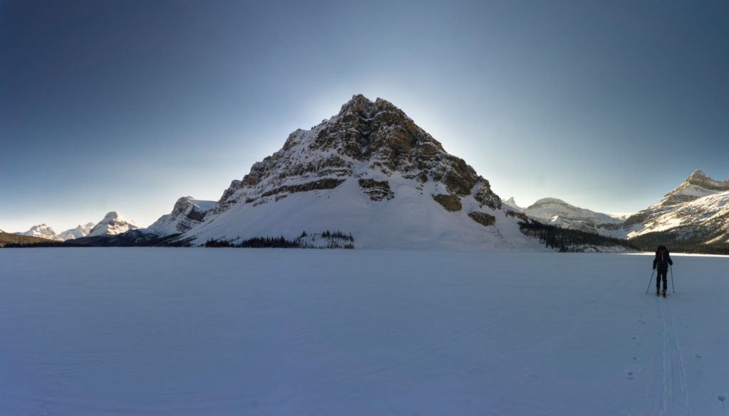
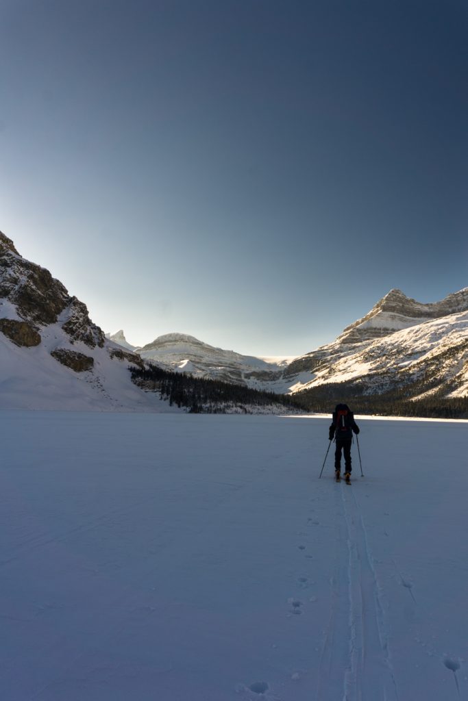
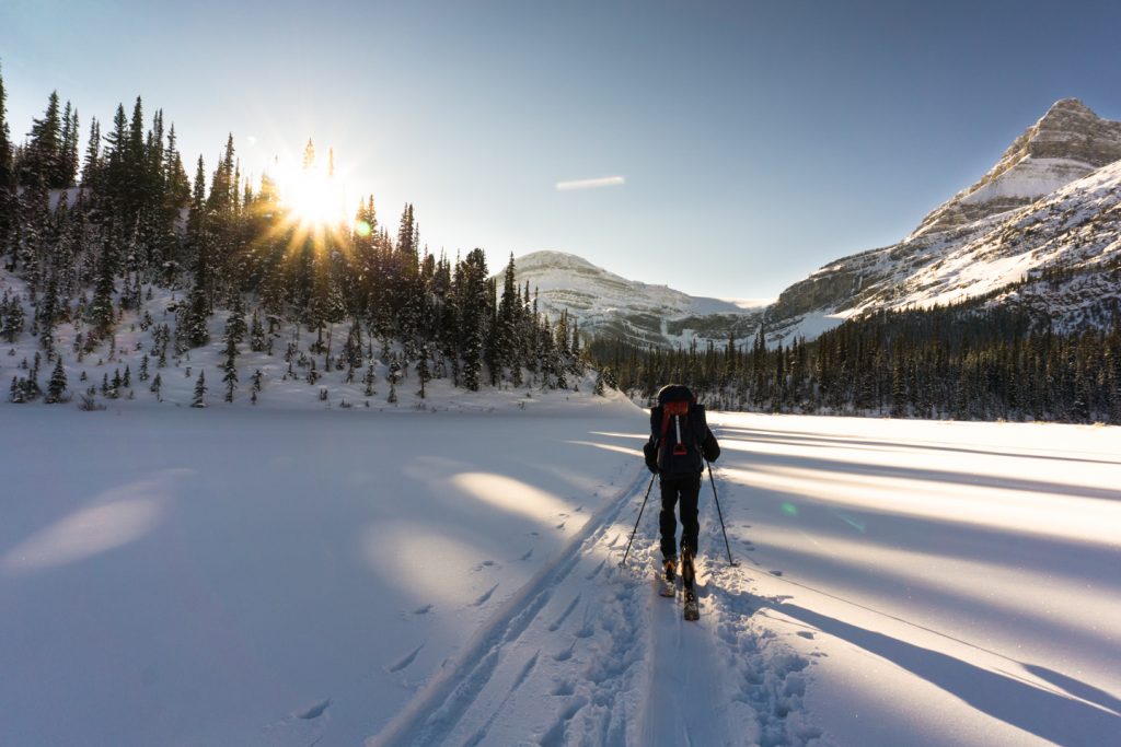
Winter Approach – Provided the ice is safe for travel, ski across the lake heading (west) to the back of Bow Lake. Follow the moraine as far as you can. When the canyon narrows, you will climb left, running above and parallel to the canyon. The trail gains and loses a bit of elevation before it crosses a few exposed avalanche paths and drops back into the open onto the creek bed. Turning left, follow the base of the narrow canyon. In transition season, the ice and snow on the creek might not hold your weight, so tread carefully so you can keep enjoying dry socks.
Keep in mind that this can be a pretty precarious terrain trap as everything above you funnels down into this canyon. Keep your wits about you and hold your bladder till you are well above the creek.
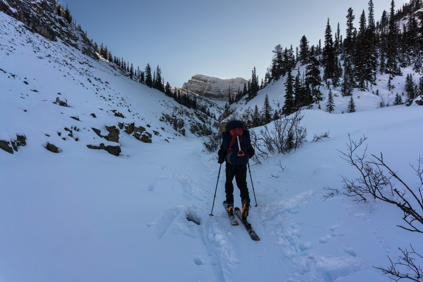
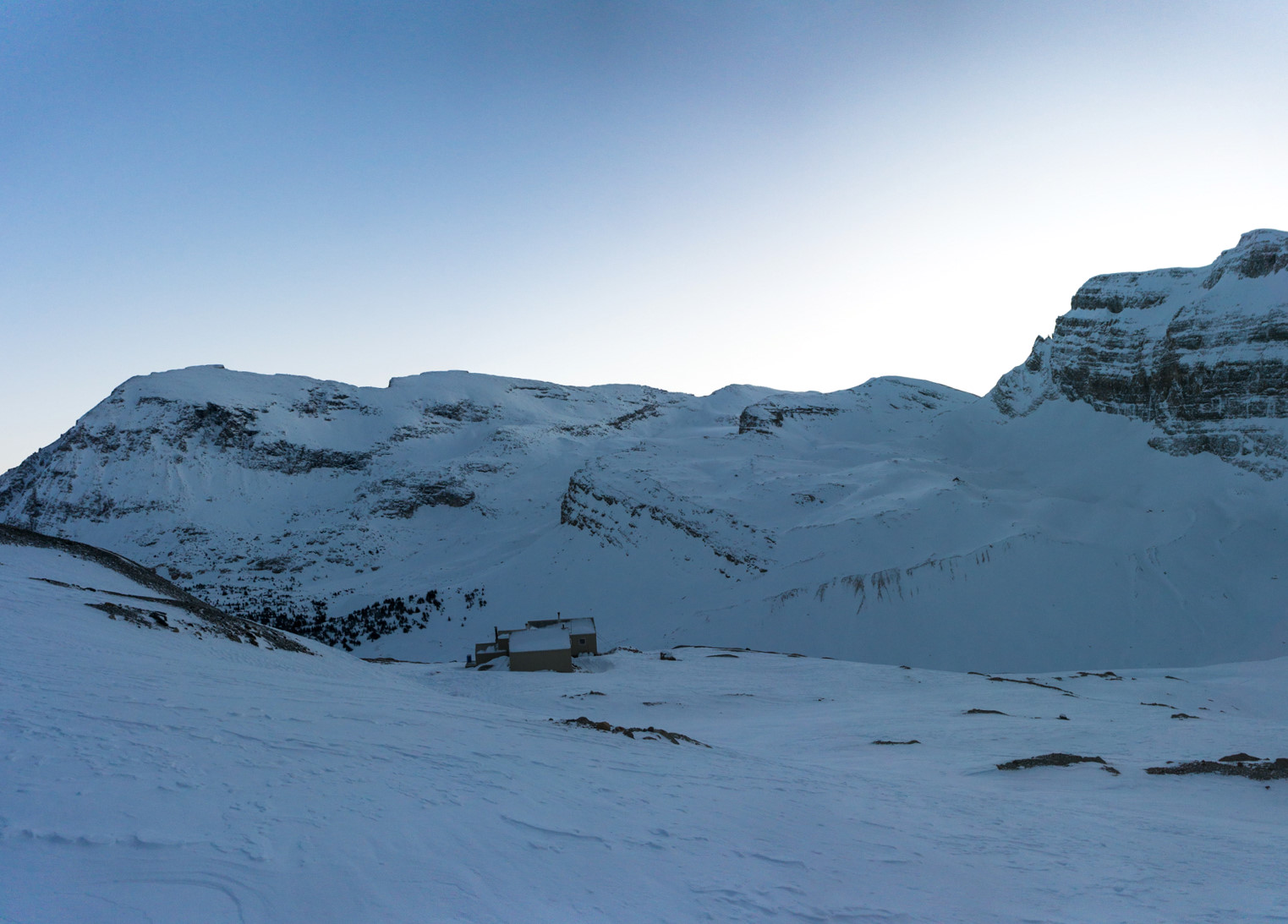
About one kilometer in, you will taper up to your left to exit the canyon. If you happen to miss this turn, you can exit the canyon further up, but it is a bit of a scramble up and out, usually involving removing your skis and wading the wrong way through pillows of snow on rock. If you took the smart path, you will continue to rise until you come out of the trees into a wide basin. You should be able to see the hut up to your right trying to blend into a rocky ledge that slopes left, down into the basin.
There isn’t a ‘right’ way to cross this basin as it has varied aspects which can hold varied risks, so pick your path carefully toward the headwall at the south. Most times, the trail will contour around the basin from left to right, meeting the steep headwall where the hut ledge slopes down into the basin. Conditions may vary, so keep in mind that the further you are to the left, the less intensive the incline. After a few laboured switchbacks, you’ll find yourself leveling out on a bench. Keeping to the right of the bench toward the cliffs, head uphill a short distance until you arrive at the hut. The bench is quite narrow, so unless there is a persistent whiteout, it is hard to miss the hut, as it stands only 10 meters from the cliff to the north.

Summer Approach – After skirting the north side of the lake, the trail may drag you through streams as you head to the right side of the canyon toward the back of the moraine. The trail is well maintained and large steps up into the trees make it hard to miss. Take the first left across the boulder bridge.
After snapping a selfie on the boulder, cross to the south and follow the trail as it meanders just above the canyon until you find yourself back on the stream bed in a basin under Bow Falls. Stay on the left side of the creek and follow the trail left, back up into the trees.
Soon, you will emerge from the trees to a large moraine. At this point, you should be able to see the hut on a rocky ledge above you to the right. Cross the moraine on one of many routes, aiming for the back of the basin where you can gain the rocky ledge. The further to the right you start on the ledge, the steeper your approach to the hut. I would recommend keeping more to the left than to the right. Once you level out on top of the ledge, the hut is not far above you. Keep to the right of the ledge as it heads toward the icefield until you see the hut.
What to do once you arrive
There are a number of objectives from Bow Hut.
- Bag some easy summits – St Nicholas, Mount Olive, Mount Gordon, Mount Rhonda, to name a few. All these peaks are close enough to make them each a day trip. An eager beaver could probably hit them all in one, well planned, 5000 calorie day.
- Peyto Hut (Usually the first hut on the classic Wapta Traverse, the Bow-Peyto traverse might be seen as backward by many veterans, but going against the grain on the Wapta will ensure your company isn’t stagnant for the duration of your trip.)
- Wapta Traverse – this is a classic trip that every mountaineer should have under their belt. Hiring a guide is recommended, as there are a number of nuanced minefields to navigate. The full Wapta Traverse starts from Peyto Hut, then Bow Hut, Balfour Hut, and finally Scott-Duncan Hut. To shorten the route, many start directly from Bow Hut and skip Peyto altogether. Personally, I like to start at Peyto, skip Bow Hut (and the sardine-esque experience) altogether heading straight to Balfour Hut.
- Bow-Yoho Traverse – if there is a path less taken, this is it. Thanks to the ACC’s new hut, I can see this route becoming a new favourite for many. With the new Louise and Richard Guy Hut, there is no longer a need for a bivy to reach the Stanley-Mitchell Hut that lies deep in Yoho National Park, near Takkakaw Falls.
- Louise and Richard Guy Hut (only open in winter to protect sensitive Grizzly habitat)
- Stanley-Mitchell Hut (via the Louise and Richard Guy Hut. Can also be accesed from Takkakaw Falls parking lot in Yoho National Park.)
Where to stay
For those who like to camp, Mosquito Creek Campground and the Mosquito Creek Hostel are only 10km south of the trailhead. Lake Louise (a 30-minute drive) is the most comfortable and convenient place to stay in the area, with a large hostel and a few hotels to choose from.
More difficult destinations include
- Peyto Hut – a 4-7 hour hike/ski across the Wapta Icefield and Peyto Glacier
- Balfour Hut – a 4-6 hour hike/ski across the Vulture Glacier
- Scott-Duncan Hut – a 6-10 hour hike/ski from Balfour Hut over Balfour Col and across Wapta Icefield
- Louise and Richard Guy Hut – a 7-10 hour ski (only open in winter)
- Stanley-Mitchel Hut – a 6-8 hour hike/ski from Louise and Richard Guy Hut
- Bow, Balfour, Scott-Duncan, Peyto, Louise and Richard Guy, Stanley-Mitchell huts must all be booked through the Alpine Club of Canada‘s website or by calling their Canmore Office.
Refer to Parks Canada’s rules if you are considering the possibility of an overnight bivi in the backcountry. There are no designated campgrounds once you are in the alpine, and camping may be restricted because of the delicate Grizzly bear habitat throughout the Parks.
Routes
Download the winter route to Bow Hut – GPX
Download the Summer route to Bow Hut – GPX
What you need to know
Parks Canada requires:
- an entry pass that can be purchased at the entry gate.
- a back-country permit (or annual wilderness pass).
Pictures

Comments 2
Pingback: Louise and Richard Guy Hut | GotMountains
Pingback: Stanley Mitchell Hut | GotMountains